
1956 Map of North Manitou
USGS Topo · Published 1958About this map
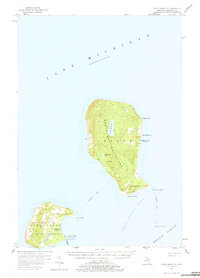
North Manitou Island and its smaller neighbor to the south dominate this mid-century survey of the Manitou Passage waters in Lake Michigan. The map depicts an era of transition for these isolated landmasses, where human infrastructure like the Landing Field and the settlement of North Manitou sit alongside evidence of a declining permanent population, notably the N Manitou I Sch (Abandoned) and its counterpart on the southern island.
Find a feature on this map
31 named features on this map. Tap any name to fly to it.
Don’t see what you’re looking for? This feature index may not catch every label — zoom into the map to look around manually.
Map Details
Editions of this 1956 North Manitou Map
2 editions found
Other maps of this area

1954 · Traverse City
USGS Topo · 1:250,000

1954 · Escanaba
USGS Topo · 1:250,000

1954 · Manitowoc
USGS Topo · 1:250,000

1955 · Cheboygan
USGS Topo · 1:250,000

1956 · South Fox Island
USGS Topo · 1:62,500

1957 · Escanaba
USGS Topo · 1:250,000

1957 · Empire
USGS Topo · 1:62,500

1957 · Maple City
USGS Topo · 1:62,500

1958 · Escanaba
USGS Topo · 1:250,000

1958 · Cheboygan
USGS Topo · 1:250,000