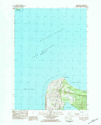
1983 Map of Glen Haven
USGS Topo · Published 1984About this map
Sleeping Bear Dunes National Lakeshore dominates this coastal landscape on the Leelanau Peninsula, showing the protected shoreline as it was recorded in the late 1970s and early 1980s. The village of Glen Haven sits at the edge of Sleeping Bear Bay, a historic point of entry for lake traffic navigating the Manitou Passage. The transition from the sandy elevations of Sleeping Bear Point to the sheltered waters of Glen Lake illustrates the natural barrier created by the massive dune systems along Lake Michigan. A Campground near the coast and the proximity of Glen Arbor highlight the area's development as a destination for outdoor recreation. This provisional survey provides a specific look at the bathymetry of Sleeping Bear Shoal and the shifting, indefinite boundaries of the coastal topography before modern digital mapping.
Find a feature on this map
13 named features on this map. Tap any name to fly to it.
Don’t see what you’re looking for? This feature index may not catch every label — zoom into the map to look around manually.
Map Details
Editions of this 1983 Glen Haven Map
This is the sole edition of this map. No revisions or reprints were ever made.
Other maps of this area

1954 · Traverse City
USGS Topo · 1:250,000

1954 · Escanaba
USGS Topo · 1:250,000

1954 · Manitowoc
USGS Topo · 1:250,000

1955 · Cheboygan
USGS Topo · 1:250,000

1956 · North Manitou
USGS Topo · 1:62,500

1957 · Escanaba
USGS Topo · 1:250,000

1957 · Empire
USGS Topo · 1:62,500

1957 · Maple City
USGS Topo · 1:62,500

1958 · Escanaba
USGS Topo · 1:250,000

1958 · Cheboygan
USGS Topo · 1:250,000