1900s (20th Century) Maps of Leelanau Township, Michigan
Explore 10 historic maps of Leelanau Township from the 1900s (20th Century). These maps offer a rare glimpse into what life looked like during the 1900s — showing old roads, neighborhoods, homes, and landmarks that have changed or disappeared over time.
Whether you're researching your family's past, planning a metal detecting trip, or studying how Leelanau Township's landscape evolved across the 1900s, these high-resolution maps are a powerful tool for exploring the history of this region.
- Focus on a specific era: All maps on this page are from the 1900s, giving you a focused view of this time period.
- See what’s changed: Compare century-old streets, trails, and buildings to today's modern landscape using overlays and satellite layers.
- Research with precision: Use these maps for genealogy, historical research, land use analysis, or educational projects.
- View, download, or print: Maps are fully viewable online in high resolution, and can be downloaded or printed for your own records.
Start exploring Leelanau Township's history through authentic maps from the 1900s. This is your window into the past.
Leelanau Township, MI maps
(10)- 1955 Map of Cheboygan, 1964 Print
 1955 Cheboygan1964 Print · USGSNorthern Michigan in the mid-fifties is a landscape of dense timber and deep water, showing the region just as the road network began to modernize. Trace family roots in lakeside towns like St Ignace and Petoskey, or follow the historic tracks of the Pennsylvania RR and New York Central RR.5 unique versions available
 - 1956 Map of South Fox Island, 1959 Print
 1956 South Fox Island1959 Print · USGSIsolated in the waters of Lake Michigan during the mid-fifties, these islands represent a unique maritime outpost within Leelanau Twp. Researchers can trace the layout of the South Fox Island Lighthouse and the early Landing Field on the southern island.2 unique versions available
 - 1957 Map of Northport, 1958 Print
 1957 Northport1958 Print · USGSThe tip of Michigan's Leelanau Peninsula is captured here in the late fifties, showcasing its unique bayside settlements and maritime history. Genealogists and local historians can locate St Wenceslaus Ch, the village of Peshawbestown, and the Grand Traverse Light.2 unique versions available
 - 1958 Map of Cheboygan
 1958 Cheboygan1958 Print · USGSThe tip of Michigan's Lower Peninsula and the surrounding Great Lakes islands are shown here in the late fifties, during the peak of the rail-and-ferry era. Trace the paths of the Pennsylvania RR and explore lakeside settlements like St James, Petoskey, and Indian River.2 unique versions available
 - 1983 Map of Northport, 1984 Print
 1983 Northport1984 Print · USGSThe northern tip of the Leelanau Peninsula comes into focus in the early eighties, showing a landscape where state parklands and lakeside villages meet. Trace the shoreline from Lighthouse Point to Northport, locating local landmarks like the Woolsey Memorial Airport and Grand Traverse Light.
 - 1983 Map of Omena, 1984 Print
 1983 Omena1984 Print · USGSLeelanau Peninsula’s eastern shore is captured here in the early eighties, showing a landscape of coastal settlements and lakeside camps. Trace family roots and local geography through Peshawbestown, the rails of the Leelanau Transit Company, and Omena Point.
 - 1983 Map of Northport NW, 1984 Print
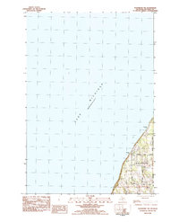 1983 Northport NW1984 Print · USGSThe Leelanau Peninsula shoreline meets the water in the early eighties, showcasing a landscape of sandy beaches and rural crossroads. Genealogists and local historians can trace family-named routes like Nelson Road and explore the area around Garthe and Peterson Park.
 - 1983 Map of Gills Pier, 1984 Print
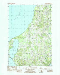 1983 Gills Pier1984 Print · USGSThe Leelanau Peninsula shoreline in the early eighties reveals a landscape of lakeside settlements and quiet interior farm roads. Genealogists can trace family landmarks and rural institutions like the Indian Mission Ch, Solar Sch, and Beechwood Cem.
 - 1984 Map of Charlevoix, 1985 Print
 1984 Charlevoix1985 Print · USGSNorthern Michigan’s coastal peninsulas and deep inland lakes are captured here in the mid-eighties, showing the region's unique maritime and rail connectivity. Researchers can trace historic family-named landmarks and infrastructure like Woolsey Memorial Airport, Barnard Ch, and the Chesapeake and Ohio RR.2 unique versions available
 - 1986 Map of South Fox Island
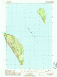 1986 South Fox Island1986 Print · USGSIsolated in the waters of Lake Michigan during the mid-eighties, this survey details two remote islands of the Beaver Archipelago. Researchers can trace the layout of the Landing Strip on both islands and locate the navigational Light at the southern point of South Fox Island.
End of results
Showing maps 1-10 of 10
Top cities near Leelanau Township
Top neighborhoods of Leelanau Township
Frequently asked questions
- What are the different types of historical maps available for Leelanau Township?
- What is the oldest map of Leelanau Township?
- Where can I purchase historical maps of Leelanau Township for my home or office?
- Where can I download high-res historical maps of Leelanau Township?
- Are there historical topographic maps available for Leelanau Township?
- Is there historical aerial imagery available for Leelanau Township?
- Where are historical maps of Leelanau Township sourced from?