2020s Maps of Ridgeway Township, Michigan
Explore 4 historic maps of Ridgeway Township from the 2020s. These maps offer a rare glimpse into what life looked like during the 2020s — showing old roads, neighborhoods, homes, and landmarks that have changed or disappeared over time.
Whether you're researching your family's past, planning a metal detecting trip, or studying how Ridgeway Township's landscape evolved across the 2020s, these high-resolution maps are a powerful tool for exploring the history of this region.
- Focus on a specific era: All maps on this page are from the 2020s, giving you a focused view of this time period.
- See what’s changed: Compare century-old streets, trails, and buildings to today's modern landscape using overlays and satellite layers.
- Research with precision: Use these maps for genealogy, historical research, land use analysis, or educational projects.
- View, download, or print: Maps are fully viewable online in high resolution, and can be downloaded or printed for your own records.
Start exploring Ridgeway Township's history through authentic maps from the 2020s. This is your window into the past.
Ridgeway Township, MI maps
(4)- 2023 Map of Deerfield, 2023 Print
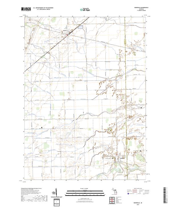 2023 Deerfield2023 Print · USGSSoutheast Michigan's rural landscape is captured here in the contemporary era, centered on the historic river crossings of the Lenawee county line. Genealogists and local historians can trace family burial sites at Saint Alphonsus Cem and Leib Cem or follow the intricate paths of Swamp Raisin Creek and the River Raisin.
 - 2023 Map of Tecumseh North, 2023 Print
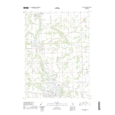 2023 Tecumseh North2023 Print · USGSLenawee County at the start of the 2020s shows the continued importance of the River Raisin to the communities of TECUMSEH and Clinton. Genealogists can locate several local burial sites like Old East Cem and Aten Cem, or trace the development of local aviation at Carl's Airport.
 - 2023 Map of Macon, 2023 Print
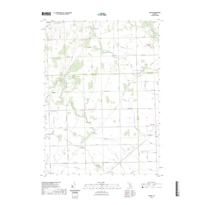 2023 Macon2023 Print · USGSThe rural landscape of Lenawee County and its neighbors is captured here during a period of modern agricultural stewardship. Genealogists can trace family footprints through sites like Macon Cem, Lake Ridge Cem, and the small crossroads at Benton.
 - 2023 Map of Tecumseh South, 2023 Print
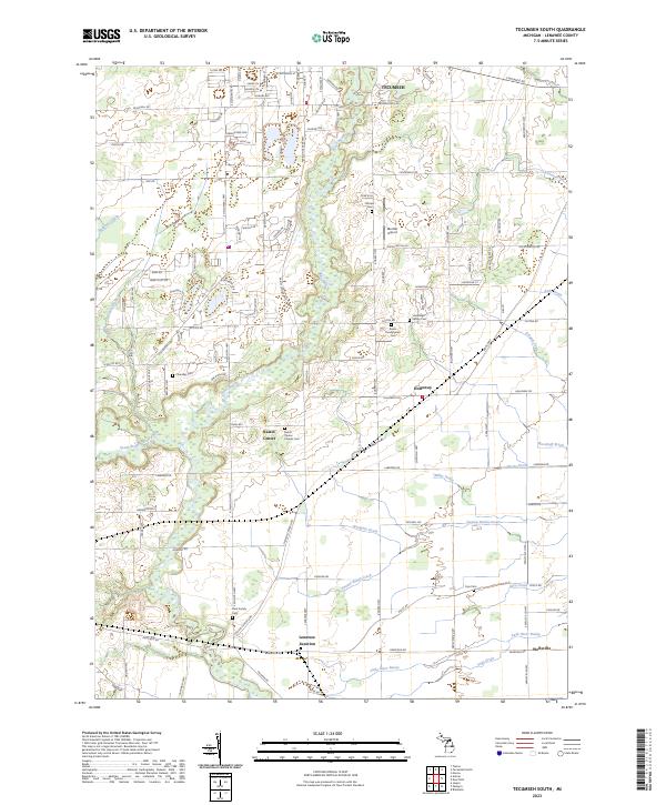 2023 Tecumseh South2023 Print · USGSSoutheast Michigan's rural heartland is meticulously documented here, showing the intricate drainage and settlement patterns of Lenawee County. Genealogists can trace family heritage through local landmarks like McLain Cem, Raisin Center, and the historic Lenawee Junction.
End of results
Showing maps 1-4 of 4
Top cities near Ridgeway Township
- Ypsilanti Charter Township historical maps
- Pittsfield Charter Township historical maps
- Bedford Township historical maps
- Adrian historical maps
- Lambertville historical maps
- York Charter Township historical maps
See more
Top neighborhoods of Ridgeway Township
Frequently asked questions
- What are the different types of historical maps available for Ridgeway Township?
- What is the oldest map of Ridgeway Township?
- Where can I purchase historical maps of Ridgeway Township for my home or office?
- Where can I download high-res historical maps of Ridgeway Township?
- Are there historical topographic maps available for Ridgeway Township?
- Is there historical aerial imagery available for Ridgeway Township?
- Where are historical maps of Ridgeway Township sourced from?