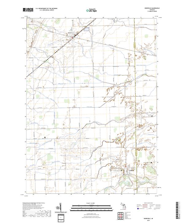
2023 Map of Deerfield
USGS Topo · Published 2023About this map
The River Raisin and its complex network of tributaries define this agricultural corridor along the border of Lenawee and Monroe counties. The landscape is characterized by an extensive system of man-made and natural drainage, including the Little River Raisin, Swamp Raisin Creek, and several named watercourses such as Macon Creek and Schreeder Brook. This intricate hydrology supported the development of the primary settlements at Deerfield and Britton, which serve as the anchors for a grid of rural roads like Britton Hwy and Blissfield Hwy.
Find a feature on this map
87 named features on this map. Tap any name to fly to it.
Don’t see what you’re looking for? This feature index may not catch every label — zoom into the map to look around manually.
Map Details
Editions of this 2023 Deerfield Map
This is the sole edition of this map. No revisions or reprints were ever made.
Other maps of this area

1902 · Ypsilanti
USGS Topo · 1:62,500

1904 · Ann Arbor
USGS Topo · 1:125,000

1906 · Ypsilanti
USGS Topo · 1:62,500

1906 · Saline
USGS Topo · 1:62,500

1908 · Ann Arbor
USGS Topo · 1:125,000

1912 · Dundee
USGS Topo · 1:62,500

1926 · Dundee
USGS Topo · 1:62,500

1939 · Blissfield
USGS Topo · 1:62,500
1939 · Dundee
USGS Topo · 1:62,500
1940 · Dundee
USGS Topo · 1:62,500