Old Maps of Monroe County, Michigan
Explore 194 old maps of Monroe County, spanning from 1900 to today. These high-resolution historic maps reveal how streets, neighborhoods, landmarks, and natural features evolved over time — perfect for genealogy, metal detecting, research, and local history exploration.
What you can do with these maps:
- See how Monroe County changed over time: Compare historical maps to modern-day views to trace roads, homesites, rail lines & more.
- View detailed metadata: Each map includes creators, publishers, year, scale, and archive source.
- Overlay maps with satellite & LiDAR: Visualize the past alongside modern tools to explore terrain & human change.
- Trusted historical sources: Maps sourced from the USGS, Library of Congress, and other archives.
- Access maps your way: View online, download high-res files, or order prints for personal or research use.
Start exploring old maps of Monroe County to uncover forgotten places, hidden landmarks, and the deep history beneath your feet.
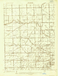
Monroe County, MI maps
(194)- 1900 Map of Maumee Bay, 1921 Print
 1900 Maumee Bay1921 Print · USGSNorthwest Ohio and the Lake Erie shoreline are shown here just as the regions rail and energy sectors were maturing. Genealogists and historians can locate vanished post offices at Shepardsville Bono P. O. and trace early industrial sites like the Oil Wells and Coke Ovens near Curtice.2 unique versions available
 - 1900 Map of Toledo, 1932 Print
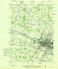
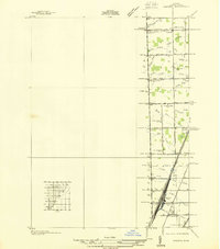
 1900 Toledo1932 Print · USGSToledo and the lower Maumee River valley are shown at the height of the railroad era, as the city expanded into an industrial powerhouse. Researchers can trace early infrastructure like the Michigan Division Canal and locate historic sites like the Toledo Insane Asylum or the Oil Wells near Lime City.
 - 1902 Map of Ypsilanti, 1958 Print
 1902 Ypsilanti1958 Print · USGSSoutheast Michigan at the turn of the century shows a landscape defined by thriving rail towns and winding river valleys. Genealogists and historians can trace the early footprints of Ypsilanti or find smaller locales like Rawsonville and Azalia along the Huron River and Michigan Central RR.
 - 1904 Map of Ann Arbor
 1904 Ann Arbor1904 Print · USGSEarly twentieth-century Washtenaw County comes to life through its dense network of interurban electric lines and steam railroads. Researchers can trace the layout of Ann Arbor, locate the Duck Lake School, or find vanished stops along the Michigan Central R. R. and Ann Arbor R. R..2 unique versions available
 - 1906 Map of Ypsilanti
 1906 Ypsilanti1906 Print · USGSSoutheast Michigan at the dawn of the century reveals a landscape defined by its bustling river towns and burgeoning rail networks. Trace the early development of Ypsilanti and Milan or locate vanished stops along the Michigan Central RR and the Wabash RR.3 unique versions available
 - 1906 Map of Wyandotte
 1906 Wyandotte1906 Print · USGSThe Detroit River shoreline and its industrial borderlands are captured here at the height of the electric railway era. Genealogists and historians can trace the early footprints of Wyandotte, the development of Grosse Isle, and the complex rail networks of the M C R R.2 unique versions available
 - 1906 Map of Saline
 1906 Saline1906 Print · USGSSoutheastern Michigan at the start of the century was a landscape of thriving rail hubs and productive farm country. Trace the early tracks of the Lake Shore and Michigan Southern R R through the streets of Saline, Tecumseh, and the village of Clinton.4 unique versions available
 - 1906 Map of Romulus
 1906 Romulus1906 Print · USGSSoutheast Michigan at the turn of the century shows a landscape defined by the winding Huron River and a dense network of competing steam and electric railways. Genealogists can trace early homesteads and rail stops in settlements like New Boston, Waltz, and the early crossroads at Carleton.2 unique versions available
 - 1908 Map of Ann Arbor
 1908 Ann Arbor1908 Print · USGSSoutheast Michigan at the turn of the century shows a landscape transitioning through the arrival of electric rail and the growth of the Huron River valley. Genealogists and researchers can trace old family lands near Saline, Ypsilanti, and Whitmore Lake, or follow the path of the Michigan Central RR.
 - 1911 Map of Swanton, 1956 Print
 1911 Swanton1956 Print · USGSNorthwest Ohio and the Michigan border are captured here just before the era of major highway expansion. Genealogists can trace early twentieth-century property locations near Metamora, Raab Corners, and numerous rural schoolhouses like Frogpond School.
 - 1912 Map of Wyandotte
 1912 Wyandotte1912 Print · USGSThe industrial corridor south of Detroit thrives along the river just before the Great War. Genealogists and historians can trace the early rail networks of the Michigan Central RR and find specific river landmarks like Grosse Isle and Gibraltar.
 - 1912 Map of Monroe
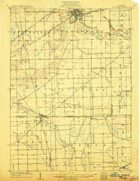
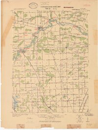
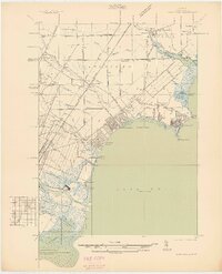
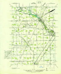
 1912 Monroe1912 Print · USGSMonroe County before the First World War was a landscape defined by its strategic lakefront positioning and a massive concentration of competing railroads. Genealogists can trace the early footprints of Monroe, Brest P.O., and Erie while following local landmarks like Sandy Creek and Plum Creek.
 - 1912 Map of Dundee
 1912 Dundee1912 Print · USGSMonroe County was a bustling intersection of rail and river commerce just before the First World War. Local historians can trace the exact routes of the Cincinnati Northern R. R. and the Ann Arbor R. R. as they pass through Dundee and Petersburg.
 - 1914 Map of Monroe, 1928 Print
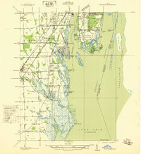
 1914 Monroe1928 Print · USGSCoastal Michigan between Detroit and Toledo is shown here in the early twentieth century as a bustling hub of rail and river commerce. Genealogists and historians can trace the paths of six different railroads through Monroe and locate the old Brest Post Office near Point Aux Peaux.
 - 1914 Map of Swanton, 1937 Print
 1914 Swanton1937 Print · USGSThe Ohio-Michigan borderlands come alive in this era of peak rail transit and rural schoolhouse density. Genealogists and historians can trace family roots through numerous local landmarks like Metamora, Richfield Center, and uniquely named sites such as Huckleberry School or Frogpond School.
 - 1926 Map of Dundee
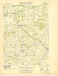
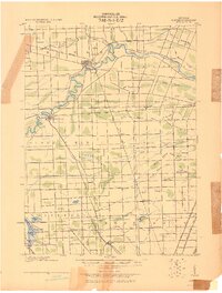 1926 Dundee1926 Print · USGSSoutheastern Michigan is captured here during the height of the steam-rail era, showing the intricate network of Monroe County townships. Genealogists and historians can trace family locations near Dundee, Lambertville, or the rail junctions at Ida and Strasburgh.
 - 1927 Map of Monroe
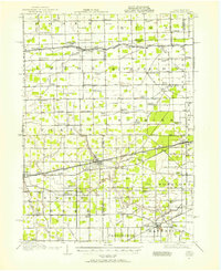
 1927 Monroe1927 Print · USGSMonroe and the surrounding Lake Erie shoreline are shown here during the late 1930s as a thriving industrial and rail corridor. Researchers can locate family landmarks like the Monroe Co Cem, Strasburg Sch, and the notable Monroe Co Infirmary.
 - 1928 Map of Romulus
 1928 Romulus1928 Print · USGSSoutheast Michigan at the height of its rail-and-river era shows a dense network of transit lines and river towns. Genealogists can trace family roots through settlements like French Landing, Waltz, and South Rockwood or follow the path of the Pere Marquette RR.
 - 1929 Map of Wyandotte
 1929 Wyandotte1929 Print · USGSThe Detroit River shoreline comes alive in this late 1920s survey of the industrial corridor south of the city. Genealogists and historians can trace the early grids of Wyandotte and Amherstburg, or locate riverfront landmarks like Grosse Isle and Slocum Junc.
 - 1934 Map of Point Place
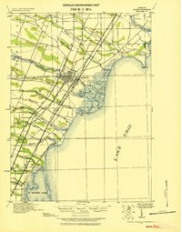
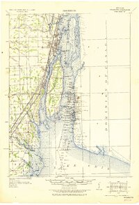
 1934 Point Place1934 Print · USGSThe Lake Erie shoreline near Toledo comes to life in the mid-1930s, showing a landscape defined by maritime trade and residential growth. Genealogists and historians can trace family locations near Point Place, Momineetown, and landmarks like the Toledo Yacht Club.
 - 1935 Map of Berkey
 1935 Berkey1935 Print · USGSLucas County farms and small crossroads settlements are captured here in the mid-1930s as the region transitioned from electric rail to highway travel. Researchers can trace family sites near Wolfinger Cem, the St Elizabeth Sch Richfield Center, and the industrial spur at Allen Junction.
 - 1936 Map of Samaria
 1936 Samaria1936 Print · USGSDuring the mid-1930s, this corridor north of the Michigan-Ohio border was a hub of drainage projects and rail expansion. Researchers can trace the layout of the Ottawa Yard, the site of Vienna Junction, and local landmarks like Erie Union Cem and Yargerville Sch.
 - 1936 Map of Rockwood
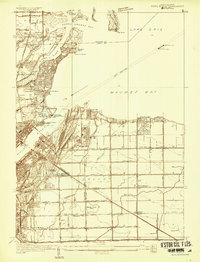
 1936 Rockwood1936 Print · USGSCoastal Wayne County and the Detroit River islands are shown here in the mid-thirties, just as the aviation and shipping industries were maturing. Researchers can locate the U S Naval Reserve Aviation Base on Grosse Ile, the St Marys Cem, and the marshy expanses around Point Mouillee.
 - 1936 Map of Stony Point
 1936 Stony Point1936 Print · USGSMonroe County’s Lake Erie shoreline was a burgeoning corridor of summer beaches and rail transport in the mid-1930s. Genealogists and researchers can trace family-named schools like Loranger Sch and Masserant Sch, or locate the historic St Charles Cem near Oldport.2 unique versions available
 - 1936 Map of Flat Rock
 1936 Flat Rock1936 Print · USGSSoutheast Michigan's riverfront and rail corridors are captured here in the mid-1930s as industrial yards and rural townships began to interface. Researchers can trace ancestral roots through dozens of local landmarks including Ash Center Cem, Maple Grove Sch, and the unique settlement at Scrabble.
Showing maps 1-25 of 194
Top cities of Monroe County
- Bedford Township historical maps
- Frenchtown Charter Township historical maps
- Monroe historical maps
- Monroe Charter Township historical maps
- Berlin Charter Township historical maps
- Ash Township historical maps
See more
Frequently asked questions
- What are the different types of historical maps available for Monroe County?
- What is the oldest map of Monroe County?
- Where can I purchase historical maps of Monroe County for my home or office?
- Where can I download high-res historical maps of Monroe County?
- Are there historical topographic maps available for Monroe County?
- Is there historical aerial imagery available for Monroe County?
- Where are historical maps of Monroe County sourced from?