1970s Maps of Mecosta County, Michigan
Explore 8 historic maps of Mecosta County from the 1970s. These maps offer a rare glimpse into what life looked like during the 1970s — showing old roads, neighborhoods, homes, and landmarks that have changed or disappeared over time.
Whether you're researching your family's past, planning a metal detecting trip, or studying how Mecosta County's landscape evolved across the 1970s, these high-resolution maps are a powerful tool for exploring the history of this region.
- Focus on a specific era: All maps on this page are from the 1970s, giving you a focused view of this time period.
- See what’s changed: Compare century-old streets, trails, and buildings to today's modern landscape using overlays and satellite layers.
- Research with precision: Use these maps for genealogy, historical research, land use analysis, or educational projects.
- View, download, or print: Maps are fully viewable online in high resolution, and can be downloaded or printed for your own records.
Start exploring Mecosta County's history through authentic maps from the 1970s. This is your window into the past.
Mecosta County, MI maps
(8)- 1976 Map of Big Rapids SE, 1979 Print
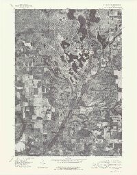 1976 Big Rapids SE1979 Print · USGSThe rural landscapes of Mecosta County are shown in fine detail in the mid-1970s through this aerial-imagery survey. Genealogists and historians can trace the early residential layouts around Lake Mecosta and the historic settlement patterns of Altona and Sylvester.
 - 1976 Map of Evart SW, 1979 Print
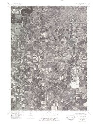
 1976 Evart SW1979 Print · USGSIn the mid-1970s, the rural landscapes of central Michigan remained dominated by the winding Muskegon River and timbered tracts. Researchers can trace the layout of small communities like Hersey and Grant Center or examine the 1976 field patterns near Reed City.
 - 1976 Map of Big Rapids SW, 1979 Print
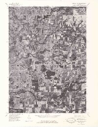
 1976 Big Rapids SW1979 Print · USGSMecosta County at the height of the 1970s shows a landscape of river-fed farm country and small village hubs. Trace rural roads to find the village of Stanwood or the riverbanks near Rogers Dam Pond and Higbee Corner.
 - 1976 Map of Howard City NW, 1979 Print
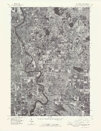
 1976 Howard City NW1979 Print · USGSMontcalm County farmland and river valleys are captured in detail in the mid-seventies, showing the region's rural character. Trace the meandering Little Muskegon River and explore the historic footprints of Morley and Howard City.
 - 1976 Map of Big Rapids NW, 1979 Print
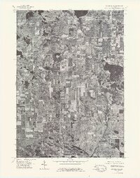
 1976 Big Rapids NW1979 Print · USGSBig Rapids and the surrounding Mecosta County countryside are captured in this mid-1970s aerial survey during a period of steady growth. Researchers can trace the exact 1976 shoreline of the Muskegon River and see the early residential footprints near Clear Lake.
 - 1976 Map of Big Rapids NE, 1979 Print
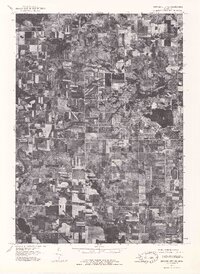
 1976 Big Rapids NE1979 Print · USGSMecosta County farmland and glacial lakes are captured in high detail during the mid-seventies. This orthophoto allows researchers to trace the exact boundaries of rural farmsteads near Rodney and the shorelines of Chippewa Lake and Horsehead Lake.
 - 1976 Map of Howard City NE, 1979 Print
 1976 Howard City NE1979 Print · USGSMontcalm County farmland and the village of Lakeview are captured during the mid-seventies in this detailed aerial orthophoto. Researchers can trace the development of the lakeshore around Tamarack Lake and follow the path of Tamarack Creek.
 - 1979 Map of Mecosta, 1982 Print
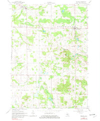 1979 Mecosta1982 Print · USGSMecosta and Remus appear at a crossroads of rail and agriculture in the late seventies. Researchers can locate family landmarks like Morgan Cem, trace the Old Railroad Grade, or find the St Michael Sch in Wheatland.
End of results
Showing maps 1-8 of 8
Top cities of Mecosta County
Frequently asked questions
- What are the different types of historical maps available for Mecosta County?
- What is the oldest map of Mecosta County?
- Where can I purchase historical maps of Mecosta County for my home or office?
- Where can I download high-res historical maps of Mecosta County?
- Are there historical topographic maps available for Mecosta County?
- Is there historical aerial imagery available for Mecosta County?
- Where are historical maps of Mecosta County sourced from?