1930s Maps of Menominee County, Michigan
Explore 5 historic maps of Menominee County from the 1930s. These maps offer a rare glimpse into what life looked like during the 1930s — showing old roads, neighborhoods, homes, and landmarks that have changed or disappeared over time.
Whether you're researching your family's past, planning a metal detecting trip, or studying how Menominee County's landscape evolved across the 1930s, these high-resolution maps are a powerful tool for exploring the history of this region.
- Focus on a specific era: All maps on this page are from the 1930s, giving you a focused view of this time period.
- See what’s changed: Compare century-old streets, trails, and buildings to today's modern landscape using overlays and satellite layers.
- Research with precision: Use these maps for genealogy, historical research, land use analysis, or educational projects.
- View, download, or print: Maps are fully viewable online in high resolution, and can be downloaded or printed for your own records.
Start exploring Menominee County's history through authentic maps from the 1930s. This is your window into the past.
Menominee County, MI maps
(5)- 1932 Map of Bark River NE
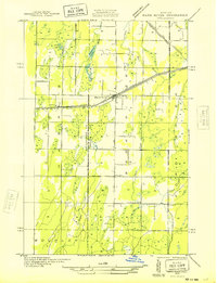 1932 Bark River NE1932 Print · USGSUpper Peninsula life in the early 1930s centered on the rail-and-highway corridor through Harris and Bark River. Local historians can trace the early townships of Gourley and Harris, locating rural landmarks like Sunnyside Sch and Riverside Sch.2 unique versions available
 - 1932 Map of Whitney NE
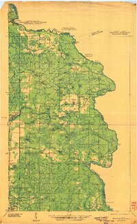
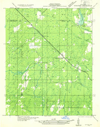 1932 Whitney NE1932 Print · USGSThe Upper Peninsula interior during the early 1930s was a landscape of timber-hauling railroads and remote hydro projects. Researchers can locate small communities like Woodlawn and Hendricks or trace the schools and dams along the Escanaba River.
 - 1932 Map of Whitney SE
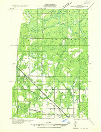 1932 Whitney SE1932 Print · USGSLower Peninsula timber country comes to life in this early 1930s survey of the Menominee and Delta county line. Genealogists can trace family roots at Schaffer Cem or locate the old Tenmile Sch and Eustis Sta along the historic rail lines.
 - 1939 Map of Marinette
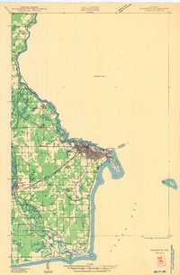 1939 Marinette1939 Print · USGSThe Green Bay shoreline and the Menominee River border come to life in the late 1930s as industrial and rural landscapes intersect. Genealogists can trace family footprints through numerous rural schools like Garfield Sch and Columbus Sch or the settlement at Winesville.
 - 1939 Map of Pembine, 1941 Print
 1939 Pembine1941 Print · USGSThe Menominee River borderlands in the late thirties showcase a landscape of granite quarries, rail junctions, and river falls. Trace early settlements and infrastructure including Pembine, the Chalk Hill Dam, and the St Anthony Cem.2 unique versions available
End of results
Showing maps 1-5 of 5
Top cities of Menominee County
Frequently asked questions
- What are the different types of historical maps available for Menominee County?
- What is the oldest map of Menominee County?
- Where can I purchase historical maps of Menominee County for my home or office?
- Where can I download high-res historical maps of Menominee County?
- Are there historical topographic maps available for Menominee County?
- Is there historical aerial imagery available for Menominee County?
- Where are historical maps of Menominee County sourced from?