2020s Maps of Menominee County, Michigan
Explore 34 historic maps of Menominee County from the 2020s. These maps offer a rare glimpse into what life looked like during the 2020s — showing old roads, neighborhoods, homes, and landmarks that have changed or disappeared over time.
Whether you're researching your family's past, planning a metal detecting trip, or studying how Menominee County's landscape evolved across the 2020s, these high-resolution maps are a powerful tool for exploring the history of this region.
- Focus on a specific era: All maps on this page are from the 2020s, giving you a focused view of this time period.
- See what’s changed: Compare century-old streets, trails, and buildings to today's modern landscape using overlays and satellite layers.
- Research with precision: Use these maps for genealogy, historical research, land use analysis, or educational projects.
- View, download, or print: Maps are fully viewable online in high resolution, and can be downloaded or printed for your own records.
Start exploring Menominee County's history through authentic maps from the 2020s. This is your window into the past.
Menominee County, MI maps
(34)- 2022 Map of Marinette East, 2022 Print
 2022 Marinette East2022 Print · USGSThe twin border cities of the Menominee River estuary are shown here in detail during the early 2020s. Trace the urban development near the Menominee County Courthouse or explore the coastal features of Seagull Bar and Green Island.
 - 2022 Map of McAllister, 2022 Print
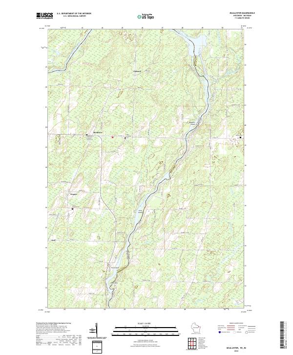 2022 McAllister2022 Print · USGSThe Menominee River border between Wisconsin and Michigan comes alive in this 2020s survey of the northern timberlands and rural settlements. Genealogists can locate family landmarks at Saint Edwards Cem or the Tabor Lutheran Cem and trace the old routes of McAllister and Goll.
 - 2022 Map of Marinette West, 2022 Print
 2022 Marinette West2022 Print · USGSThe riverfront border between Wisconsin and Michigan comes into focus in this recent survey of the Twin Cities region. Genealogists and historians can trace numerous burial sites like Forest Home Cem and explore the area surrounding the Indian Mound.
 - 2022 Map of Wausaukee South, 2022 Print
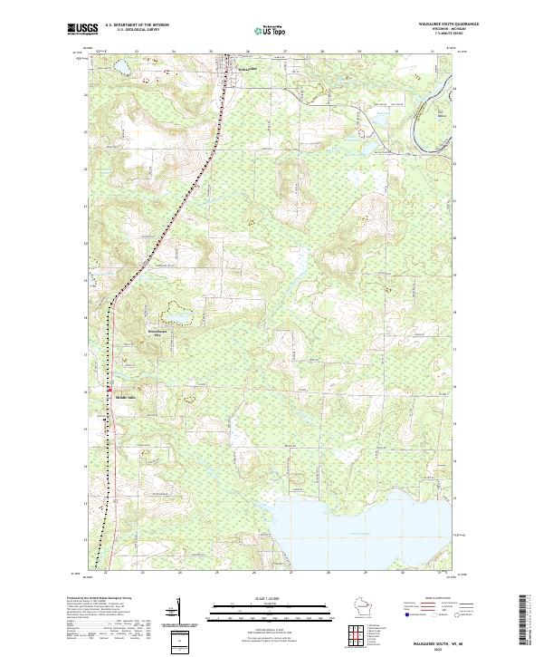 2022 Wausaukee South2022 Print · USGSMarinette County is shown in detail at the start of the 2020s, where the river-rich landscape of the Wisconsin-Michigan border unfolds. Genealogists and locals can trace family landmarks like Pine Hill Cem and the small settlements of Wausaukee and Sweetheart City.
 - 2022 Map of Chambers Island NW, 2022 Print
 2022 Chambers Island NW2022 Print · USGSCoastal Wisconsin and Michigan boundaries meet in these waters during the early twenty-first century, centered on the expanse of Green Bay. Local historians can trace the shoreline of Chambers Island and locate land features like Sand Point and Million Dollar Rd.
 - 2023 Map of Helps, 2023 Print
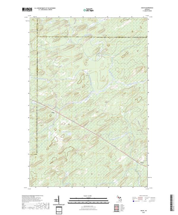 2023 Helps2023 Print · USGSUpper Peninsula timberlands and river forks come into focus in this contemporary survey of the Menominee County interior. Researchers can trace historic transportation lines like the Felch Grade Route/Trl and find old settlement markers at Helps and Faunus.
 - 2023 Map of Gourley, 2023 Print
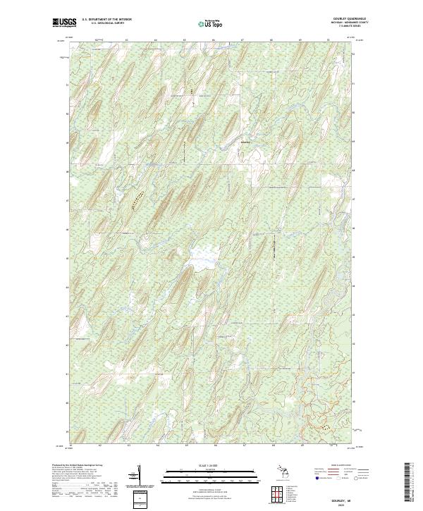 2023 Gourley2023 Print · USGSUpper Peninsula timber and river lands near the Gourley settlement are documented here in recent detail. Researchers can trace the path of the Cedar River and explore recreation routes like the Cedar River Pathway Trl and Forest Islands Trl.
 - 2023 Map of Seagull Point, 2023 Print
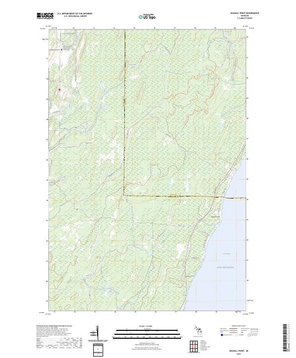 2023 Seagull Point2023 Print · USGSThe Menominee County shoreline meets the waters of Green Bay in this recent survey of the Michigan coast. Genealogists and local historians can locate the Wilson Seventh Day Adventist Church Cem or trace the path of the Cedar River and Sevenmile Marsh.
 - 2023 Map of Banat, 2023 Print
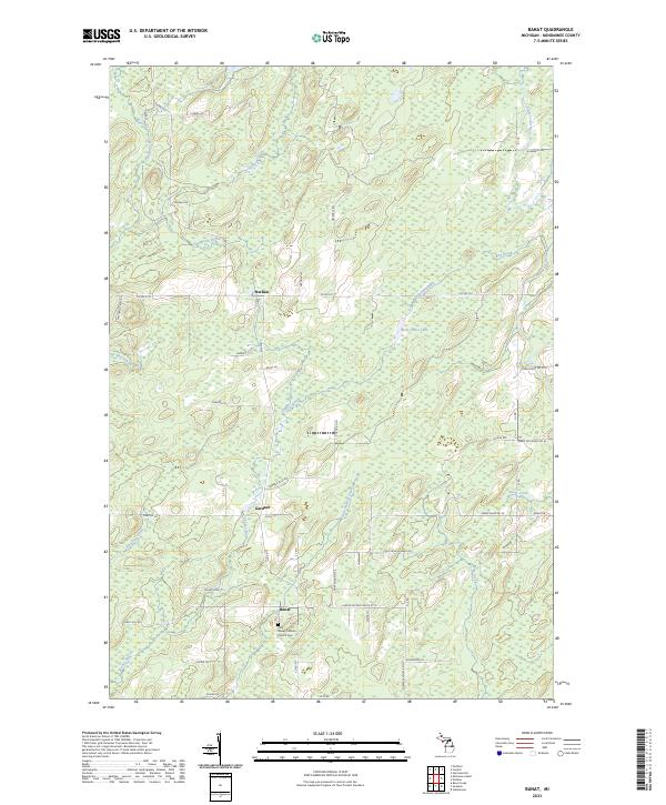 2023 Banat2023 Print · USGSThe Austro-Hungarian settlement of Banat and the Menominee County interior are shown here in recent detail. Researchers can locate the Holy Rosary Catholic Church Cem and trace rural routes like Cheese Factory Rd No 27.75 and Co Rd 577.
 - 2023 Map of Stephenson, 2023 Print
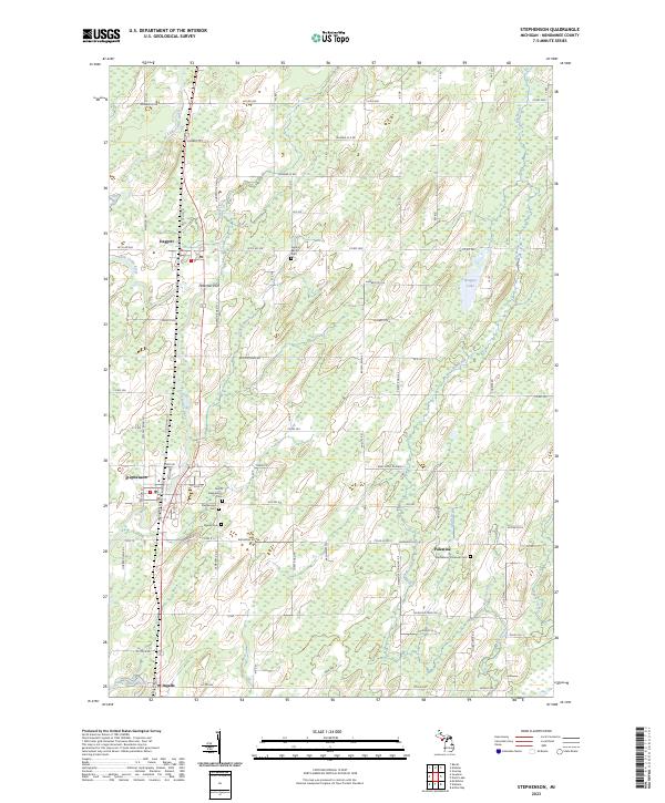 2023 Stephenson2023 Print · USGSUpper Peninsula farming and rail communities are captured here in the early twenty-first century along the Little Cedar River. Genealogists can trace family roots through sites like Stephenson Cem, Palestine, and the Bethlehem Covenant Cem.
 - 2023 Map of La Branche, 2023 Print
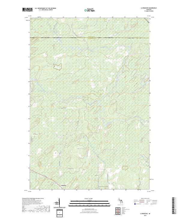 2023 La Branche2023 Print · USGSThe Upper Peninsula timberlands near the Menominee and Marquette border are mapped in detail here. Genealogists can trace family-named routes like Pach Lane F 1 and Zawacki Lane D1 near the settlement of Labranche.
 - 2023 Map of Wallace, 2023 Print
 2023 Wallace2023 Print · USGSMenominee County is depicted in this recent survey, showing the rural communities of Wallace and Carbondale amid a complex network of Upper Peninsula waterways. Researchers can trace family road names and local landmarks like Mission Church No 14 Ln or the shores of Hayward Lake.
 - 2023 Map of Waucedah, 2023 Print
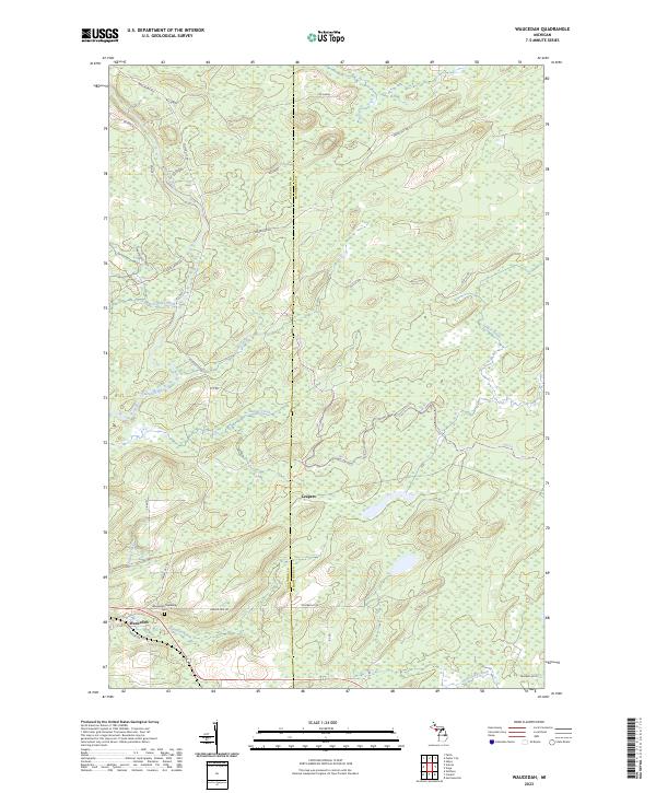 2023 Waucedah2023 Print · USGSThe Upper Peninsula landscape around the turn of the twenty-first century is marked by river systems and recreational trailways. Researchers can find the Waucedah Township Cem and trace the paths of Leapers and Waucedah along the Sturgeon River.
 - 2023 Map of Arthur Bay, 2023 Print
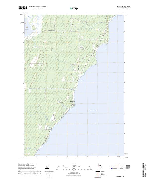 2023 Arthur Bay2023 Print · USGSThe Menominee County shoreline comes into focus during the early twenty-first century, showing the coastal hamlets and wetlands of the Upper Peninsula. Genealogists and local historians can trace land use through features like Beach Grove, Harbor Point, and Cherry Ridge Logging Rd.
 - 2023 Map of Bark River, 2023 Print
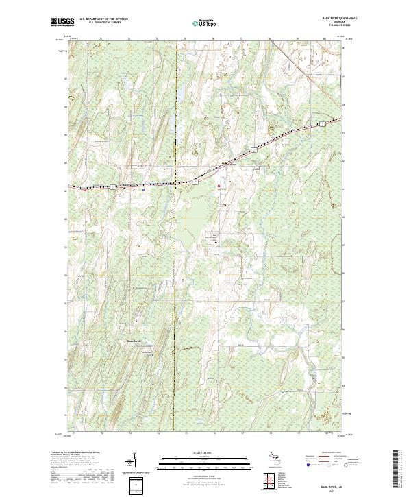 2023 Bark River2023 Print · USGSUpper Peninsula life in Delta and Menominee counties is centered on the settlements of Bark River and Hannahville in the 2020s. Genealogists and historians can trace local family markers at the Bark River Township Cem and follow the old rail alignment of the Felch Grade Route Trl.
 - 2023 Map of Nadeau, 2023 Print
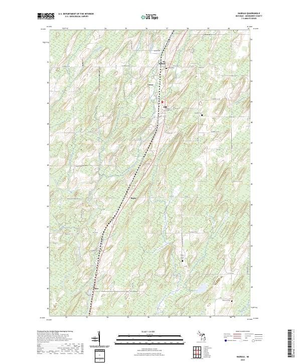 2023 Nadeau2023 Print · USGSUpper Peninsula life in Menominee County centers on the rural communities along the highway corridor. Genealogists can trace family footprints at Swedish Cem, Maple Grove Cem, and the small settlements of Nadeau and Talbot.
 - 2023 Map of Wilson, 2023 Print
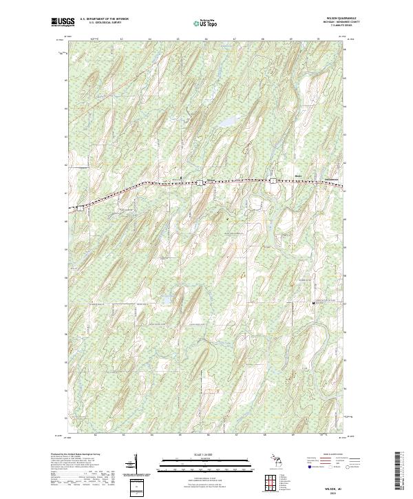 2023 Wilson2023 Print · USGSUpper Peninsula life in Menominee County centers on the crossroads of Wilson and the winding Cedar River corridor. Genealogists and local historians can trace family-named landmarks and rural burial grounds such as Wilson Cem and Harris Cem.
 - 2023 Map of Cedar River, 2023 Print
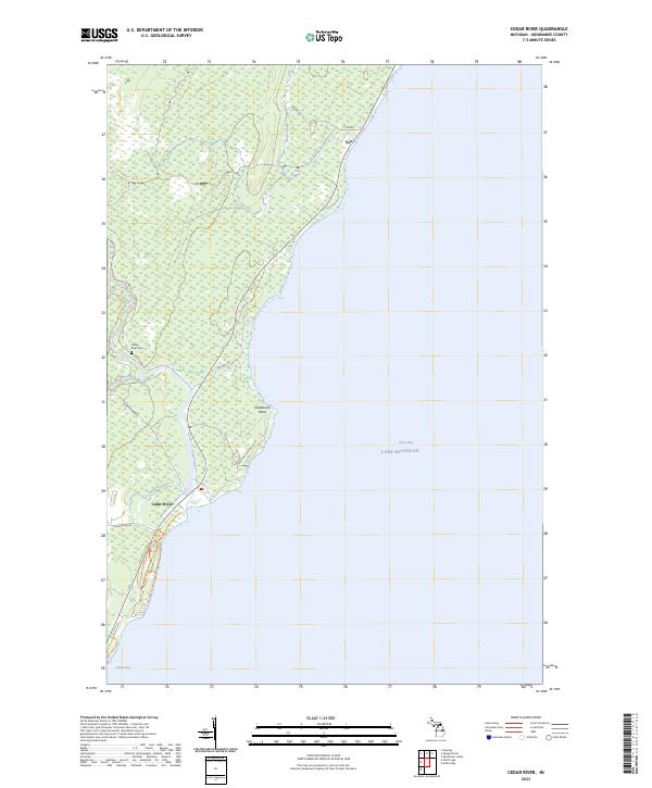 2023 Cedar River2023 Print · USGSThe Menominee County shoreline comes into focus in this contemporary survey of the Upper Peninsula’s lakefront. Researchers can trace the legacy of local families and industry at the Cedar River Cem, Deadmans Point, and Old Mill Lane No 20.75.
 - 2023 Map of Hermansville, 2023 Print
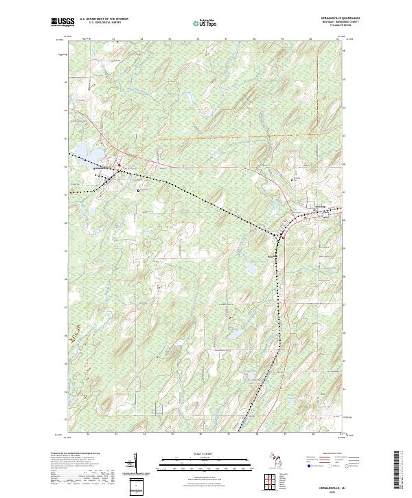 2023 Hermansville2023 Print · USGSUpper Peninsula timber and rail history converge in this 2023 survey of Menominee County. Local researchers can trace the roads and waterways around Hermansville, Powers, and Spalding, while locating historic burials at Meyer Cem or Spalding Cem.
 - 2023 Map of Schaffer, 2023 Print
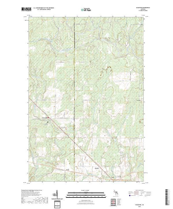 2023 Schaffer2023 Print · USGSThe rural landscapes of Delta and Menominee Counties are showcased in this recent survey of the Michigan Upper Peninsula. Researchers can trace the heritage of small settlements like Perronville and Schaffer or locate burial sites at Sacred Heart Cem.
 - 2023 Map of Bear Point, 2023 Print
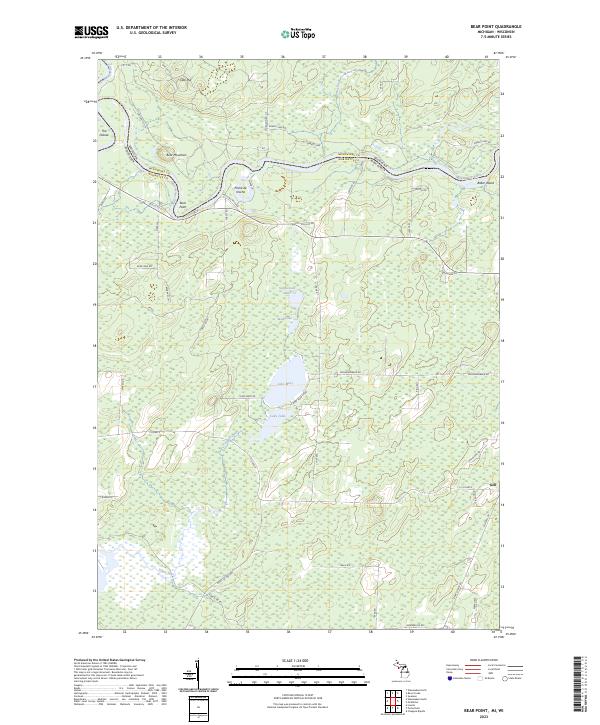 2023 Bear Point2023 Print · USGSThe Menominee River border between Michigan and Wisconsin comes into focus here during the early 2020s. Genealogists and local historians can trace the riverside settlement at Poche de Noche, the hamlet of Goll, and landmarks like Bear Point.
 - 2023 Map of Birch Creek, 2023 Print
 2023 Birch Creek2023 Print · USGSThe Menominee County shoreline comes into focus during the early twenty-first century, showing the transition from rural woodlands to the city's edge. Researchers can locate the Birch Creek Cem and trace coastal landmarks like Stony Point and Beattie Point.
 - 2023 Map of Wausaukee North, 2023 Print
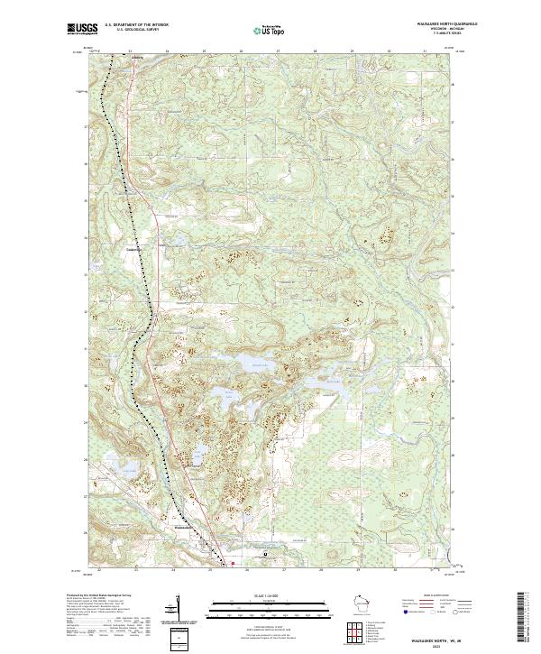 2023 Wausaukee North2023 Print · USGSMarinette County’s lake country is captured here in the early twenty-first century, showing the crossroads at Wausaukee and Amberg. Genealogists and local historians can locate Wausaukee Evergreen Cem and trace old family routes like Marcellis Rd and Feller Rd.
 - 2023 Map of Miscauno Island, 2023 Print
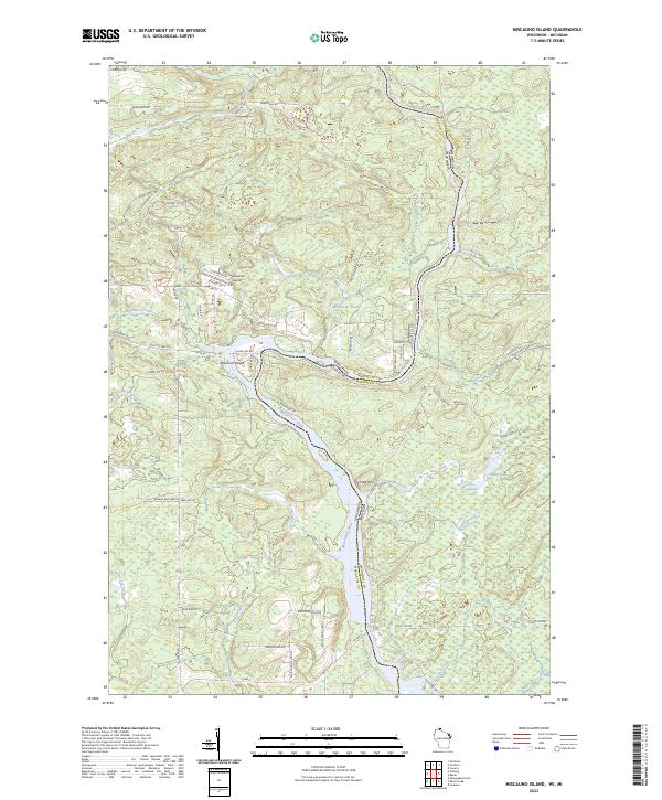 2023 Miscauno Island2023 Print · USGSThe border between Wisconsin and Michigan is defined here by the winding Menominee River in the early 2020s. Researchers can trace land use around Miscauno Island, find the Shangrila Airport, and locate Pemene Falls.
 - 2023 Map of Swanson, 2023 Print
 2023 Swanson2023 Print · USGSThe Menominee River valley along the Michigan-Wisconsin border remains a quiet landscape of small hamlets and timberlands in this recent survey. Researchers can trace family sites at the Swedish Methodist Cem or locate the settlements of Longrie and Swanson.
Showing maps 1-25 of 34
Top cities of Menominee County
Frequently asked questions
- What are the different types of historical maps available for Menominee County?
- What is the oldest map of Menominee County?
- Where can I purchase historical maps of Menominee County for my home or office?
- Where can I download high-res historical maps of Menominee County?
- Are there historical topographic maps available for Menominee County?
- Is there historical aerial imagery available for Menominee County?
- Where are historical maps of Menominee County sourced from?