2020s Maps of Nadeau Township, Michigan
Explore 6 historic maps of Nadeau Township from the 2020s. These maps offer a rare glimpse into what life looked like during the 2020s — showing old roads, neighborhoods, homes, and landmarks that have changed or disappeared over time.
Whether you're researching your family's past, planning a metal detecting trip, or studying how Nadeau Township's landscape evolved across the 2020s, these high-resolution maps are a powerful tool for exploring the history of this region.
- Focus on a specific era: All maps on this page are from the 2020s, giving you a focused view of this time period.
- See what’s changed: Compare century-old streets, trails, and buildings to today's modern landscape using overlays and satellite layers.
- Research with precision: Use these maps for genealogy, historical research, land use analysis, or educational projects.
- View, download, or print: Maps are fully viewable online in high resolution, and can be downloaded or printed for your own records.
Start exploring Nadeau Township's history through authentic maps from the 2020s. This is your window into the past.
Nadeau Township, MI maps
(6)- 2023 Map of Gourley, 2023 Print
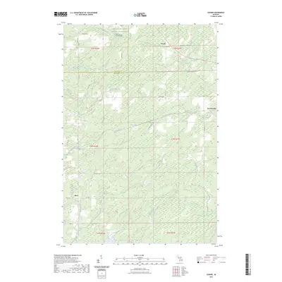
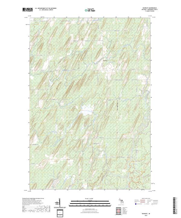 2023 Gourley2023 Print · USGSUpper Peninsula timber and river lands near the Gourley settlement are documented here in recent detail. Researchers can trace the path of the Cedar River and explore recreation routes like the Cedar River Pathway Trl and Forest Islands Trl.
 - 2023 Map of Banat, 2023 Print
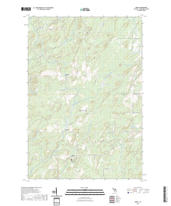 2023 Banat2023 Print · USGSThe Austro-Hungarian settlement of Banat and the Menominee County interior are shown here in recent detail. Researchers can locate the Holy Rosary Catholic Church Cem and trace rural routes like Cheese Factory Rd No 27.75 and Co Rd 577.
 - 2023 Map of Nadeau, 2023 Print
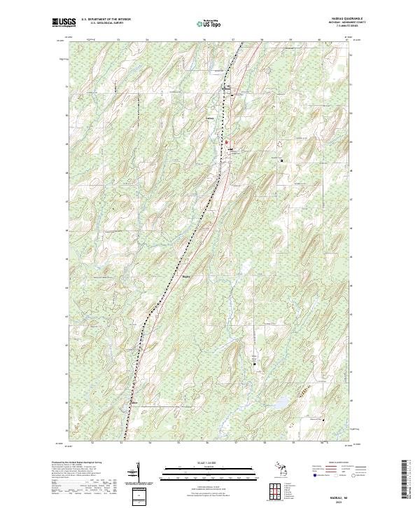 2023 Nadeau2023 Print · USGSUpper Peninsula life in Menominee County centers on the rural communities along the highway corridor. Genealogists can trace family footprints at Swedish Cem, Maple Grove Cem, and the small settlements of Nadeau and Talbot.
 - 2023 Map of Wilson, 2023 Print
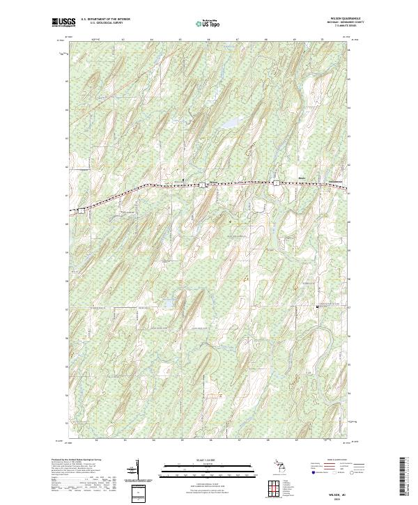 2023 Wilson2023 Print · USGSUpper Peninsula life in Menominee County centers on the crossroads of Wilson and the winding Cedar River corridor. Genealogists and local historians can trace family-named landmarks and rural burial grounds such as Wilson Cem and Harris Cem.
 - 2023 Map of Hermansville, 2023 Print
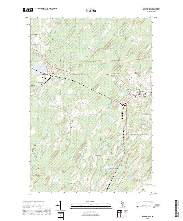 2023 Hermansville2023 Print · USGSUpper Peninsula timber and rail history converge in this 2023 survey of Menominee County. Local researchers can trace the roads and waterways around Hermansville, Powers, and Spalding, while locating historic burials at Meyer Cem or Spalding Cem.
 - 2023 Map of Cunard, 2023 Print
 2023 Cunard2023 Print · USGSThe Menominee and Dickinson County line comes into focus in this recent survey of the Michigan Upper Peninsula. Researchers can trace the watercourses of Nadeau Creek and Little Cedar River alongside local landmarks like Cunard and Blom.
End of results
Showing maps 1-6 of 6
Top cities near Nadeau Township
- Harris historical maps
- Spalding historical maps
- Nadeau historical maps
- Waucedah historical maps
- Stephenson historical maps
- Wagner historical maps
See more
Top neighborhoods of Nadeau Township
Frequently asked questions
- What are the different types of historical maps available for Nadeau Township?
- What is the oldest map of Nadeau Township?
- Where can I purchase historical maps of Nadeau Township for my home or office?
- Where can I download high-res historical maps of Nadeau Township?
- Are there historical topographic maps available for Nadeau Township?
- Is there historical aerial imagery available for Nadeau Township?
- Where are historical maps of Nadeau Township sourced from?