1980s Maps of Norwich Township, Michigan
Explore 9 historic maps of Norwich Township from the 1980s. These maps offer a rare glimpse into what life looked like during the 1980s — showing old roads, neighborhoods, homes, and landmarks that have changed or disappeared over time.
Whether you're researching your family's past, planning a metal detecting trip, or studying how Norwich Township's landscape evolved across the 1980s, these high-resolution maps are a powerful tool for exploring the history of this region.
- Focus on a specific era: All maps on this page are from the 1980s, giving you a focused view of this time period.
- See what’s changed: Compare century-old streets, trails, and buildings to today's modern landscape using overlays and satellite layers.
- Research with precision: Use these maps for genealogy, historical research, land use analysis, or educational projects.
- View, download, or print: Maps are fully viewable online in high resolution, and can be downloaded or printed for your own records.
Start exploring Norwich Township's history through authentic maps from the 1980s. This is your window into the past.
Norwich Township, MI maps
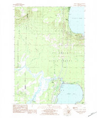
(9)- 1983 Map of Cadillac, 1984 Print
 1983 Cadillac1984 Print · USGSThe Cadillac region in the early eighties was defined by its vast public forests and the prominent dual lakes at its center. Trace the legacies of the timber era along the Old Railroad Grade or locate old rural centers like Vogel Center and Harrietta.
 - 1983 Map of Meads Landing, 1984 Print
 1983 Meads Landing1984 Print · USGSUpper Michigan's lake country in the early eighties shows a landscape of state forests and sprawling wetlands between the Great Lakes. You can locate family history at Heidemann Cem, trace the oil production at the Enterprise Oil Field, or find old river crossings near the Covered Bridge.
 - 1983 Map of Stittsville, 1984 Print
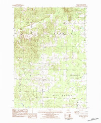 1983 Stittsville1984 Print · USGSMissaukee County's wooded interior is captured here in the early 1980s, showing a landscape defined by state forest lands and quiet crossroads. Researchers can locate the Pioneer Cem, the historic Townhall, and old settlement sites at Moorestown and Stittsville.
 - 1983 Map of Addis Creek, 1984 Print
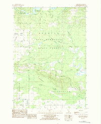 1983 Addis Creek1984 Print · USGSMissaukee County's forest and swamp lands are captured here in the early 1980s, showcasing a landscape of wildlife management and remote settlements. Researchers can trace family history at Moorestown Cem or locate the old Stratford Dam and Star City.
 - 1983 Map of Houghton Lake, 1984 Print
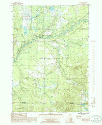
 1983 Houghton Lake1984 Print · USGSIn the early 1980s, the Michigan heartland around Houghton Lake was a patchwork of state forest and growing lakeside resorts. Genealogists and historians can trace the development of communities like West Branch and Rose City alongside landmarks like Roscommon County Airfield.
 - 1983 Map of Traverse City, 1984 Print
 1983 Traverse City1984 Print · USGSTraverse City and the surrounding bay country are captured in the early eighties as the region balanced its timber heritage with growing conservation. Genealogists and local historians can trace the rail lines of the Ann Arbor RR through settlements like Kingsley and Fife Lake.2 unique versions available
 - 1983 Map of Grayling, 1984 Print
 1983 Grayling1984 Print · USGSIn the early eighties, this Northern Michigan interior was a hub for forestry, military training, and river recreation. Researchers can trace the sprawling boundaries of Camp Grayling and locate historic markers like Hartwick Pines and Otsego Lake.2 unique versions available
 - 1985 Map of Sharon, 1986 Print
 1985 Sharon1986 Print · USGSKalkaska County's river valleys and state forest lands are captured in the mid-1980s, showcasing a landscape of timber, gas extraction, and wilderness. Researchers can trace the Old RR Grade and locate the Cannon Creek Gas Field near the settlement of Sharon.
 - 1989 Map of Traverse City, 1990 Print
 1989 Traverse City1990 Print · USGSNorthern Michigan’s lake-country and forest lands are captured in the late eighties as seasonal tourism and timber hubs expanded. Genealogists and historians can trace the routes of the Ann Arbor RR, the boundaries of Camp Grayling, and settlements like Elk Rapids and Manton.
End of results
Showing maps 1-9 of 9
Top cities near Norwich Township
Top neighborhoods of Norwich Township
Frequently asked questions
- What are the different types of historical maps available for Norwich Township?
- What is the oldest map of Norwich Township?
- Where can I purchase historical maps of Norwich Township for my home or office?
- Where can I download high-res historical maps of Norwich Township?
- Are there historical topographic maps available for Norwich Township?
- Is there historical aerial imagery available for Norwich Township?
- Where are historical maps of Norwich Township sourced from?