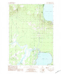
1983 Map of Meads Landing
USGS Topo · Published 1984About this map
Higgins Lake and Houghton Lake dominate this northern Michigan landscape, connected by the winding course of the Muskegon River. The 1980s terrain is heavily defined by the expansive Au Sable State Forest and Pere Marquette State Forest, which frame the low-lying Heidemann Marsh and the extensive Dead Stream Flooding area. Industry is represented by the East Norwich Oil Field and Enterprise Oil Field to the west, marking a transition from recreational waters to resource extraction. Local infrastructure is visible in the clusters at Hillcrest and Meads Landing, including the St Huberts church and a noted Covered Bridge. Genealogists may find interest in the documented Heidemann Cem and Oakwood Cem, while the inclusion of the Twp Park and various boat launches underscores the region's enduring character as a destination for outdoor enthusiasts.
Find a feature on this map
38 named features on this map. Tap any name to fly to it.
Don’t see what you’re looking for? This feature index may not catch every label — zoom into the map to look around manually.
Map Details
Editions of this 1983 Meads Landing Map
This is the sole edition of this map. No revisions or reprints were ever made.
Other maps of this area

1949 · Fletcher
USGS Topo · 1:62,500

1949 · Grayling
USGS Topo · 1:62,500

1950 · Cote Dame Marie
USGS Topo · 1:24,000

1950 · Fletcher
USGS Topo · 1:24,000

1951 · Pere Cheney
USGS Topo · 1:24,000

1954 · Traverse City
USGS Topo · 1:250,000

1956 · Houghton Lake
USGS Topo · 1:62,500

1958 · Traverse City
USGS Topo · 1:250,000

1963 · Prudenville
USGS Topo · 1:24,000
1963 · Lyon Manor
USGS Topo · 1:24,000