
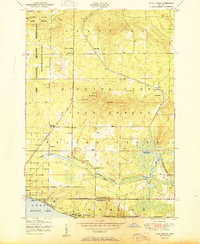
1951 Map of Pere Cheney
USGS Topo · Published 1951About this map
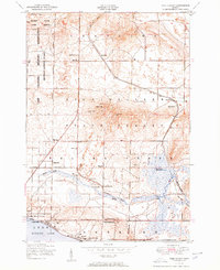
Pere Cheney sits along the New York Central railroad, appearing here as a cluster of structures near the Cheney Cemetery. This mid-century survey captures a transition in the landscape of Crawford and Roscommon counties, where the older settlement patterns of northern Michigan meet burgeoning recreational interests. To the west, the Military Reservation and Hanson State Game Refuge dominate the highlands, while the southern edge of the map follows the developed shoreline of Higgins Lake. Family names are preserved across numerous seasonal outposts and permanent landmarks, including Horrigans Siding, Leykaufs Cabins, and Rockefellers Cabins. The presence of the Sewell Fire Tower and the Department of Conservation Training School underscores the region's managed wilderness character, while leisure facilities like the Skyline Ski Slide and various lakeside tennis courts signal the area's mid-century growth as a destination.
Find a feature on this map
45 named features on this map. Tap any name to fly to it.
Don’t see what you’re looking for? This feature index may not catch every label — zoom into the map to look around manually.
Map Details
Editions of this 1951 Pere Cheney Map
3 editions found
Other maps of this area

1949 · Fletcher
USGS Topo · 1:62,500

1949 · Grayling
USGS Topo · 1:62,500

1950 · Cote Dame Marie
USGS Topo · 1:24,000

1950 · Lake Margrethe
USGS Topo · 1:24,000

1950 · Grayling
USGS Topo · 1:24,000

1950 · Roscommon North
USGS Topo · 1:24,000

1951 · Wakeley Lake
USGS Topo · 1:24,000

1951 · Grayling
USGS Topo · 1:24,000

1951 · Roscommon North
USGS Topo · 1:24,000

1954 · Traverse City
USGS Topo · 1:250,000
Featured Places
- Beaver Creek Township, MI
- Gerrish Township, MI
- Grayling Charter Township, MI
- Pere Cheney, MI
- Skyline Village, MI