2020s Maps of West Branch Township, Michigan
Explore 4 historic maps of West Branch Township from the 2020s. These maps offer a rare glimpse into what life looked like during the 2020s — showing old roads, neighborhoods, homes, and landmarks that have changed or disappeared over time.
Whether you're researching your family's past, planning a metal detecting trip, or studying how West Branch Township's landscape evolved across the 2020s, these high-resolution maps are a powerful tool for exploring the history of this region.
- Focus on a specific era: All maps on this page are from the 2020s, giving you a focused view of this time period.
- See what’s changed: Compare century-old streets, trails, and buildings to today's modern landscape using overlays and satellite layers.
- Research with precision: Use these maps for genealogy, historical research, land use analysis, or educational projects.
- View, download, or print: Maps are fully viewable online in high resolution, and can be downloaded or printed for your own records.
Start exploring West Branch Township's history through authentic maps from the 2020s. This is your window into the past.
West Branch Township, MI maps
(4)- 2023 Map of Merritt, 2023 Print
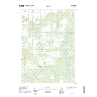 2023 Merritt2023 Print · USGSMissaukee County's rural townships are shown here in modern detail, preserving the layout of longstanding agricultural communities. Genealogists and local historians can trace the areas surrounding Merritt, Star City, and the Butterfield Cem along the Muskegon River.
 - 2023 Map of Dinca, 2023 Print
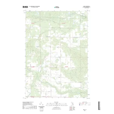 2023 Dinca2023 Print · USGSMissaukee County's rural character is captured here in the early 2020s, centered on the settlement of Dinca and its surrounding wetlands. Researchers can locate family heritage sites like Aetna Cem or follow the waters of the West Branch Muskegon River and Butterfield Creek.
 - 2023 Map of Stittsville, 2023 Print
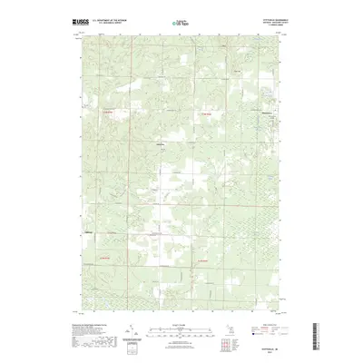 2023 Stittsville2023 Print · USGSMissaukee County's rural landscape is captured here in the early twenty-first century, showing a mix of isolated settlements and vast wetlands. Local historians can trace family locations near Stittsville Cem, the Moorestown Airpark, or the hamlet of Cutcheon.
 - 2023 Map of Addis Creek, 2023 Print
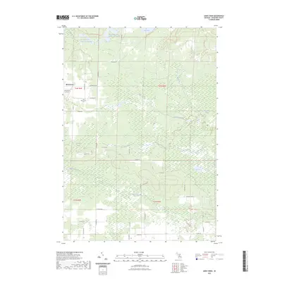 2023 Addis Creek2023 Print · USGSMissaukee County's wetlands and the settlement of Moorestown are documented here in the early twenty-first century. Researchers can trace local lineages at Moorestown Cem and explore the vast riparian network of Dead Stream Swamp and Big Cannon Creek Number One Flooding.
End of results
Showing maps 1-4 of 4
Top cities near West Branch Township
Top neighborhoods of West Branch Township
Frequently asked questions
- What are the different types of historical maps available for West Branch Township?
- What is the oldest map of West Branch Township?
- Where can I purchase historical maps of West Branch Township for my home or office?
- Where can I download high-res historical maps of West Branch Township?
- Are there historical topographic maps available for West Branch Township?
- Is there historical aerial imagery available for West Branch Township?
- Where are historical maps of West Branch Township sourced from?