2020s Maps of Cato Township, Michigan
Explore 2 historic maps of Cato Township from the 2020s. These maps offer a rare glimpse into what life looked like during the 2020s — showing old roads, neighborhoods, homes, and landmarks that have changed or disappeared over time.
Whether you're researching your family's past, planning a metal detecting trip, or studying how Cato Township's landscape evolved across the 2020s, these high-resolution maps are a powerful tool for exploring the history of this region.
- Focus on a specific era: All maps on this page are from the 2020s, giving you a focused view of this time period.
- See what’s changed: Compare century-old streets, trails, and buildings to today's modern landscape using overlays and satellite layers.
- Research with precision: Use these maps for genealogy, historical research, land use analysis, or educational projects.
- View, download, or print: Maps are fully viewable online in high resolution, and can be downloaded or printed for your own records.
Start exploring Cato Township's history through authentic maps from the 2020s. This is your window into the past.
Cato Township, MI maps
(2)- 2023 Map of Six Lakes, 2023 Print
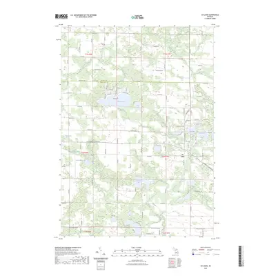 2023 Six Lakes2023 Print · USGSMontcalm County’s lakeland geography is on full display in this modern survey of the Six Lakes area and the Mecosta County line. Genealogists and local historians can locate several family burial sites including Hillcrest Cem and Morton Cem near the shores of Townline Lake.
 - 2023 Map of Lakeview, 2023 Print
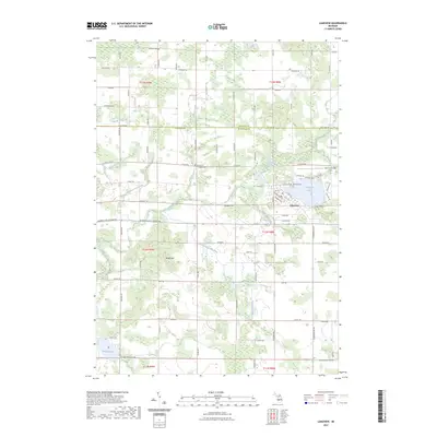 2023 Lakeview2023 Print · USGSLakeview and the surrounding farmsteads of Montcalm and Mecosta Counties are shown here at the start of the 2020s. Local researchers can trace family roots through the Lakeview Cem and Whitsell Cem, or explore the drainages of Tamarack Creek and Pickerel Lake.
End of results
Showing maps 1-2 of 2
Top cities near Cato Township
- Greenville historical maps
- Sidney historical maps
- Howard City historical maps
- Stanton historical maps
- Remus historical maps
- Edmore historical maps
See more
Top neighborhoods of Cato Township
Frequently asked questions
- What are the different types of historical maps available for Cato Township?
- What is the oldest map of Cato Township?
- Where can I purchase historical maps of Cato Township for my home or office?
- Where can I download high-res historical maps of Cato Township?
- Are there historical topographic maps available for Cato Township?
- Is there historical aerial imagery available for Cato Township?
- Where are historical maps of Cato Township sourced from?