Old Maps of Atlanta, Briley Township for Genealogy
Trace your family roots with 10 historic maps of Atlanta. These high-res maps reveal old neighborhoods, homesites, landmarks, and streets — helping you uncover where your ancestors lived and how the area evolved over time.
- Explore historic neighborhoods: Identify where your relatives may have lived in the 1800s or 1900s.
- Compare maps over time: Trace the changes in streets, buildings, and landmarks for multi-generational research.
- Perfect for genealogy & ancestry research: Used by family historians and researchers to map out lineage and migration.
These maps are an incredible resource for exploring your personal connection to Atlanta's past.
Atlanta, Briley Township maps
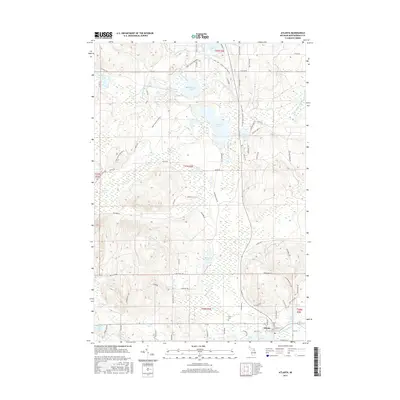
(10)- 1955 Map of Atlanta, 1956 Print
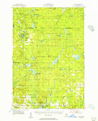 1955 Atlanta1956 Print · USGSMontmorency County is mapped here in the mid-fifties, showing a landscape of state forests and quiet settlements before modern development. Genealogists and researchers can trace local landmarks like Pleasant Valley Ch, Avery Cem, and the Edwards Sch (Abandoned).3 unique versions available
 - 1955 Map of Cheboygan, 1964 Print
 1955 Cheboygan1964 Print · USGSNorthern Michigan in the mid-fifties is a landscape of dense timber and deep water, showing the region just as the road network began to modernize. Trace family roots in lakeside towns like St Ignace and Petoskey, or follow the historic tracks of the Pennsylvania RR and New York Central RR.5 unique versions available
 - 1958 Map of Cheboygan
 1958 Cheboygan1958 Print · USGSThe tip of Michigan's Lower Peninsula and the surrounding Great Lakes islands are shown here in the late fifties, during the peak of the rail-and-ferry era. Trace the paths of the Pennsylvania RR and explore lakeside settlements like St James, Petoskey, and Indian River.2 unique versions available
 - 1982 Map of Petoskey
 1982 Petoskey1982 Print · USGSNorthern Michigan in the early eighties shows a landscape of deep timber and vast inland lakes. Genealogists and historians can trace the rail corridors of the Michigan Central and Detroit and Mackinac between Petoskey, Gaylord, and Wolverine.
 - 1986 Map of Atlanta
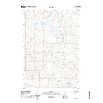
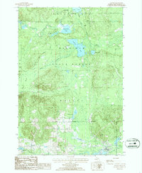 1986 Atlanta1986 Print · USGSMontmorency County in the mid-1980s reveals a landscape defined by state forestry and winding glacial waterways. Genealogists and historians can trace the Old RR Grade through the Green Swamp or locate family landmarks near Atlanta and Big Rock.
 - 2011 Map of Atlanta, 2011 Print
 2011 Atlanta2011 Print · USGSCovers Atlanta, including Avery Township, Vienna Township, and other nearby areas
 - 2014 Map of Atlanta, 2014 Print
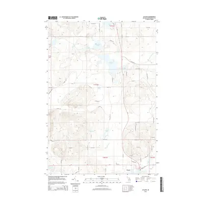 2014 Atlanta2014 Print · USGSCovers Atlanta, including Avery Township, Vienna Township, and other nearby areas
 - 2017 Map of Atlanta, 2017 Print
 2017 Atlanta2017 Print · USGSCovers Atlanta, including Avery Township, Vienna Township, and other nearby areas
 - 2019 Map of Atlanta, 2019 Print
 2019 Atlanta2019 Print · USGSCovers Atlanta, including Avery Township, Vienna Township, and other nearby areas
 - 2023 Map of Atlanta, 2023 Print
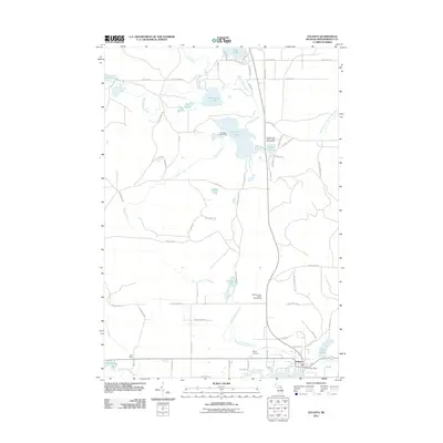
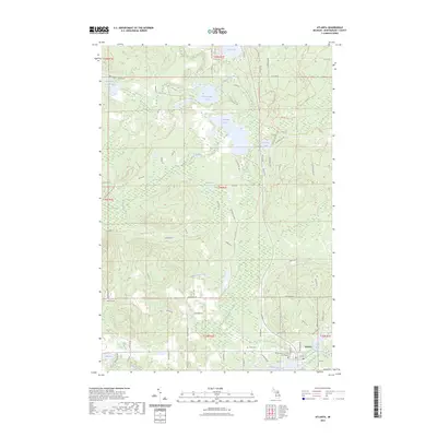 2023 Atlanta2023 Print · USGSThe northern Michigan community of Atlanta is shown in detail during the early 2020s, centered on the Thunder Bay River. Genealogists and local historians can trace the town layout near the Montmorency County Courthouse and locate the Briley Cem among the surrounding lakes.
End of results
Showing maps 1-10 of 10
Top cities near Atlanta
- Hillman historical maps
- Lewiston historical maps
- Avery historical maps
- Rust historical maps
- Canada Creek Ranch historical maps
Frequently asked questions
- What are the different types of historical maps available for Atlanta?
- What is the oldest map of Atlanta?
- Where can I purchase historical maps of Atlanta for my home or office?
- Where can I download high-res historical maps of Atlanta?
- Are there historical topographic maps available for Atlanta?
- Is there historical aerial imagery available for Atlanta?
- Where are historical maps of Atlanta sourced from?