Old Maps of Muskegon County, Michigan for Genealogy
Trace your family roots with 139 historic maps of Muskegon County. These high-res maps reveal old neighborhoods, homesites, landmarks, and streets — helping you uncover where your ancestors lived and how the area evolved over time.
- Explore historic neighborhoods: Identify where your relatives may have lived in the 1800s or 1900s.
- Compare maps over time: Trace the changes in streets, buildings, and landmarks for multi-generational research.
- Perfect for genealogy & ancestry research: Used by family historians and researchers to map out lineage and migration.
These maps are an incredible resource for exploring your personal connection to Muskegon County's past.
Muskegon County, MI maps
(139)- 1929 Map of Montague
 1929 Montague1929 Print · USGSThe Muskegon County shoreline flourished as a premier Great Lakes resort destination in the late twenties. Genealogists and local researchers can locate numerous rural schoolhouses, the White River Light, and the old Swedish Mission meeting house.
 - 1930 Map of Lake Harbor
 1930 Lake Harbor1930 Print · USGSThe industrial and recreational shoreline of Lake Michigan comes alive in this pre-war survey of the Muskegon region. Genealogists can trace family roots through specific locations like Indian Village, Port Sherman, and the Maple Grove Sch.
 - 1930 Map of Muskegon, 1960 Print
 1930 Muskegon1960 Print · USGSThe Lake Michigan shoreline and the winding Grand River valley appear here as they were in the late 1920s. Researchers can locate dozens of country schools like Carr Sch and Jones Sch, or trace the tracks of the Pere Marquette railroad.2 unique versions available
 - 1936 Map of Muskegon
 1936 Muskegon1936 Print · USGSCoastal Muskegon and Ottawa counties thrive in the mid-1930s as vital rail and shipping hubs. Genealogists and historians can trace numerous bayous along the Grand River and locate dozens of rural landmarks like Spoonville Chapel and Bates Sch.2 unique versions available
 - 1936 Map of Lake Harbor
 1936 Lake Harbor1936 Print · USGSCoastal Muskegon and its industrial neighbors are captured in the mid-1930s as the region transitioned into a major Lake Michigan port. Genealogists and historians can trace neighborhood growth through landmarks like Indian Village, Maple Grove Sch, and the rail lines of the P M RY.3 unique versions available
 - 1945 Map of Ravenna, 1947 Print
 1945 Ravenna1947 Print · USGSNear the close of the war years, this area north of the Grand River was a bustling network of small farming towns and rural school districts. Genealogists and local historians can trace the foundations of Coopersville, Ravenna, and Conklin, or locate family sites near McNitt Cem and Hoogstraat Sch.3 unique versions available
 - 1954 Map of Milwaukee, 1967 Print
 1954 Milwaukee1967 Print · USGSCoastal life and maritime commerce across Lake Michigan are seen here during the mid-fifties, bridging Wisconsin's industrial hubs and Michigan's timberlands. Genealogists and historians can trace the rail lines of the Grand Trunk Western and find long-established ports like Ludington, Port Washington, and Muskegon.3 unique versions available
 - 1954 Map of Midland, 1967 Print
 1954 Midland1967 Print · USGSMid-Michigan at the peak of the post-war era shows a landscape balancing industrial growth in Midland with the deep timberlands of the Manistee National Forest. Researchers can trace the legacy of the timber and rail era along the Pennsylvania RR or find family roots in river towns like Chesaning and Big Rapids.4 unique versions available
 - 1958 Map of Midland
 1958 Midland1958 Print · USGSCentral Michigan in the late fifties is captured here during a period of transition for its university towns and industrial hubs. Genealogists and researchers can trace family lines through old rail-stop towns like Breckenridge and Chesaning or locate property near the Muskegon River and Prairie Farm.
 - 1958 Map of Milwaukee
 1958 Milwaukee1958 Print · USGSThe shorelines of Lake Michigan in the late fifties reveal a landscape of bustling ferry ports and growing industrial suburbs. Genealogists and historians can trace rail networks like the Chesapeake & Ohio and locate landmarks such as Little Sable Point and Holy Cross Church.
 - 1958 Map of Twin Lake, 1960 Print
 1958 Twin Lake1960 Print · USGSMuskegon County in the late fifties shows a landscape of dense lake-country and growing crossroads. Genealogists and local historians can trace rural school districts at St Michaels Sch or find family plots at Blue Lake Cem and Horton Cem.3 unique versions available
 - 1958 Map of Fremont, 1960 Print
 1958 Fremont1960 Print · USGSNewaygo County's transition from forest to farmland is visible in this mid-century survey of the Muskegon River valley. Genealogists can trace family roots through numerous rural landmarks like the Danish Ch, Reeman Cem, and more than twenty localized schoolhouses.2 unique versions available
 - 1959 Map of Midland
 1959 Midland1959 Print · USGSMid-century Michigan comes alive in this survey of the central Lower Peninsula, from the streets of Grand Rapids to the Houghton Lake timberlands. Genealogists and rail fans can trace the Ann Arbor RR and Chesapeake and Ohio RR through towns like Big Rapids and Mount Pleasant.
 - 1959 Map of Montague, 1960 Print
 1959 Montague1960 Print · USGSThe Lake Michigan shoreline and White Lake harbor are shown here in the late fifties during a period of significant coastal growth. Genealogists and historians can locate numerous rural landmarks like Claybanks Church, Flower Creek School, and the White River Lighthouse.2 unique versions available
 - 1966 Map of Midland
 1966 Midland1966 Print · USGSCentral Michigan in the mid-1960s shows a landscape of growing manufacturing hubs and active resource extraction. Genealogists and historians can trace the rail corridors of the Grand Trunk Western or locate family-named landmarks near Oil wells and the Muskegon River.
 - 1972 Map of Sullivan, 1975 Print
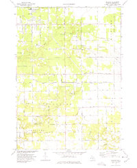 1972 Sullivan1975 Print · USGSMuskegon County is captured here in the early seventies, showing the transition from agricultural land to growing residential pockets. Researchers can find Township Cem, the Landing Field (Abandoned), and the crossing of the Penn Central railroad.2 unique versions available
 - 1972 Map of Muskegon West, 1975 Print
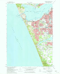 1972 Muskegon West1975 Print · USGSCoastal Michigan in the early seventies shows a bustling port city and growing suburbs nestled along the Lake Michigan shoreline. Researchers can trace neighborhood development through Lakeside Cemetery, Central High School, and the Muskegon County Airport.2 unique versions available
 - 1972 Map of Grand Haven, 1975 Print
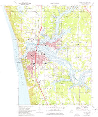 1972 Grand Haven1975 Print · USGSGrand Haven and the lower Grand River are shown in the early seventies during a period of established lakeside industry and recreation. Researchers can trace local genealogy and land use through features like Lake Forest Cemetery, Nortonville Chapel, and the Grand Haven Memorial Airpark.3 unique versions available
 - 1972 Map of Nunica, 1975 Print
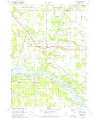 1972 Nunica1975 Print · USGSThe Grand River valley in the early seventies shows a landscape of bayous and transit routes just inland from the lake. Researchers can find many rural landmarks, from Nunica Cem and Grace Ch to the Jablonski Landing Field and the Grand Trunk Western rail line.
 - 1972 Map of Muskegon East, 1975 Print
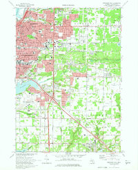 1972 Muskegon East1975 Print · USGSMuskegon and its southern lakefront suburbs reached a peak of mid-century development in the early seventies. Genealogists and researchers can trace family roots through numerous parish schools like Sacred Heart Sch and several local burial grounds including Mona View Cemetery.2 unique versions available
 - 1976 Map of Twin Lake SE
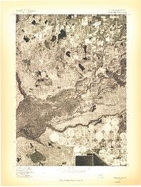 1976 Twin Lake SE1976 Print · USGSMid-century Michigan land use and river morphology are captured in this 1976 aerial study. Researchers can trace the winding course of the Muskegon River, the development near Wolf Lake, and the distinctive circular patterns of industrial-scale irrigation.
 - 1976 Map of Montague NW
 1976 Montague NW1976 Print · USGSThe Michigan shoreline and surrounding farmlands are captured in high detail in this mid-seventies aerial survey. Genealogists and local historians can trace property boundaries and coastal changes near Lake Michigan and the northern tip of White Lake.
 - 1976 Map of Montague SW
 1976 Montague SW1976 Print · USGSAlong the Muskegon County coast in the mid-seventies, this aerial orthophoto captures the meeting of the Great Lakes and inland waters. Researchers can trace the development of Wabaningo and the mouth of White Lake against the expanse of Lake Michigan.
 - 1976 Map of Twin Lake NE
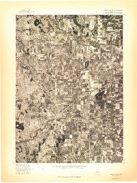 1976 Twin Lake NE1976 Print · USGSMuskegon County farmland and small settlements are captured from above in the mid-1970s just as these rural communities were evolving. Genealogists and land researchers can trace the exact 1976 footprints of Holton, Brunswick, and Reeman.
 - 1976 Map of Montague NE, 1979 Print
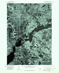 1976 Montague NE1979 Print · USGSSettlements along the Michigan coast are captured from above during the mid-seventies, showing the developed centers of Montague and Whitehall. Genealogists and historians can trace local property layouts and neighborhood growth in Maple Grove and Lakewood.
Showing maps 1-25 of 139
Top cities of Muskegon County
- Muskegon historical maps
- Norton Shores historical maps
- Muskegon Heights historical maps
- North Muskegon historical maps
- Roosevelt Park historical maps
- Whitehall historical maps
See more
Frequently asked questions
- What are the different types of historical maps available for Muskegon County?
- What is the oldest map of Muskegon County?
- Where can I purchase historical maps of Muskegon County for my home or office?
- Where can I download high-res historical maps of Muskegon County?
- Are there historical topographic maps available for Muskegon County?
- Is there historical aerial imagery available for Muskegon County?
- Where are historical maps of Muskegon County sourced from?