2020s Maps of Ashland Township, Michigan
Explore 4 historic maps of Ashland Township from the 2020s. These maps offer a rare glimpse into what life looked like during the 2020s — showing old roads, neighborhoods, homes, and landmarks that have changed or disappeared over time.
Whether you're researching your family's past, planning a metal detecting trip, or studying how Ashland Township's landscape evolved across the 2020s, these high-resolution maps are a powerful tool for exploring the history of this region.
- Focus on a specific era: All maps on this page are from the 2020s, giving you a focused view of this time period.
- See what’s changed: Compare century-old streets, trails, and buildings to today's modern landscape using overlays and satellite layers.
- Research with precision: Use these maps for genealogy, historical research, land use analysis, or educational projects.
- View, download, or print: Maps are fully viewable online in high resolution, and can be downloaded or printed for your own records.
Start exploring Ashland Township's history through authentic maps from the 2020s. This is your window into the past.
Ashland Township, MI maps
(4)- 2023 Map of Bridgeton, 2023 Print
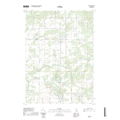
 2023 Bridgeton2023 Print · USGSThe Muskegon River valley and the rural town of Bridgeton are captured here during the 2020s. Researchers can locate family burial sites at Bridgeton Township Cem and Shippy Cem, or trace the varied waterways including Mosquito Creek and Sand Lake.
 - 2023 Map of Newaygo, 2023 Print
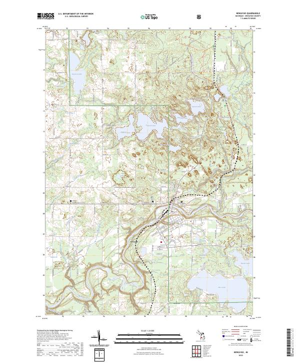 2023 Newaygo2023 Print · USGSNewaygo and the surrounding lake country appear in high detail during this recent survey of west-central Michigan. Researchers can trace property near Hess Lake or locate ancestral sites at the Newaygo City Cem and Saint Marks Cem.
 - 2023 Map of Fremont, 2023 Print
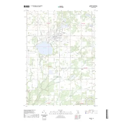 2023 Fremont2023 Print · USGSFremont and the surrounding Newaygo County townships are shown here in the early 2020s, centered on the city grid and the expansive Fremont Lake. Local historians can trace cemetery locations like Maple Grove Cem and smaller settlements such as Reeman and Bishop.
 - 2023 Map of Grant, 2023 Print
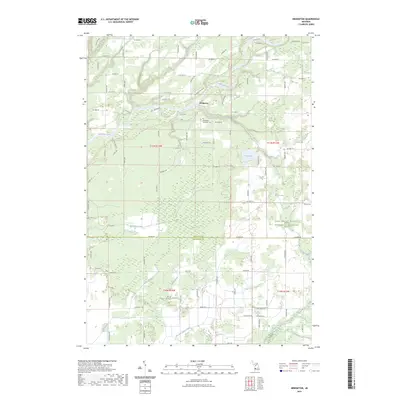
 2023 Grant2023 Print · USGSNewaygo County and its surrounding rural townships are shown here in modern detail, capturing the agricultural character of western Michigan. Researchers can locate several family cemeteries and small-town centers like Ashland Center, Grant, and Shippy Cem.
End of results
Showing maps 1-4 of 4
Top cities near Ashland Township
- Plainfield Charter Township historical maps
- Alpine Township historical maps
- Fremont historical maps
- Sparta historical maps
- Croton historical maps
- Wright historical maps
See more
Top neighborhoods of Ashland Township
Frequently asked questions
- What are the different types of historical maps available for Ashland Township?
- What is the oldest map of Ashland Township?
- Where can I purchase historical maps of Ashland Township for my home or office?
- Where can I download high-res historical maps of Ashland Township?
- Are there historical topographic maps available for Ashland Township?
- Is there historical aerial imagery available for Ashland Township?
- Where are historical maps of Ashland Township sourced from?