Old Maps of Brandon Charter Township, Michigan for Hiking & Exploration
Hike through history with 23 historic maps of Brandon Charter Township. Explore old trails, ghost towns, and forgotten backroads — perfect for outdoor adventurers and local explorers.
- Rediscover forgotten places: Map out old mining camps, roads, and footpaths that no longer exist on modern maps.
- Layer with modern tools: Combine with LiDAR or satellite views to plan hikes through historical terrain.
- Made for exploration: Popular among hikers, overlanders, and local history lovers.
Use these maps to find adventure and explore the hidden past of Brandon Charter Township.
Brandon Charter Township, MI maps
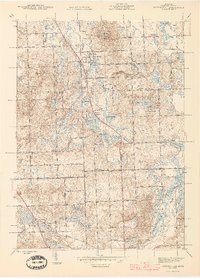
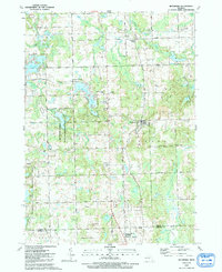
(23)- 1943 Map of Ortonville, 1959 Print
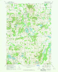
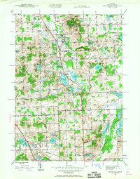 1943 Ortonville1959 Print · USGSDuring the early 1940s, the village of Ortonville and the surrounding townships remained a landscape of country schools and glacial lakes. Genealogists can locate family landmarks like Eaton Cem, Mt Bethel Ch, and the Seymour Lake Sch.
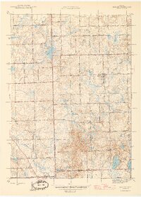
 - 1943 Map of Oxford, 1960 Print
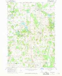
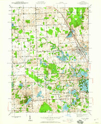 1943 Oxford1960 Print · USGSNorthern Oakland County appears here in the early 1940s, showing a landscape of glacial lakes and rural school districts. Genealogists can locate family landmarks like Oakwood Cem, the Seymour Lake Ch, and numerous schoolhouses including Bailey Sch.2 unique versions available
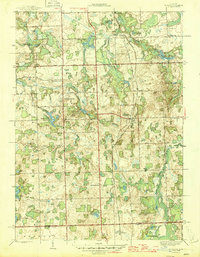
 - 1943 Map of Metamora, 1964 Print
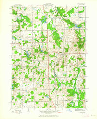 1943 Metamora1964 Print · USGSLapeer County during the early 1940s shows a landscape of small villages and rural schools along the Michigan Central line. Genealogists can trace family names through landmarks like Harris Cem, Newark Sch, and Lake Minnewanna.
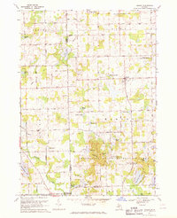
 - 1945 Map of Oxford
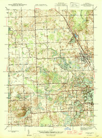 1945 Oxford1945 Print · USGSOakland County's lake country is captured here in the mid-1940s, showing a landscape of small farms and lakeside retreats. Genealogists can locate several rural schools like Bailey Sch and Hunter Sch, or trace the Michigan Central rail line.
 - 1945 Map of Ortonville
 1945 Ortonville1945 Print · USGSNorthwestern Oakland County during the mid-forties reveals a landscape of lakeside communities and rural schools just as post-war growth began. Genealogists can locate family landmarks like Jossman Acres, Mt Bethel Ch, and the Union Brandon Sch.2 unique versions available
 - 1945 Map of Hadley
 1945 Hadley1945 Print · USGSLapeer County at the end of the war reveals a quiet landscape of agricultural homesteads and numerous small lakes. Genealogists can trace family roots at Green Corners Cem or locate rural landmarks like Kipp Sch and the Sawmill near Sawmill Lake.2 unique versions available
 - 1946 Map of Metamora
 1946 Metamora1946 Print · USGSLapeer County was a landscape of small farms and numerous glacial lakes during the mid-1940s. Researchers can trace the Michigan Central rail corridor and locate community landmarks like Farmers Creek Cem, Camp Metamora, and several rural schools.2 unique versions available
 - 1954 Map of Detroit
 1954 Detroit1954 Print · USGSThe Detroit metro and its Ontario neighbors are shown at the height of the mid-century industrial era, just as the suburbs were rapidly expanding. Researchers can trace the massive rail networks of the Wabash Railroad or locate landmarks like Grosse Ile and Selfridge Air Force Base.
 - 1961 Map of Detroit, 1973 Print
 1961 Detroit1973 Print · USGSThe international border between Michigan and Ontario was a bustling industrial corridor in the early sixties. Researchers can trace the transit networks and riverfront infrastructure connecting Detroit to Windsor via the Detroit-Windsor Tunnel and major air hubs like Willow Run Airport.2 unique versions available
 - 1965 Map of Detroit
 1965 Detroit1965 Print · USGSThe industrial corridor between Michigan and Ontario is captured here at mid-century, showing the dense rail and river networks of the Great Lakes. Local historians can trace the paths of the Grand Trunk Western RR and locate key landmarks like Selfridge Air Force Base and Grosse Ile.
 - 1968 Map of Hadley, 1970 Print
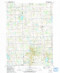
 1968 Hadley1970 Print · USGSMid-century Lapeer and Genesee counties are captured here as traditional farming communities met the growth of lakeside recreation. Researchers can locate family landmarks like Sanborn Cem, the community at Hadley, and the hills of the Ortonville State Recreation Area.2 unique versions available
 - 1968 Map of Ortonville, 1970 Print
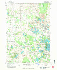
 1968 Ortonville1970 Print · USGSIn the late sixties, this northern Oakland County landscape featured a dense network of glacial lakes and developing residential hubs. Genealogists and local historians can trace family sites at Carmer Cemetery or explore the growth of Ortonville and Brandon Gardens.3 unique versions available
 - 1968 Map of Metamora, 1970 Print
 1968 Metamora1970 Print · USGSLapeer County's rolling lake country is captured here in the late sixties as the village of Metamora and the hamlet of Thomas anchor the local rail line. Researchers can trace historic family burial sites like Harris Cem and Schuneman Cem or explore the early footprints of Camp Metamora and the Metamora-Hadley State Recreation Area.2 unique versions available
 - 1968 Map of Oxford, 1971 Print
 1968 Oxford1971 Print · USGSThe northern Oakland County lake country is captured here during the late sixties, showing a landscape of deep glacial basins and growing shoreline communities. Researchers can trace historic schools and cemeteries such as Clear Lake Sch, Oakwood Cem, and the notable St Josephs Convent.3 unique versions available
 - 1985 Map of Pontiac
 1985 Pontiac1985 Print · USGSSoutheast Michigan in the mid-1980s shows a landscape of growing suburban corridors and expansive public parklands. Genealogists and local historians can trace the footprint of rail lines like the Grand Trunk Western or locate family sites near Oakwood Cem and White Chapel Cem.2 unique versions available
 - 1991 Map of Oxford
 1991 Oxford1991 Print · USGSInland Oakland County in the early nineties shows a landscape of deep glacial lakes and heavy industry. Genealogists can locate family sites at Case Cem or Seymour Lake Cem, while others can trace the Grand Trunk Western RR and numerous gravel pits.2 unique versions available
 - 1991 Map of Metamora
 1991 Metamora1991 Print · USGSLapeer County's lake-studded landscape is captured here in the early nineties as rural homesteads and recreation areas define the terrain. Researchers can trace family history at Farmers Creek Cem, locate the village of Metamora, and find the D Bar A Scout Ranch.
 - 1991 Map of Ortonville
 1991 Ortonville1991 Print · USGSOakland County's lake-rich landscape in the early nineties shows a balance of small-town life and vast public recreation areas. Researchers can trace family history through sites like Ortonville Cem, Mt Bethel Ch, and the Old Railroad Grade.
 - 1991 Map of Hadley
 1991 Hadley1991 Print · USGSThe Lapeer County countryside around Hadley and the northern edge of Oakland County are shown in the early nineties as a landscape of glacial lakes and protected parkland. Genealogists can locate family sites near South Hadley Cem or trace rural properties along Pratt Road and Brigham Road.
 - 2023 Map of Metamora, 2023 Print
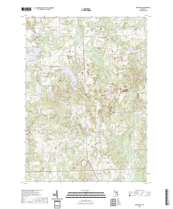 2023 Metamora2023 Print · USGSLapeer County’s glacial lake country is captured in this recent survey of the Metamora and Thomas area. Researchers can trace historic cemeteries like Hunters Creek Cem and old community centers such as Farmers Creek or the high ground at Mount Christie.
 - 2023 Map of Hadley, 2023 Print
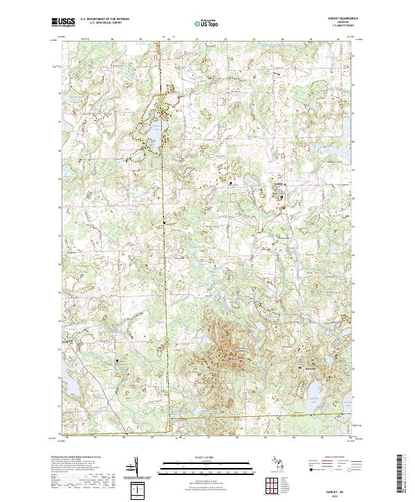 2023 Hadley2023 Print · USGSLapeer County’s glacial landscape is shown in detail during the early 2020s, highlighting the area’s dense concentration of lakes and hills. Researchers can locate family landmarks like the Sweers Family Burial Ground and Sanborn Cem or trace the drainage of Hasler Creek.
 - 2023 Map of Ortonville, 2023 Print
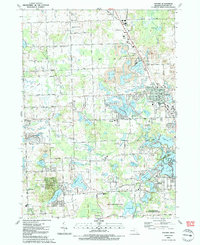
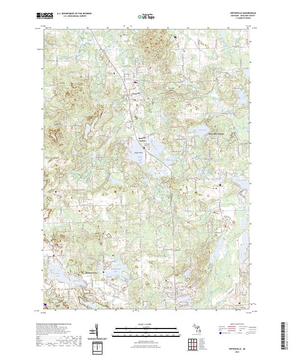 2023 Ortonville2023 Print · USGSOakland County's lake-studded interior is detailed here as it appeared in the early 2020s, centered on the historic village of Ortonville. Researchers can trace local burial sites like Springfield Plains Cem and Bald Eagle Lake Cem or explore the shorelines of Susin Lake and Wau-Me-Gah Lake.
 - 2023 Map of Oxford, 2023 Print
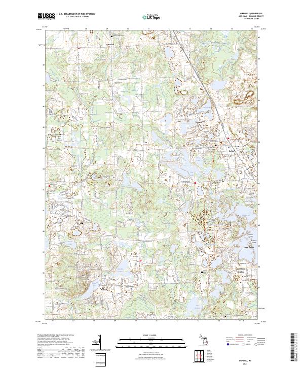 2023 Oxford2023 Print · USGSOakland County's lake country is detailed in this contemporary survey of the Oxford and Lake Orion area. Researchers can trace local heritage through numerous burial sites like Ridgelawn Memorial Cem or locate regional landmarks such as Victoria Island and the Willie Run Airport.
End of results
Showing maps 1-23 of 23
Top cities near Brandon Charter Township
- Troy historical maps
- Rochester Hills historical maps
- Waterford Township historical maps
- West Bloomfield Township historical maps
- Pontiac historical maps
- Commerce Charter Township historical maps
See more
Top neighborhoods of Brandon Charter Township
- Brandon Gardens historical maps
- Perry Lake Heights historical maps
- Oakwood historical maps
- Ortonville historical maps
Frequently asked questions
- What are the different types of historical maps available for Brandon Charter Township?
- What is the oldest map of Brandon Charter Township?
- Where can I purchase historical maps of Brandon Charter Township for my home or office?
- Where can I download high-res historical maps of Brandon Charter Township?
- Are there historical topographic maps available for Brandon Charter Township?
- Is there historical aerial imagery available for Brandon Charter Township?
- Where are historical maps of Brandon Charter Township sourced from?