Old Maps of White Lake Charter Township, Michigan for Genealogy
Trace your family roots with 26 historic maps of White Lake Charter Township. These high-res maps reveal old neighborhoods, homesites, landmarks, and streets — helping you uncover where your ancestors lived and how the area evolved over time.
- Explore historic neighborhoods: Identify where your relatives may have lived in the 1800s or 1900s.
- Compare maps over time: Trace the changes in streets, buildings, and landmarks for multi-generational research.
- Perfect for genealogy & ancestry research: Used by family historians and researchers to map out lineage and migration.
These maps are an incredible resource for exploring your personal connection to White Lake Charter Township's past.
White Lake Charter Township, MI maps
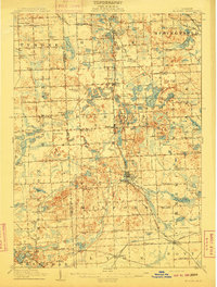
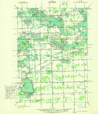
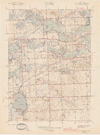
(26)- 1907 Map of Pontiac
 1907 Pontiac1907 Print · USGSOakland County is captured here at a pivotal moment when early electric railways and the Grand Trunk line first connected these lake communities. Trace historic institutional landmarks like the Asylum and Military Academy alongside the Bigelow Mill.5 unique versions available
 - 1909 Map of Milford
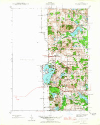
 1909 Milford1909 Print · USGSIn the decade before the automobile era, this area of Oakland County was a patchwork of lakefront settlements and busy rail junctions. Genealogists can trace family footprints near Spring Mills or rural landmarks like the Remington Church and Kenny School.4 unique versions available
 - 1936 Map of Wixom
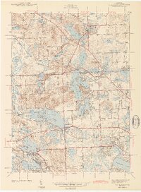
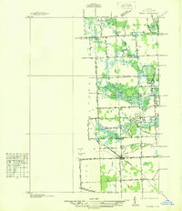 1936 Wixom1936 Print · USGSOakland County's lake district is documented here in the mid-1930s, showing the intersection of rural agriculture and growing recreation. Trace family history at Wixom Cem or locate former landmarks like Stone Sch and the Pere Marquette rail line.
 - 1936 Map of Highland
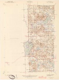
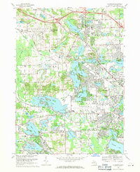
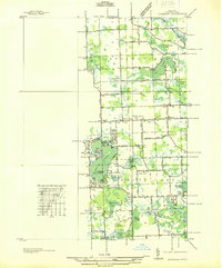 1936 Highland1936 Print · USGSOakland County's lake-rich landscape is captured in the mid-1930s, showing the early residential development around White Lake and the Huron River. Genealogists and local historians can trace the locations of the White Lake Center Sch, Seven Harbors, and the historic White Lake Cem.
 - 1936 Map of Clarkston
 1936 Clarkston1936 Print · USGSOakland County during the mid-1930s shows a landscape of interconnected lakes and early suburban growth near the Clinton River. Genealogists and local historians can trace schoolhouse locations like Dublin Sch and Granger Sch, or explore the rail-era infrastructure of the Grand Trunk Western.
 - 1936 Map of Walled Lake
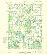
 1936 Walled Lake1936 Print · USGSOakland County's lake country is captured here in the mid-1930s, showing a landscape defined by seasonal recreation and rural institutions. Genealogists and local historians can locate early landmarks like Commerce Cem, the State Tuberculosis Sanitarium, and the lakeside Walled Lake Amusement Park.
 - 1942 Map of Highland, 1965 Print
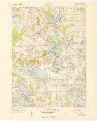
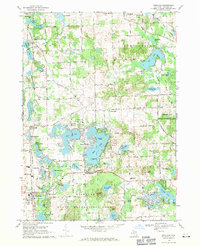
 1942 Highland1965 Print · USGSOakland County's lake country is captured here in the early 1940s, showing a landscape of scattered rural schoolhouses and developing shoreline communities. Researchers can trace the local educational history at White Lake Sch or explore early lakeside life at Seven Harbors.
 - 1943 Map of Clarkston
 1943 Clarkston1943 Print · USGSOakland County's lake country is captured here during the early war years, showing a landscape of interconnected waterways and expanding rail-side villages. Researchers can trace family sites at Lakeview Cem, locate early aviation history at Pontiac Municipal Airport, or follow the Grand Trunk Western RR through Waterford.2 unique versions available
 - 1945 Map of Highland
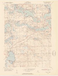
 1945 Highland1945 Print · USGSOakland County's lake country in the mid-1940s reveals a landscape of lakeside settlements and rural schools amidst a growing recreation area. Researchers can trace early family connections through sites like Seven Harbors, White Lake Sch, and the winding Huron River.2 unique versions available
 - 1945 Map of Wixom
 1945 Wixom1945 Print · USGSThe Wixom area in the mid-1940s was a landscape defined by the intersection of the Pere Marquette railway and a burgeoning lakefront community. Local historians can trace early school sites like Stephens Sch or explore the drainage of the Huron River and Proud Lake.2 unique versions available
 - 1945 Map of Walled Lake
 1945 Walled Lake1945 Print · USGSOakland County's lake country is captured here during the mid-1940s as rural farmsteads and lakeside retreats coexist. Genealogists can locate family sites near Commerce Cem, St Joseph Ch, or old schools like Hosner Sch.2 unique versions available
 - 1952 Map of Clarkston, 1954 Print
 1952 Clarkston1954 Print · USGSOakland County's lake country is seen here in the early fifties during its transition from a resort and rail destination to a suburban hub. Researchers can trace the Grand Trunk rail line through Clarkston and Waterford, locating sites like the Fish Hatchery and Sunny Vale Ch.3 unique versions available
 - 1952 Map of Walled Lake, 1954 Print
 1952 Walled Lake1954 Print · USGSOakland County's lake country is captured here in the early fifties, showing a landscape of burgeoning summer retreats and established farmsteads. Researchers can locate family landmarks such as the Richardson Cem, the North Farmington Cem, and local schools like Bassett Sch.3 unique versions available
 - 1954 Map of Detroit
 1954 Detroit1954 Print · USGSThe Detroit metro and its Ontario neighbors are shown at the height of the mid-century industrial era, just as the suburbs were rapidly expanding. Researchers can trace the massive rail networks of the Wabash Railroad or locate landmarks like Grosse Ile and Selfridge Air Force Base.
 - 1954 Map of Milford, 1955 Print
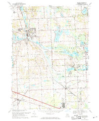
 1954 Milford1955 Print · USGSOakland County's lake country is captured here in the mid-fifties, showing the evolution of Milford and New Hudson before modern suburban sprawl. Researchers can trace the Huron River corridor, locate the New Hudson Airport, and find early local landmarks like Glengary and the Hickory Hill Golf Club.
 - 1961 Map of Detroit, 1973 Print
 1961 Detroit1973 Print · USGSThe international border between Michigan and Ontario was a bustling industrial corridor in the early sixties. Researchers can trace the transit networks and riverfront infrastructure connecting Detroit to Windsor via the Detroit-Windsor Tunnel and major air hubs like Willow Run Airport.2 unique versions available
 - 1965 Map of Detroit
 1965 Detroit1965 Print · USGSThe industrial corridor between Michigan and Ontario is captured here at mid-century, showing the dense rail and river networks of the Great Lakes. Local historians can trace the paths of the Grand Trunk Western RR and locate key landmarks like Selfridge Air Force Base and Grosse Ile.
 - 1968 Map of Clarkston, 1971 Print
 1968 Clarkston1971 Print · USGSOakland County's lake-rich landscape is captured in the late sixties as suburban growth surrounds established villages and rural colleges. Trace family roots and local history at Lakeview Cemetery, Columbiere College, or along the historic Dixie Hwy.4 unique versions available
 - 1968 Map of Highland, 1971 Print
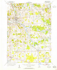
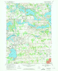
 1968 Highland1971 Print · USGSOakland County's lake country is seen here in the late sixties as residential shoreline development expanded around the region's glacial basins. Researchers can trace family sites at Rose Center Cem, locate old schools like Duck Lake Sch, and follow the Chesapeake and Ohio rail line.4 unique versions available
 - 1969 Map of Milford, 1971 Print
 1969 Milford1971 Print · USGSOakland County's lake country is captured here in the late sixties as the area between Milford and Wixom began to develop. Researchers can trace local landmarks like Milford High School, the Fish Hatchery, and the Chesapeake and Ohio rail line.5 unique versions available
 - 1969 Map of Walled Lake, 1971 Print
 1969 Walled Lake1971 Print · USGSOakland County's lake country transitions from a rural past to a suburban future in the late sixties. Genealogists and historians can locate old burial grounds like Richardson Cem and Walled Lake Cem or trace the Grand Trunk Western rail line.5 unique versions available
 - 1985 Map of Pontiac
 1985 Pontiac1985 Print · USGSSoutheast Michigan in the mid-1980s shows a landscape of growing suburban corridors and expansive public parklands. Genealogists and local historians can trace the footprint of rail lines like the Grand Trunk Western or locate family sites near Oakwood Cem and White Chapel Cem.2 unique versions available
 - 2023 Map of Walled Lake, 2023 Print
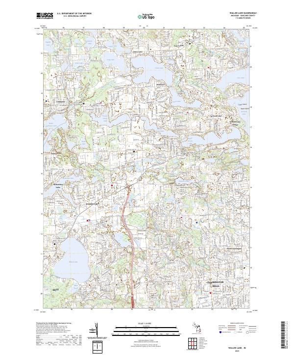 2023 Walled Lake2023 Print · USGSOakland County's lake country is seen here in a period of mature suburban development, where historic trails meet modern residential clusters. Genealogists and local researchers can pinpoint early burial sites like the Commerce Village Burying Ground and Richardson Cem near Wolverine Lake.
 - 2023 Map of Clarkston, 2023 Print
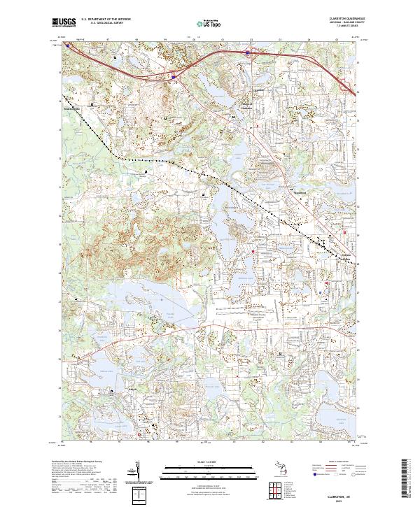 2023 Clarkston2023 Print · USGSOakland County's lake country is captured in this modern survey, showing the evolution of historic settlements into thriving residential communities. Genealogists can trace family sites at All Saints Cem, Andersonville, and the Village of Clarkston.
 - 2023 Map of Milford, 2023 Print
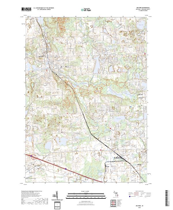 2023 Milford2023 Print · USGSOakland County's lake-rich terrain is captured in this contemporary survey of the Huron River corridor. Genealogists can trace burial grounds like Oak Grove Cem and Wixom Cem alongside the historic routes of Pontiac Trl.
Showing maps 1-25 of 26
Top cities near White Lake Charter Township
- Detroit historical maps
- Livonia historical maps
- Farmington Hills historical maps
- Southfield historical maps
- Waterford Township historical maps
- Novi historical maps
See more
Top neighborhoods of White Lake Charter Township
Frequently asked questions
- What are the different types of historical maps available for White Lake Charter Township?
- What is the oldest map of White Lake Charter Township?
- Where can I purchase historical maps of White Lake Charter Township for my home or office?
- Where can I download high-res historical maps of White Lake Charter Township?
- Are there historical topographic maps available for White Lake Charter Township?
- Is there historical aerial imagery available for White Lake Charter Township?
- Where are historical maps of White Lake Charter Township sourced from?