2020s Maps of Rose City, Michigan
Explore 2 historic maps of Rose City from the 2020s. These maps offer a rare glimpse into what life looked like during the 2020s — showing old roads, neighborhoods, homes, and landmarks that have changed or disappeared over time.
Whether you're researching your family's past, planning a metal detecting trip, or studying how Rose City's landscape evolved across the 2020s, these high-resolution maps are a powerful tool for exploring the history of this region.
- Focus on a specific era: All maps on this page are from the 2020s, giving you a focused view of this time period.
- See what’s changed: Compare century-old streets, trails, and buildings to today's modern landscape using overlays and satellite layers.
- Research with precision: Use these maps for genealogy, historical research, land use analysis, or educational projects.
- View, download, or print: Maps are fully viewable online in high resolution, and can be downloaded or printed for your own records.
Start exploring Rose City's history through authentic maps from the 2020s. This is your window into the past.
Rose City, MI maps
(2)- 2023 Map of Rose City, 2023 Print
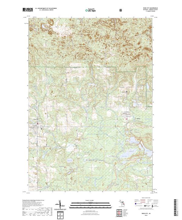 2023 Rose City2023 Print · USGSRose City and Lupton sit at the gateway to the North Woods in this modern topographic study of Ogemaw County. Researchers can trace local lineage at Rose City Cem and Lane Heights Cem or explore the lake-rich landscape of the Rifle River State Recreation Area.
 - 2023 Map of Damon, 2023 Print
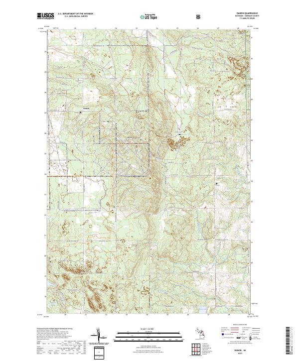 2023 Damon2023 Print · USGSOgemaw County’s forested interior is documented here in the 2020s, showing a landscape defined by wildlife management and the Huron National Forest. Researchers can locate the settlement of Damon and several local burial sites including Damon Cem and Tucker Cem.
End of results
Showing maps 1-2 of 2
Top cities near Rose City
Frequently asked questions
- What are the different types of historical maps available for Rose City?
- What is the oldest map of Rose City?
- Where can I purchase historical maps of Rose City for my home or office?
- Where can I download high-res historical maps of Rose City?
- Are there historical topographic maps available for Rose City?
- Is there historical aerial imagery available for Rose City?
- Where are historical maps of Rose City sourced from?