2020s Maps of Reed City, Michigan
Explore 4 historic maps of Reed City from the 2020s. These maps offer a rare glimpse into what life looked like during the 2020s — showing old roads, neighborhoods, homes, and landmarks that have changed or disappeared over time.
Whether you're researching your family's past, planning a metal detecting trip, or studying how Reed City's landscape evolved across the 2020s, these high-resolution maps are a powerful tool for exploring the history of this region.
- Focus on a specific era: All maps on this page are from the 2020s, giving you a focused view of this time period.
- See what’s changed: Compare century-old streets, trails, and buildings to today's modern landscape using overlays and satellite layers.
- Research with precision: Use these maps for genealogy, historical research, land use analysis, or educational projects.
- View, download, or print: Maps are fully viewable online in high resolution, and can be downloaded or printed for your own records.
Start exploring Reed City's history through authentic maps from the 2020s. This is your window into the past.
Reed City, MI maps
(4)- 2023 Map of Reed City North, 2023 Print
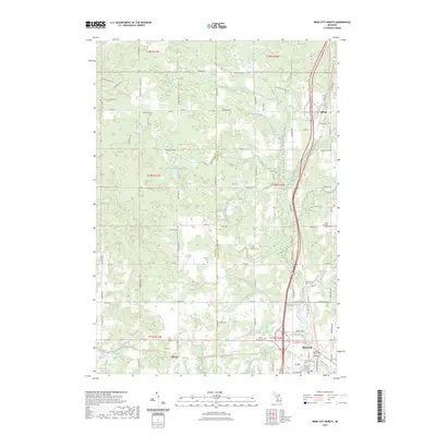 2023 Reed City North2023 Print · USGSOsceola County at the start of the 2020s shows the enduring layout of the northern Michigan countryside around Reed City. Researchers can trace the path of the Fred Meijer White Pine Trail State Park Trl or locate family burial sites at Ashton Cem and Wilson Cem.
 - 2023 Map of Hersey, 2023 Print
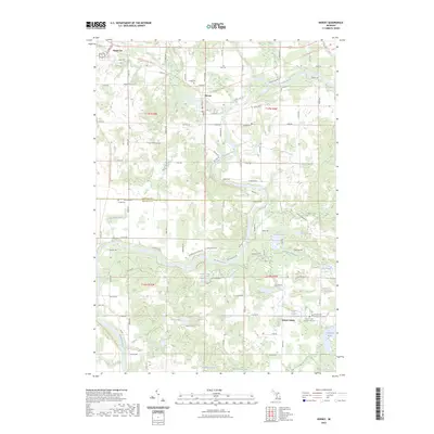 2023 Hersey2023 Print · USGSOsceola County at the junction of the Muskegon and Hersey Rivers shows a landscape transitioning from its rail-industrial roots to recreation. You can trace early burial sites at Crapo and Oakdale Cemeteries, or locate the settlements of Hersey and Grant Center.
 - 2023 Map of Slaybaugh Corner, 2023 Print
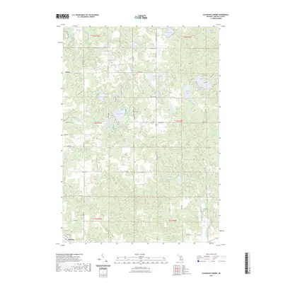 2023 Slaybaugh Corner2023 Print · USGSOsceola County is captured here in the early 2020s, revealing a landscape of dense glacial lakes and rural settlements. Trace family history near Ashton and the Bethel Cem, or explore the shorelines of Robinson Lake and Eggleston Lake.
 - 2023 Map of Reed City South, 2023 Print
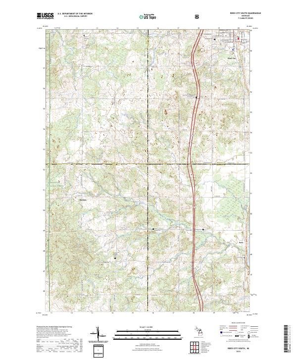 2023 Reed City South2023 Print · USGSFour Michigan counties converge in this contemporary survey of the wooded and agricultural lands south of the Reed City hub. Genealogists can trace family footprints through numerous rural burial grounds such as Barton Township Cem and the Saint Paul's Evangelical Lutheran Cem.
End of results
Showing maps 1-4 of 4
Top cities near Reed City
- Big Rapids historical maps
- Evart historical maps
- Chase historical maps
- Hersey historical maps
- Luther historical maps
- LeRoy historical maps
See more
Frequently asked questions
- What are the different types of historical maps available for Reed City?
- What is the oldest map of Reed City?
- Where can I purchase historical maps of Reed City for my home or office?
- Where can I download high-res historical maps of Reed City?
- Are there historical topographic maps available for Reed City?
- Is there historical aerial imagery available for Reed City?
- Where are historical maps of Reed City sourced from?