2020s Maps of Livingston Township, Michigan
Explore 2 historic maps of Livingston Township from the 2020s. These maps offer a rare glimpse into what life looked like during the 2020s — showing old roads, neighborhoods, homes, and landmarks that have changed or disappeared over time.
Whether you're researching your family's past, planning a metal detecting trip, or studying how Livingston Township's landscape evolved across the 2020s, these high-resolution maps are a powerful tool for exploring the history of this region.
- Focus on a specific era: All maps on this page are from the 2020s, giving you a focused view of this time period.
- See what’s changed: Compare century-old streets, trails, and buildings to today's modern landscape using overlays and satellite layers.
- Research with precision: Use these maps for genealogy, historical research, land use analysis, or educational projects.
- View, download, or print: Maps are fully viewable online in high resolution, and can be downloaded or printed for your own records.
Start exploring Livingston Township's history through authentic maps from the 2020s. This is your window into the past.
Livingston Township, MI maps
(2)- 2023 Map of Gaylord, 2023 Print
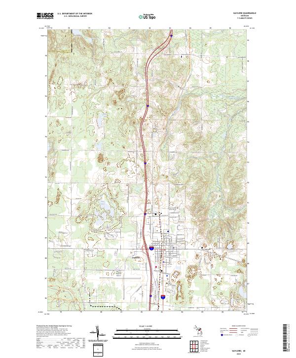 2023 Gaylord2023 Print · USGSGaylord and the surrounding Otsego County countryside are shown in high detail during this recent decade of development and preservation. Researchers can locate several burial grounds like Saint Mary Cem and Bagley Cem or trace the headwaters of the Sturgeon River.
 - 2023 Map of Sparr, 2023 Print
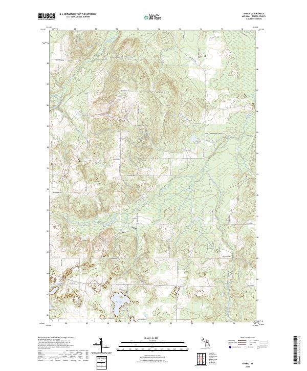 2023 Sparr2023 Print · USGSOtsego County's rural character and complex drainage systems are visible in this recent study of the area surrounding Sparr. Genealogists and researchers can trace local family landmarks and access points along Jackson Hill Rd, Big Lake, and the winding Pigeon River.
End of results
Showing maps 1-2 of 2
Top cities near Livingston Township
- Gaylord historical maps
- Otsego Lake historical maps
- Elmira historical maps
- Vanderbilt historical maps
- Wolverine historical maps
Frequently asked questions
- What are the different types of historical maps available for Livingston Township?
- What is the oldest map of Livingston Township?
- Where can I purchase historical maps of Livingston Township for my home or office?
- Where can I download high-res historical maps of Livingston Township?
- Are there historical topographic maps available for Livingston Township?
- Is there historical aerial imagery available for Livingston Township?
- Where are historical maps of Livingston Township sourced from?