1980s Maps of Presque Isle County, Michigan
Explore 15 historic maps of Presque Isle County from the 1980s. These maps offer a rare glimpse into what life looked like during the 1980s — showing old roads, neighborhoods, homes, and landmarks that have changed or disappeared over time.
Whether you're researching your family's past, planning a metal detecting trip, or studying how Presque Isle County's landscape evolved across the 1980s, these high-resolution maps are a powerful tool for exploring the history of this region.
- Focus on a specific era: All maps on this page are from the 1980s, giving you a focused view of this time period.
- See what’s changed: Compare century-old streets, trails, and buildings to today's modern landscape using overlays and satellite layers.
- Research with precision: Use these maps for genealogy, historical research, land use analysis, or educational projects.
- View, download, or print: Maps are fully viewable online in high resolution, and can be downloaded or printed for your own records.
Start exploring Presque Isle County's history through authentic maps from the 1980s. This is your window into the past.
Presque Isle County, MI maps
(15)- 1982 Map of Petoskey
 1982 Petoskey1982 Print · USGSNorthern Michigan in the early eighties shows a landscape of deep timber and vast inland lakes. Genealogists and historians can trace the rail corridors of the Michigan Central and Detroit and Mackinac between Petoskey, Gaylord, and Wolverine.
 - 1982 Map of Cordwood Point, 1983 Print
 1982 Cordwood Point1983 Print · USGSCoastal Cheboygan County during the early eighties shows a landscape of protected timberlands and quiet bays. You can trace early trails and landmarks like Cordwood Trail, the Coast Guard Chapel, and the elevated vistas of High Banks.
 - 1982 Map of Grace, 1983 Print
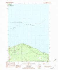
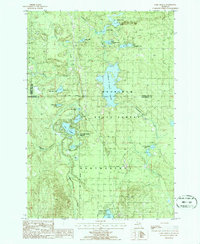
 1982 Grace1983 Print · USGSCoastal Presque Isle County meets the shoreline of the Great Lakes in the early 1980s, showcasing a landscape defined by state forests and northern waters. Local historians can trace the lakeside settlements of Grace and Huron Beach or locate the Township Cem near Clear Lake.
 - 1982 Map of Nilemile Point, 1983 Print
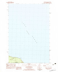 1982 Nilemile Point1983 Print · USGSThe Lake Huron shoreline comes into focus in the early eighties at the boundary of Cheboygan and Presque Isle counties. Researchers can trace the coastal geography of Benton and Bearinger townships, from Greene Creek to the Roadside Park at Ninemile Point.
 - 1982 Map of Manning, 1983 Print
 1982 Manning1983 Print · USGSCheboygan County’s backcountry comes into focus in the early eighties, showing the transition from the Black River wetlands to the heights of Black Mountain. Researchers can locate the Black River Ch and trace old transportation routes like the northern Railroad Grade.
 - 1984 Map of Alpena
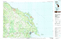 1984 Alpena1984 Print · USGSThe Lake Huron shoreline in the 1980s reveals a region defined by maritime industry, timberlands, and vast inland waters. Genealogists and historians can trace the Detroit and Mackinac Railroad past old settlements like Posen, Hagensville, and the harbor at Rockport.
 - 1984 Map of Cheboygan, 1985 Print
 1984 Cheboygan1985 Print · USGSThe Straits of Mackinac and the northern tip of Michigan's Lower Peninsula are shown here in the mid-1980s. Local researchers can trace family landmarks and rural crossroads from St Ignace to Cheboygan, including Riggsville and Levering.
 - 1986 Map of Onaway
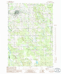 1986 Onaway1986 Print · USGSIn the mid-1980s, the northern Michigan community of Onaway sat at the edge of the sprawling Mackinaw State Forest. Researchers can trace the path of an Abandoned Railroad or locate local landmarks like Loon Lake and the Cem near the county line.
 - 1986 Map of Millersburg
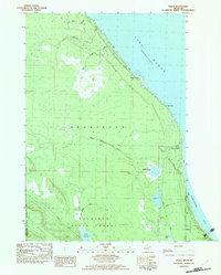
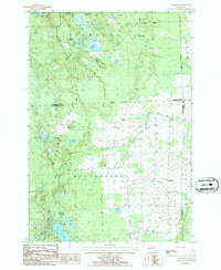
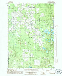 1986 Millersburg1986 Print · USGSPresque Isle County in the mid-1980s is shown here as a dense network of state forests and inland lakes centered on the village of Millersburg. Trace old rural infrastructure and shoreline properties at Lake Nettie, Rainy Lake, and the locality of Big Cut.
 - 1986 Map of Ocqueoc
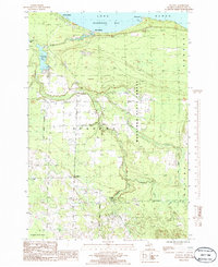 1986 Ocqueoc1986 Print · USGSCoastal Presque Isle County is captured here in the mid-1980s, showcasing the intersection of Lake Huron shorelines and deep state forests. Researchers can trace the path of the Ocqueoc River to Ocqueoc Falls or locate the shoreline community of Huron Beach.
 - 1986 Map of Royston
 1986 Royston1986 Print · USGSMontmorency County and the Mackinaw State Forest are shown here in the mid-1980s, revealing a landscape of dense timber and glacial lakes. Genealogists and local historians can trace the early Old Railroad Grade and find family sites near Royston or the Cem in Wellington.
 - 1986 Map of Cranberry Lake
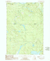 1986 Cranberry Lake1986 Print · USGSMontmorency and Presque Isle counties are captured in the mid-1980s as a densely forested lake district within the Mackinaw State Forest. Researchers can trace the water flow from the Rainy River Dam through the Rainy River Flooding and locate remote features like the northern Landing Strip (Pvt).
 - 1986 Map of Black Lake Bluffs
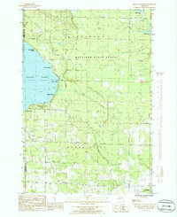 1986 Black Lake Bluffs1986 Print · USGSThe southeastern shores of Black Lake are captured here in the mid-1980s, showcasing a landscape of public forests and lakefront settlements. Genealogists and researchers can trace the Old RR Grade or locate early recreation sites like Onaway State Park and Coddes Beach.
 - 1986 Map of Hillman NE
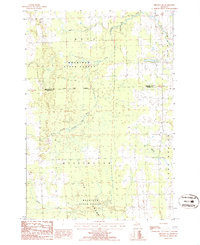 1986 Hillman NE1986 Print · USGSNortheastern Michigan in the mid-1980s reveals a landscape of dense state timberlands and winding river systems. Local historians can trace property lines through Metz and Wellington or locate landmarks like Long Swamp and the Gravel Pit.
 - 1986 Map of Lake Geneva
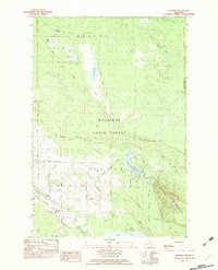
 1986 Lake Geneva1986 Print · USGSMontmorency County and the surrounding state forest lands are shown here in the mid-eighties as a pristine network of glacial lakes and managed timber. You can trace the boundaries of Canada Creek Ranch or locate campsites at Clear Lake State Park and Shoepac Lake.
End of results
Showing maps 1-15 of 15
Top cities of Presque Isle County
Frequently asked questions
- What are the different types of historical maps available for Presque Isle County?
- What is the oldest map of Presque Isle County?
- Where can I purchase historical maps of Presque Isle County for my home or office?
- Where can I download high-res historical maps of Presque Isle County?
- Are there historical topographic maps available for Presque Isle County?
- Is there historical aerial imagery available for Presque Isle County?
- Where are historical maps of Presque Isle County sourced from?