Old Maps of Rogers City, Michigan for Genealogy
Trace your family roots with 11 historic maps of Rogers City. These high-res maps reveal old neighborhoods, homesites, landmarks, and streets — helping you uncover where your ancestors lived and how the area evolved over time.
- Explore historic neighborhoods: Identify where your relatives may have lived in the 1800s or 1900s.
- Compare maps over time: Trace the changes in streets, buildings, and landmarks for multi-generational research.
- Perfect for genealogy & ancestry research: Used by family historians and researchers to map out lineage and migration.
These maps are an incredible resource for exploring your personal connection to Rogers City's past.
Rogers City, MI maps
(11)- 1954 Map of Alpena, 1978 Print
 1954 Alpena1978 Print · USGSThe northern waters of Lake Huron meet the Ontario islands during the mid-1950s, a time of active coastal shipping and timber management. Genealogists and historians can trace the Detroit and Mackinac rail line through Alpena or locate rural landmarks like St. Catharine Ch and Forty Mile Point.2 unique versions available
 - 1957 Map of Alpena
 1957 Alpena1957 Print · USGSNortheast Michigan and the islands of the North Channel are captured in the mid-1950s, showing the vital maritime and rail connections of the region. Researchers can trace the path of the Detroit and Mackinac RR or locate small settlements like Meldrum Bay and Lachine.
 - 1958 Map of Alpena
 1958 Alpena1958 Print · USGSThe northern reaches of Lake Huron and the Ontario islands are mapped here in the late fifties. You can trace the Detroit and Mackinac RR through Rogers City or locate remote outposts like Meldrum Bay and St. Vital church.
 - 1969 Map of Alpena
 1969 Alpena1969 Print · USGSThe Lake Huron coastline and the Manitoulin islands come alive in this mid-century survey of the Michigan-Ontario border. Genealogists and historians can trace the Detroit and Mackinac rail line through settlements like Lachine and Cathro, or locate the numerous island reservations including Obigewong Indian Reservation No 21.
 - 1971 Map of Rogers City, 1974 Print
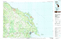
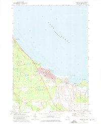 1971 Rogers City1974 Print · USGSPresque Isle County’s industrial and lakeside character comes to life in the early 1970s. Genealogists and researchers can trace the streets of Rogers City, locate parochial schools like St Johns Sch, and see the footprint of the massive Quarry.
 - 1984 Map of Alpena
 1984 Alpena1984 Print · USGSThe Lake Huron shoreline in the 1980s reveals a region defined by maritime industry, timberlands, and vast inland waters. Genealogists and historians can trace the Detroit and Mackinac Railroad past old settlements like Posen, Hagensville, and the harbor at Rockport.
 - 2011 Map of Rogers City, 2011 Print
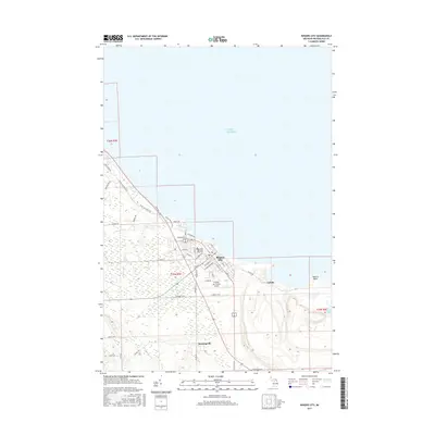
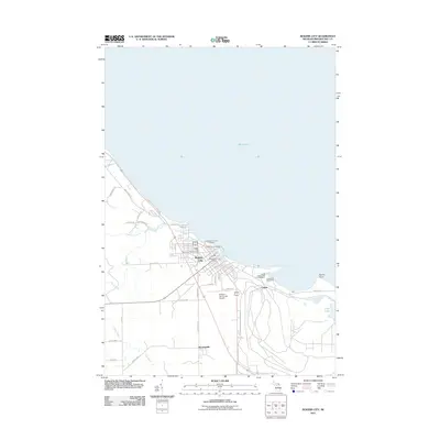 2011 Rogers City2011 Print · USGSCovers Rogers City, including Bruningville, Pulawski Township, and other nearby areas
 - 2014 Map of Rogers City, 2014 Print
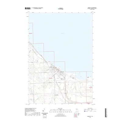
 2014 Rogers City2014 Print · USGSCovers Rogers City, including Bruningville, Pulawski Township, and other nearby areas
 - 2017 Map of Rogers City, 2017 Print
 2017 Rogers City2017 Print · USGSCovers Rogers City, including Bruningville, Pulawski Township, and other nearby areas
 - 2019 Map of Rogers City, 2019 Print
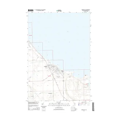
 2019 Rogers City2019 Print · USGSCovers Rogers City, including Bruningville, Pulawski Township, and other nearby areas
 - 2023 Map of Rogers City, 2023 Print
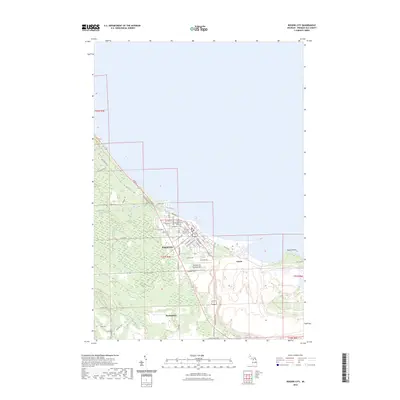 2023 Rogers City2023 Print · USGSRogers City and the surrounding Presque Isle County coastline are captured here in the early twenty-first century. Researchers can trace local genealogy and land use through landmarks like City Memorial Park Cem, the industrial site at Calcite, and the small community of Bruningville.
End of results
Showing maps 1-11 of 11
Top cities near Rogers City
Top neighborhoods of Rogers City
Frequently asked questions
- What are the different types of historical maps available for Rogers City?
- What is the oldest map of Rogers City?
- Where can I purchase historical maps of Rogers City for my home or office?
- Where can I download high-res historical maps of Rogers City?
- Are there historical topographic maps available for Rogers City?
- Is there historical aerial imagery available for Rogers City?
- Where are historical maps of Rogers City sourced from?