Old Maps of Albee Township, Michigan for Metal Detecting
Plan your next treasure hunt with 43 historic maps of Albee Township. Find old homesites, ghost towns, trails, and gathering spots that may be lost to time — perfect for identifying promising metal detecting locations.
- Locate forgotten sites: Uncover places like long-lost settlements, abandoned rail lines, or gathering spots.
- Plan better hunts: Use map overlays combined with LiDAR or satellite views to narrow in on historically rich areas.
- Made for detectorists: Thousands of hobbyists use these maps to discover relics, coins, and hidden history.
Use these historic maps to boost your research and find new opportunities beneath the surface of Albee Township.
Albee Township, MI maps
(43)- 1917 Map of Chesaning
 1917 Chesaning1917 Print · USGSSaginaw and Shiawassee Counties were thriving agricultural and rail hubs when this survey was completed in the mid-1910s. Genealogists and local historians can trace family roots through numerous country schoolhouses like Ziegler School and landmarks like the Sixmile Mine.4 unique versions available
 - 1917 Map of St. Charles
 1917 St. Charles1917 Print · USGSThe Saginaw Valley coal and rail corridor comes into focus here during the early twentieth century. Genealogists and researchers can trace family lands near dozens of local landmarks like No 3 Mine, Oakwood Cemetery, and the Prairie Farm.4 unique versions available
 - 1919 Map of Saginaw
 1919 Saginaw1919 Print · USGSSaginaw and its river-based industrial corridor are captured here at a peak of rail and water transport just after the Great War. Genealogists and researchers can locate dozens of country schools like Jewett School, the Whatcheer Mine, and local stops such as Frankenmuth Junction.3 unique versions available
 - 1919 Map of Burt, 1959 Print
 1919 Burt1959 Print · USGSThe rural landscape between Saginaw and Flint is captured here in the years following the Great War. Genealogists can locate dozens of country schoolhouses like Marr School and Deneen School, or trace the path of the Michigan United Electric Railway.
 - 1921 Map of Burt
 1921 Burt1921 Print · USGSSaginaw and Genesee Counties are captured here at the end of the Great War, showing a landscape of tight-knit farming communities and early electric transit. Researchers can trace family roots through dozens of named sites like St Michaels Church, Marr School, and the Michigan Electric Railway.2 unique versions available
 - 1941 Map of Saginaw, 1958 Print
 1941 Saginaw1958 Print · USGSThe Saginaw River Valley in the early 1940s reveals a bustling network of river-and-rail industry and rural district schools. Genealogists can trace family landmarks like Frankentrost Sta, Birch Run, and the Crow Island Sch.2 unique versions available
 - 1943 Map of Burt
 1943 Burt1943 Print · USGSThe rural borders of Saginaw and Genesee counties come alive in the 1940s as the Flint River winds past growing farm towns. Genealogists and historians can trace dozens of family-named schoolhouses and crossroads, from St Michaels Ch to the rail hubs of Burt and Montrose.
 - 1943 Map of Chesaning
 1943 Chesaning1943 Print · USGSMid-Michigan's river-driven economy is on display here during the early 1940s, as the Shiawassee River winds through fertile farm country. Genealogists and researchers can locate dozens of country schoolhouses like Albert Sch and trace industrial sites including the Sixmile Mine.
 - 1943 Map of Saginaw
 1943 Saginaw1943 Print · USGSSaginaw and its surrounding river valleys are captured here during the wartime era, showing a landscape defined by heavy rail and branching waterways. Genealogists and historians can locate dozens of country schoolhouses like Frankentrost Sch and Popp Sch alongside rail stops at Fosters and Blackmar.
 - 1943 Map of St. Charles
 1943 St. Charles1943 Print · USGSMid-century Saginaw County emerges here as a hub of river-and-rail industry during the height of the coal era. Genealogists and historians can trace family-named schools and early settlements from St. Charles to Hemlock, alongside No 3 Mine.
 - 1954 Map of Midland, 1967 Print
 1954 Midland1967 Print · USGSMid-Michigan at the peak of the post-war era shows a landscape balancing industrial growth in Midland with the deep timberlands of the Manistee National Forest. Researchers can trace the legacy of the timber and rail era along the Pennsylvania RR or find family roots in river towns like Chesaning and Big Rapids.4 unique versions available
 - 1954 Map of Flint, 1968 Print
 1954 Flint1968 Print · USGSThe industrial corridor and fertile Thumb region of Michigan come alive in this mid-century survey. Genealogists and historians can trace the rail networks of the Grand Trunk, locate established settlements like Bad Axe and Sandusky, or explore the 1950s shoreline along Saginaw Bay.4 unique versions available
 - 1958 Map of Flint
 1958 Flint1958 Print · USGSThe Michigan Thumb and the Saginaw Valley are captured here during the height of the post-war industrial era. Researchers can trace the complex rail networks of the Grand Trunk Western or locate mid-century landmarks like Lakeport State Park and the port at Bay City.2 unique versions available
 - 1958 Map of Midland
 1958 Midland1958 Print · USGSCentral Michigan in the late fifties is captured here during a period of transition for its university towns and industrial hubs. Genealogists and researchers can trace family lines through old rail-stop towns like Breckenridge and Chesaning or locate property near the Muskegon River and Prairie Farm.
 - 1959 Map of Midland
 1959 Midland1959 Print · USGSMid-century Michigan comes alive in this survey of the central Lower Peninsula, from the streets of Grand Rapids to the Houghton Lake timberlands. Genealogists and rail fans can trace the Ann Arbor RR and Chesapeake and Ohio RR through towns like Big Rapids and Mount Pleasant.
 - 1966 Map of Midland
 1966 Midland1966 Print · USGSCentral Michigan in the mid-1960s shows a landscape of growing manufacturing hubs and active resource extraction. Genealogists and historians can trace the rail corridors of the Grand Trunk Western or locate family-named landmarks near Oil wells and the Muskegon River.
 - 1967 Map of Bridgeport, 1969 Print
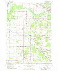 1967 Bridgeport1969 Print · USGSSaginaw County’s river-bound lowlands are captured here in the late sixties, showing the transition from rural farming to mid-century development. Researchers can trace family roots at Taymouth Cem or locate local landmarks like White Sch and the Radio Towers (WKNX).2 unique versions available
 - 1969 Map of Montrose, 1971 Print
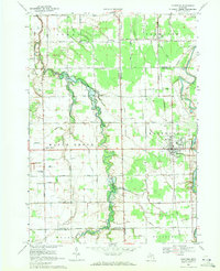 1969 Montrose1971 Print · USGSThe agricultural borderlands of Saginaw and Genesee counties are captured here in the late sixties as traditional farming life centered around the Grand Trunk Western rail line. Researchers can trace family-named sites like Layton Corners, Indian Cem, and Cook Chapel.2 unique versions available
 - 1975 Map of Alicia, 1978 Print
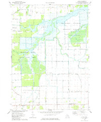 1975 Alicia1978 Print · USGSSaginaw County's river-rich lowlands are mapped here in the mid-1970s at the confluence of several major waterways. Researchers can trace the drainage and settlement patterns around Alicia, Prairie Farm, and the Shiawassee National Wildlife Refuge.
 - 1975 Map of Chesaning East, 1978 Print
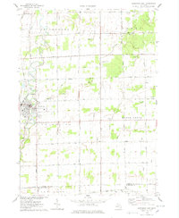 1975 Chesaning East1978 Print · USGSSaginaw County's agricultural heartland is documented here in the mid-seventies, centered on the riverfront village of Chesaning. Genealogists and local historians can trace family locations near St Mary Cem, the Conrail line, and numerous rural crossroads like Amman Road.
 - 1984 Map of Flint, 1985 Print
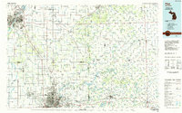 1984 Flint1985 Print · USGSThe industrial corridor between Flint and Saginaw is captured here during the mid-1980s, showcasing a landscape of growing suburbs and preserved wildlands. Researchers can trace the Grand Trunk Western RR or locate local landmarks like St Johns Ch and Flint Memorial Park Cem.
 - 1985 Map of Alma
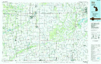 1985 Alma1985 Print · USGSCentral Michigan in the mid-eighties shows a landscape of steady agricultural communities and vital rail corridors. Genealogists and local historians can trace family roots through the detailed grids of Alma, Ithaca, and Chesaning, or locate rural landmarks like Riverside Cem and Lumberjack Land Airport.2 unique versions available
 - 1990 Map of Flint, 1991 Print
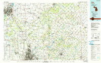 1990 Flint1991 Print · USGSThe Flint and Saginaw corridors are captured here in the early nineties, showing a landscape defined by heavy industry and rural expanses. Genealogists and historians can trace the rail lines of the Penn Central RR, visit Flint Memorial Park Cem, or explore the limits of Zilwaukee.
 - 2011 Map of Alicia, 2011 Print
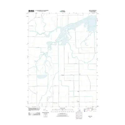 2011 Alicia2011 Print · USGSSaginaw County’s riverine landscape is captured here in the early twenty-first century, centered on the wetlands of the Shiawassee River. Researchers can locate Indiantown Cemetery and trace the drainage of Prairie Farm and the settlement at Alicia.
 - 2011 Map of Chesaning East, 2011 Print
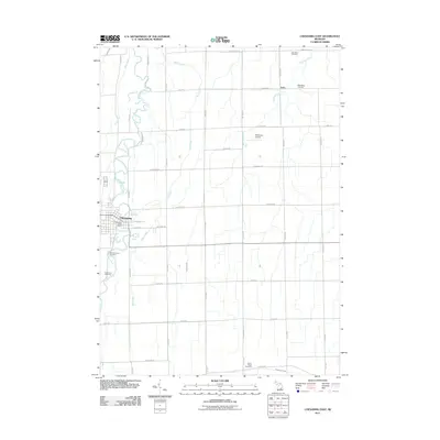 2011 Chesaning East2011 Print · USGSSaginaw County's agricultural heartland is documented here in the early twenty-first century, centered on the riverfront village of Chesaning. Local historians can trace family locations and land use near the Shiawassee River, Luce, and Wildwood Cemetery.
Showing maps 1-25 of 43
Top cities near Albee Township
- Flint historical maps
- Saginaw historical maps
- Flushing historical maps
- Taymouth historical maps
- Swan Creek historical maps
- Chesaning historical maps
See more
Top neighborhoods of Albee Township
Frequently asked questions
- What are the different types of historical maps available for Albee Township?
- What is the oldest map of Albee Township?
- Where can I purchase historical maps of Albee Township for my home or office?
- Where can I download high-res historical maps of Albee Township?
- Are there historical topographic maps available for Albee Township?
- Is there historical aerial imagery available for Albee Township?
- Where are historical maps of Albee Township sourced from?