Old Maps of Gardendale, Fort Gratiot Charter Township for Academic Research
Study the evolution of Gardendale with 9 high-resolution historic maps. Whether you're teaching, researching, or modeling changes in land use, these maps provide essential visual documentation of urban, environmental, and geographic change.
- Analyze long-term change: Track patterns in development, transportation, and natural features.
- Ideal for environmental or urban studies: Support academic projects with primary historical map data.
- Use in the classroom or lab: Educators and researchers rely on these maps to bring historical context to life.
These maps are a powerful tool for teaching, research, and visualizing how Gardendale has changed over the decades.
Gardendale, Fort Gratiot Charter Township maps
(9)- 1954 Map of Flint, 1968 Print
 1954 Flint1968 Print · USGSThe industrial corridor and fertile Thumb region of Michigan come alive in this mid-century survey. Genealogists and historians can trace the rail networks of the Grand Trunk, locate established settlements like Bad Axe and Sandusky, or explore the 1950s shoreline along Saginaw Bay.4 unique versions available
 - 1958 Map of Flint
 1958 Flint1958 Print · USGSThe Michigan Thumb and the Saginaw Valley are captured here during the height of the post-war industrial era. Researchers can trace the complex rail networks of the Grand Trunk Western or locate mid-century landmarks like Lakeport State Park and the port at Bay City.2 unique versions available
 - 1961 Map of Lakeport, 1963 Print
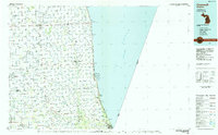
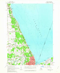 1961 Lakeport1963 Print · USGSCoastal St. Clair County meets the Ontario shoreline in the early sixties, documenting the bustling international border along the St Clair River. Researchers can trace the layout of Port Huron, locate the historic Mt Hope Cemetery, and find the early footprint of Baker Airport.2 unique versions available
 - 1984 Map of Croswell, 1985 Print
 1984 Croswell1985 Print · USGSThe Michigan Thumb region and the Lake Huron shoreline appear here in the mid-1980s, showcasing a landscape of drainage-fed farmland and coastal retreats. Researchers can trace the Chesapeake rail route and explore shoreline communities from Lexington Heights to Keewahdin.2 unique versions available
 - 2011 Map of Lakeport, 2011 Print
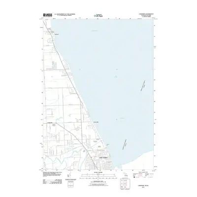 2011 Lakeport2011 Print · USGSCovers Gardendale, including Sarnia, Port Huron, and other nearby areas
 - 2014 Map of Lakeport, 2014 Print
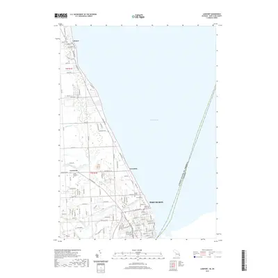
 2014 Lakeport2014 Print · USGSCovers Gardendale, including Sarnia, Port Huron, and other nearby areas
 - 2017 Map of Lakeport, 2017 Print
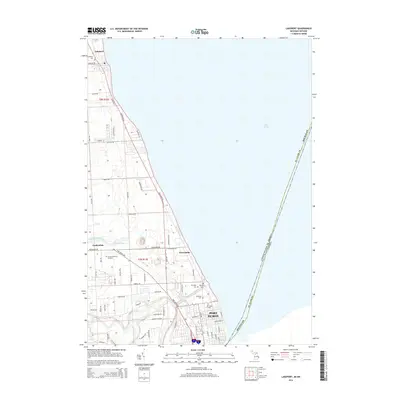
 2017 Lakeport2017 Print · USGSCovers Gardendale, including Sarnia, Port Huron, and other nearby areas
 - 2019 Map of Lakeport, 2019 Print
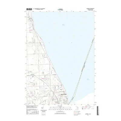
 2019 Lakeport2019 Print · USGSCovers Gardendale, including Sarnia, Port Huron, and other nearby areas
 - 2023 Map of Lakeport, 2023 Print
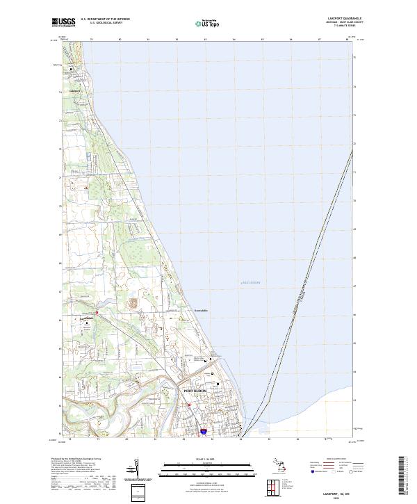 2023 Lakeport2023 Print · USGSCoastal St. Clair County is shown in detail during the early 2020s, documenting the northward growth of Port Huron along the lake. Researchers can trace numerous local burial sites like Lakeport Cem and Mount Sinai Cem, or follow the path of the Black River-Canal.
End of results
Showing maps 1-9 of 9
Top cities near Gardendale
- Port Huron historical maps
- Marysville historical maps
- Kimball historical maps
- West Tappan historical maps
- Saint Clair historical maps
- Columbus Township historical maps
See more
Frequently asked questions
- What are the different types of historical maps available for Gardendale?
- What is the oldest map of Gardendale?
- Where can I purchase historical maps of Gardendale for my home or office?
- Where can I download high-res historical maps of Gardendale?
- Are there historical topographic maps available for Gardendale?
- Is there historical aerial imagery available for Gardendale?
- Where are historical maps of Gardendale sourced from?