1960s Maps of Greenleaf Township, Michigan
Explore 4 historic maps of Greenleaf Township from the 1960s. These maps offer a rare glimpse into what life looked like during the 1960s — showing old roads, neighborhoods, homes, and landmarks that have changed or disappeared over time.
Whether you're researching your family's past, planning a metal detecting trip, or studying how Greenleaf Township's landscape evolved across the 1960s, these high-resolution maps are a powerful tool for exploring the history of this region.
- Focus on a specific era: All maps on this page are from the 1960s, giving you a focused view of this time period.
- See what’s changed: Compare century-old streets, trails, and buildings to today's modern landscape using overlays and satellite layers.
- Research with precision: Use these maps for genealogy, historical research, land use analysis, or educational projects.
- View, download, or print: Maps are fully viewable online in high resolution, and can be downloaded or printed for your own records.
Start exploring Greenleaf Township's history through authentic maps from the 1960s. This is your window into the past.
Greenleaf Township, MI maps
(4)- 1963 Map of New Greenleaf, 1964 Print
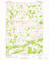 1963 New Greenleaf1964 Print · USGSAgricultural life in Michigan's Thumb is captured here during the early sixties, as drainage and rail networks sustained the rural economy. Genealogists can locate family landmarks like McTaggart Cemetery, the Stoner School, and St Columbkille Church.
 - 1963 Map of Ubly, 1964 Print
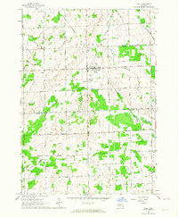 1963 Ubly1964 Print · USGSHuron and Sanilac counties are captured here in the early sixties, showing a landscape defined by rail-side commerce and an extensive network of field drains. Genealogists and local historians can trace family-named landmarks such as Valley Cem, Bingham Sch, and the village of Tyre.
 - 1963 Map of Shabbona, 1964 Print
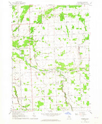 1963 Shabbona1964 Print · USGSSanilac and Tuscola Counties are shown here in the early 1960s, documenting a landscape of rural townships and winding river branches. Researchers can trace family sites near Shabbona, Evergreen Cem, and country churches like Mizpah Ch.
 - 1963 Map of Argyle, 1964 Print
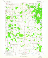 1963 Argyle1964 Print · USGSSanilac County's rural landscape is captured here in the early sixties, showing a community organized around the Middle Branch Cass River. Genealogists and local historians can locate small settlements like Argyle and identify old schoolhouses such as Laing Sch or McBride Sch.2 unique versions available
End of results
Showing maps 1-4 of 4
Top cities near Greenleaf Township
- Bad Axe historical maps
- Sandusky historical maps
- Cass City historical maps
- Pigeon historical maps
- Verona historical maps
- Elmer historical maps
See more
Top neighborhoods of Greenleaf Township
Frequently asked questions
- What are the different types of historical maps available for Greenleaf Township?
- What is the oldest map of Greenleaf Township?
- Where can I purchase historical maps of Greenleaf Township for my home or office?
- Where can I download high-res historical maps of Greenleaf Township?
- Are there historical topographic maps available for Greenleaf Township?
- Is there historical aerial imagery available for Greenleaf Township?
- Where are historical maps of Greenleaf Township sourced from?