Old Maps of Brownstown Charter Township, Michigan
Explore 46 old maps of Brownstown Charter Township, spanning from 1906 to today. These high-resolution historic maps reveal how streets, neighborhoods, landmarks, and natural features evolved over time — perfect for genealogy, metal detecting, research, and local history exploration.
What you can do with these maps:
- See how Brownstown Charter Township changed over time: Compare historical maps to modern-day views to trace roads, homesites, rail lines & more.
- View detailed metadata: Each map includes creators, publishers, year, scale, and archive source.
- Overlay maps with satellite & LiDAR: Visualize the past alongside modern tools to explore terrain & human change.
- Trusted historical sources: Maps sourced from the USGS, Library of Congress, and other archives.
- Access maps your way: View online, download high-res files, or order prints for personal or research use.
Start exploring old maps of Brownstown Charter Township to uncover forgotten places, hidden landmarks, and the deep history beneath your feet.
Brownstown Charter Township, MI maps
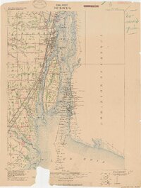
(46)- 1906 Map of Wyandotte
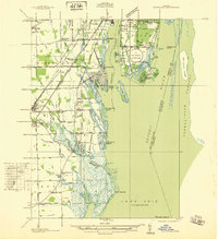
 1906 Wyandotte1906 Print · USGSThe Detroit River shoreline and its industrial borderlands are captured here at the height of the electric railway era. Genealogists and historians can trace the early footprints of Wyandotte, the development of Grosse Isle, and the complex rail networks of the M C R R.2 unique versions available
 - 1906 Map of Romulus
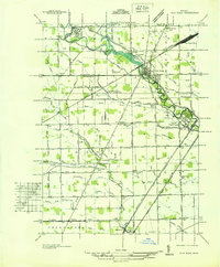
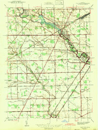
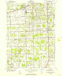
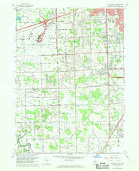
 1906 Romulus1906 Print · USGSSoutheast Michigan at the turn of the century shows a landscape defined by the winding Huron River and a dense network of competing steam and electric railways. Genealogists can trace early homesteads and rail stops in settlements like New Boston, Waltz, and the early crossroads at Carleton.2 unique versions available
 - 1912 Map of Wyandotte
 1912 Wyandotte1912 Print · USGSThe industrial corridor south of Detroit thrives along the river just before the Great War. Genealogists and historians can trace the early rail networks of the Michigan Central RR and find specific river landmarks like Grosse Isle and Gibraltar.
 - 1928 Map of Romulus
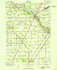
 1928 Romulus1928 Print · USGSSoutheast Michigan at the height of its rail-and-river era shows a dense network of transit lines and river towns. Genealogists can trace family roots through settlements like French Landing, Waltz, and South Rockwood or follow the path of the Pere Marquette RR.
 - 1929 Map of Wyandotte
 1929 Wyandotte1929 Print · USGSThe Detroit River shoreline comes alive in this late 1920s survey of the industrial corridor south of the city. Genealogists and historians can trace the early grids of Wyandotte and Amherstburg, or locate riverfront landmarks like Grosse Isle and Slocum Junc.
 - 1936 Map of Wyandotte
 1936 Wyandotte1936 Print · USGSThe industrial corridor south of Detroit is captured here in the mid-1930s as manufacturing and residential grids expanded toward the river. Trace the development of local neighborhoods and landmarks like the Sibley Quarry, Sacred Heart Cem, and the Thorofare Canal on Grosse Ile.
 - 1936 Map of Rockwood
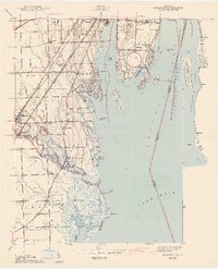
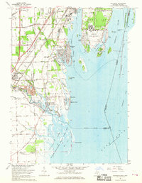
 1936 Rockwood1936 Print · USGSCoastal Wayne County and the Detroit River islands are shown here in the mid-thirties, just as the aviation and shipping industries were maturing. Researchers can locate the U S Naval Reserve Aviation Base on Grosse Ile, the St Marys Cem, and the marshy expanses around Point Mouillee.
 - 1936 Map of Flat Rock
 1936 Flat Rock1936 Print · USGSSoutheast Michigan's riverfront and rail corridors are captured here in the mid-1930s as industrial yards and rural townships began to interface. Researchers can trace ancestral roots through dozens of local landmarks including Ash Center Cem, Maple Grove Sch, and the unique settlement at Scrabble.
 - 1936 Map of Wayne Co Airport
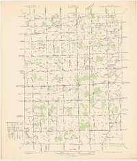 1936 Wayne Co Airport1936 Print · USGSWayne County was evolving from a rural landscape of family farms to an aviation hub in the mid-1930s. Researchers can trace early schools and cemeteries like Hale Sch, Tryskett Sch, and West Mound Cem alongside the Wayne County Airport.
 - 1942 Map of Wayne Co Airport
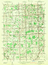 1942 Wayne Co Airport1942 Print · USGSWayne County during the early years of the war shows a landscape balancing its rural roots with new aviation infrastructure. Genealogists and historians can trace dozens of family-named drainage systems and rural institutions like Eureka Belt Sch and West Mound Cem.
 - 1942 Map of Flat Rock
 1942 Flat Rock1942 Print · USGSThe Detroit-Toledo corridor comes into focus just before the mid-century, where the Huron River meets a network of major railroads and early highways. Genealogists and local historians can trace rural schoolhouses like Bancroft Sch and Peters Sch, or locate family plots within Riverside Cem and Oakwood Cem.2 unique versions available
 - 1942 Map of Rockwood
 1942 Rockwood1942 Print · USGSThe Downriver shoreline and Grosse Ile appear here in the early 1940s as the region's shipping and rail networks expanded. Genealogists and historians can trace local landmarks like St Marys Cem, the Powderhouse, and small settlements such as Milleville Beach.2 unique versions available
 - 1942 Map of Wyandotte
 1942 Wyandotte1942 Print · USGSThe Detroit River industrial corridor is shown in detail during the early 1940s, from the city of Wyandotte south to Trenton. Genealogists and historians can trace family-named sites and vanished landmarks like Goddard Farms, the Sibley Quarry, and Heintzen Sch.2 unique versions available
 - 1952 Map of Flat Rock, 1953 Print
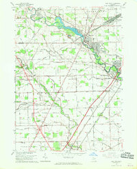
 1952 Flat Rock1953 Print · USGSThe Huron River valley in the early fifties shows a landscape of busy rail corridors and small-town growth. Trace family roots and local history through Michigan Memorial Park Cemetery, the Flat Rock Yard, and rural landmarks like Evergreen Cem.2 unique versions available
 - 1952 Map of Detroit Wayne Airport, 1954 Print
 1952 Detroit Wayne Airport1954 Print · USGSMid-century Wayne County is captured here as the townships of Taylor and Romulus transition from rural landscapes to suburban hubs. Genealogists can trace family roots through Huron Cem, St Johns Sch, and the residential blocks of Rosenworth.2 unique versions available
 - 1952 Map of Rockwood, 1954 Print
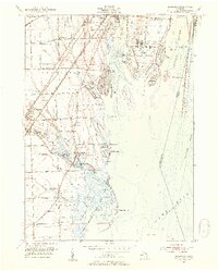 1952 Rockwood1954 Print · USGSThe Detroit River archipelago and the marshlands of Lake Erie come into focus in the early fifties. Genealogists and historians can trace South Road Sch, St Marys Ch, and the sprawling Grosse Ile Naval Air Station.2 unique versions available
 - 1952 Map of Wyandotte, 1954 Print
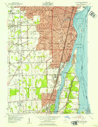 1952 Wyandotte1954 Print · USGSThe downriver industrial corridor south of Detroit thrives in the early fifties as suburbs like Allen Park and Lincoln Park expand. Genealogists and historians can trace neighborhood growth through dozens of local schools and landmarks like Elizabeth Park, Hange Airport, and Bloomdale Cem.2 unique versions available
 - 1954 Map of Detroit
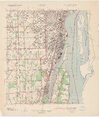
 1954 Detroit1954 Print · USGSThe Detroit metro and its Ontario neighbors are shown at the height of the mid-century industrial era, just as the suburbs were rapidly expanding. Researchers can trace the massive rail networks of the Wabash Railroad or locate landmarks like Grosse Ile and Selfridge Air Force Base.
 - 1961 Map of Detroit, 1973 Print
 1961 Detroit1973 Print · USGSThe international border between Michigan and Ontario was a bustling industrial corridor in the early sixties. Researchers can trace the transit networks and riverfront infrastructure connecting Detroit to Windsor via the Detroit-Windsor Tunnel and major air hubs like Willow Run Airport.2 unique versions available
 - 1965 Map of Detroit
 1965 Detroit1965 Print · USGSThe industrial corridor between Michigan and Ontario is captured here at mid-century, showing the dense rail and river networks of the Great Lakes. Local historians can trace the paths of the Grand Trunk Western RR and locate key landmarks like Selfridge Air Force Base and Grosse Ile.
 - 1967 Map of Wyandotte, 1969 Print
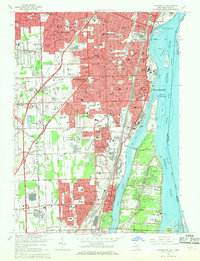 1967 Wyandotte1969 Print · USGSThe Detroit River shoreline was a hive of industrial and suburban development in the late sixties. Genealogists and local historians can trace family roots through numerous parish schools and older burial grounds like Mt Carmel Cem and Bloomdale Cem.4 unique versions available
 - 1967 Map of Flat Rock NE, 1969 Print
 1967 Flat Rock NE1969 Print · USGSWayne County was undergoing a mid-century suburban shift when this survey recorded its complex drainage networks and expanding transport hubs. Genealogists can trace family landmarks like Krause Cem, John F Kennedy Sch, and Fellowship Ch.3 unique versions available
 - 1967 Map of Rockwood, 1969 Print
 1967 Rockwood1969 Print · USGSCoastal Wayne County enters the late sixties as a hub of naval aviation and heavy river traffic along the Detroit River islands. Genealogists and local historians can trace the foundations of East Rockwood, the Grosse Ile Naval Air Station, and Gibraltar Cem.3 unique versions available
 - 1967 Map of Flat Rock, 1969 Print
 1967 Flat Rock1969 Print · USGSThe Huron River valley in the late sixties shows a landscape of industrial rail yards and growing residential communities. Genealogists can trace family landmarks like Ash-Center Cem, St Rochs Ch, and the many schools serving Flat Rock and Newport.2 unique versions available
 - 1985 Map of Detroit
 1985 Detroit1985 Print · USGSSoutheast Michigan in the mid-eighties shows a landscape defined by industrial power and suburban reach from the Detroit River to the Huron Valley. Researchers can trace the rail lines of the Conrail, explore the grounds of the University of Michigan, and locate numerous sites like Mt Olivet Cem.
Showing maps 1-25 of 46
Top cities near Brownstown Charter Township
- Detroit historical maps
- Canton Township historical maps
- Dearborn historical maps
- Westland historical maps
- Taylor historical maps
- Dearborn Heights historical maps
See more
Top neighborhoods of Brownstown Charter Township
Frequently asked questions
- What are the different types of historical maps available for Brownstown Charter Township?
- What is the oldest map of Brownstown Charter Township?
- Where can I purchase historical maps of Brownstown Charter Township for my home or office?
- Where can I download high-res historical maps of Brownstown Charter Township?
- Are there historical topographic maps available for Brownstown Charter Township?
- Is there historical aerial imagery available for Brownstown Charter Township?
- Where are historical maps of Brownstown Charter Township sourced from?