
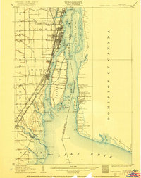
1906 Map of Wyandotte
USGS Topo · Published 1906About this map
The Detroit River serves as a bustling international corridor in the early 1900s, anchoring a dense network of industrial and commuter transportation between Michigan and Ontario. Along the western shore, the settlements of Wyandotte, Ecorse, and Trenton are tightly connected by an intricate web of steam and electric railways, including the Detroit Monroe and Toledo Shore Line Electric RR and the Detroit United Ry. This era of transit is further highlighted by the Detroit River Tunnel crossing near the northern boundary.
Find a feature on this map
77 named features on this map. Tap any name to fly to it.
Don’t see what you’re looking for? This feature index may not catch every label — zoom into the map to look around manually.
Map Details
Editions of this 1906 Wyandotte Map
2 editions found
Other maps of this area

1905 · Wayne
USGS Topo · 1:62,500

1905 · Detroit
USGS Topo · 1:62,500

1905 · Grosse Pointe
USGS Topo · 1:62,500

1906 · Romulus
USGS Topo · 1:62,500

1912 · Wyandotte
USGS Topo · 1:62,500

1912 · Wayne
USGS Topo · 1:62,500

1912 · Monroe
USGS Topo · 1:62,500

1914 · Monroe
USGS Topo · 1:62,500

1918 · Detroit
USGS Topo · 1:62,500

1918 · Grosse Pointe
USGS Topo · 1:62,500