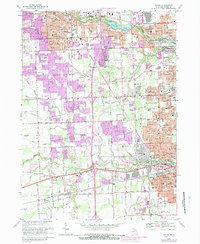
1912 Map of Wayne
USGS Topo · Published 1912About this map
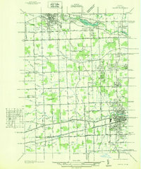
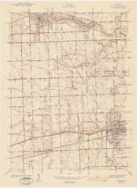
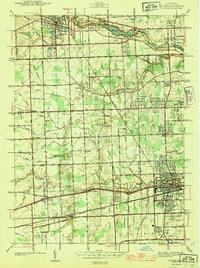
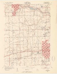
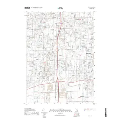
Wayne and the surrounding townships of western Wayne County appear here at a moment of transition from agricultural landscape to industrial corridor. The Corps of Engineers captured a detailed network of early transit, including the Orchard Lake Concrete Road and the Ypsilanti Concrete Road, highlighting the region's pioneering role in modern highway construction. Interurban electric lines such as the Detroit and Northville Electric R. R. and the Detroit Jackson and Chicago Electric Ry parallel the older steam routes of the Pere Marquette and Detroit and Michigan Central RR, connecting rural hubs like Farmington and Northville. Genealogists can locate smaller, vanished points of interest such as the settlement of Perrinville and the Eloise complex, alongside various family-named landmarks like Powers and Stark during this pre-war period of growth.
Find a feature on this map
62 named features on this map. Tap any name to fly to it.
Don’t see what you’re looking for? This feature index may not catch every label — zoom into the map to look around manually.
Map Details
Editions of this 1912 Wayne Map
This is the sole edition of this map. No revisions or reprints were ever made.
Historical Maps of Detroit Through Time
11 maps found