Old Maps of Wexford Township, Michigan for Academic Research
Study the evolution of Wexford Township with 34 high-resolution historic maps. Whether you're teaching, researching, or modeling changes in land use, these maps provide essential visual documentation of urban, environmental, and geographic change.
- Analyze long-term change: Track patterns in development, transportation, and natural features.
- Ideal for environmental or urban studies: Support academic projects with primary historical map data.
- Use in the classroom or lab: Educators and researchers rely on these maps to bring historical context to life.
These maps are a powerful tool for teaching, research, and visualizing how Wexford Township has changed over the decades.
Wexford Township, MI maps
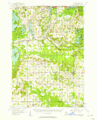
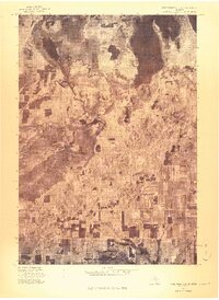
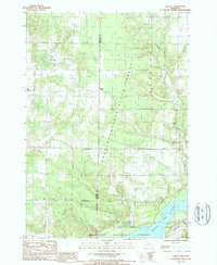
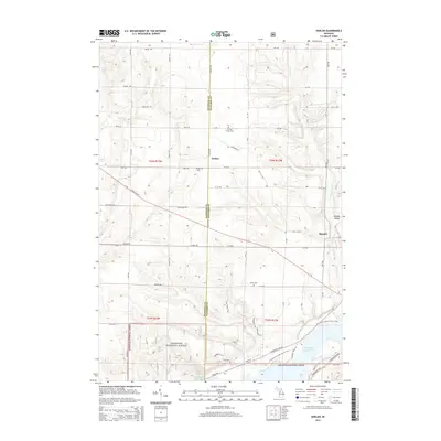
(34)- 1954 Map of Traverse City, 1965 Print
 1954 Traverse City1965 Print · USGSNorthern Michigan’s vast lakeshores and timberlands are captured here in the mid-fifties, showing the region before the modern interstate era. Genealogists and researchers can trace rail connections like the Detroit and Mackinac RR or find old communities such as Suttons Bay, Elk Rapids, and Prudenville.4 unique versions available
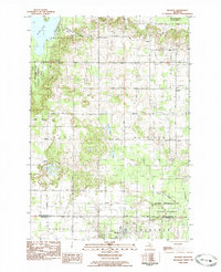
 - 1956 Map of Kingsley, 1958 Print
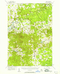
 1956 Kingsley1958 Print · USGSGrand Traverse County at mid-century shows a landscape of developing recreation and fading rural school districts near the shores of the bay. Genealogists and historians can trace the transition from rail-town life in Kingsley to remote forest outposts like Summit City and Buckley.2 unique versions available
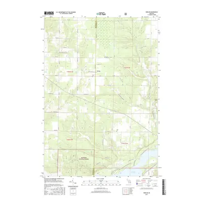
 - 1956 Map of Mesick, 1958 Print
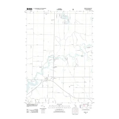
 1956 Mesick1958 Print · USGSIn the mid-1950s, this area of Wexford County was a landscape of dense state and national forests tied together by the Ann Arbor RR. Researchers can locate old community hubs like Sherman and Meauwataka, along with several abandoned schools and the Briar Hill Ski Jump.3 unique versions available
 - 1956 Map of Thompsonville, 1958 Print
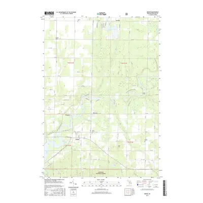
 1956 Thompsonville1958 Print · USGSNorthern Michigan's lake country thrived around mid-century rail hubs and cultural sites. You can trace the ANN ARBOR rail line through Thompsonville or locate the National Music Camp near Interlochen.3 unique versions available
 - 1957 Map of Copemish, 1958 Print
 1957 Copemish1958 Print · USGSNorthwest Michigan in the late fifties was a landscape of deep forests and river-driven power. Genealogists and historians can trace the foundations of Copemish or locate family plots at Marilla Cem and the Harlan Cem near the Hodenpyle Dam.3 unique versions available
 - 1958 Map of Traverse City
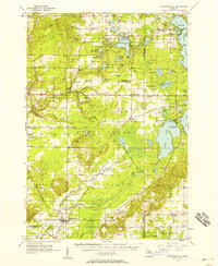
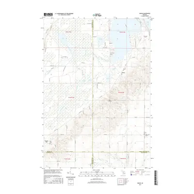
 1958 Traverse City1958 Print · USGSNorthern Lower Michigan was a landscape of vast state forests and burgeoning lakeside retreats in the late fifties. Genealogists and historians can trace the rail corridors of the Ann Arbor RR and find established settlements from Elk Rapids to Houghton Lake.2 unique versions available
 - 1976 Map of Thompsonville SE
 1976 Thompsonville SE1976 Print · USGSGrand Traverse County is seen here during the mid-seventies, captured in a detailed aerial orthophoto that reveals the precise layout of the landscape. Researchers can trace the path of the Betsie River and locate the small settlement of Karlin.
 - 1983 Map of Cadillac, 1984 Print
 1983 Cadillac1984 Print · USGSThe Cadillac region in the early eighties was defined by its vast public forests and the prominent dual lakes at its center. Trace the legacies of the timber era along the Old Railroad Grade or locate old rural centers like Vogel Center and Harrietta.
 - 1983 Map of Buckley, 1984 Print
 1983 Buckley1984 Print · USGSWexford and Grand Traverse counties meet in this early 1980s landscape of timber and small-town settlements. Genealogists and local historians can trace the rural layout of Buckley and Monroe Center, or locate family sites near St Marys Cem and the Red School.
 - 1983 Map of Traverse City, 1984 Print
 1983 Traverse City1984 Print · USGSTraverse City and the surrounding bay country are captured in the early eighties as the region balanced its timber heritage with growing conservation. Genealogists and local historians can trace the rail lines of the Ann Arbor RR through settlements like Kingsley and Fife Lake.2 unique versions available
 - 1983 Map of Karlin, 1984 Print
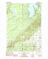 1983 Karlin1984 Print · USGSNorthern Michigan’s forest and lake country is captured here during the early eighties, showcasing the intersection of four counties. You can trace family history at Karlin or locate rural landmarks like the De Lorme Cem, Grant Ch, and Pavlovic Corner.2 unique versions available
 - 1987 Map of Mesick, 1988 Print
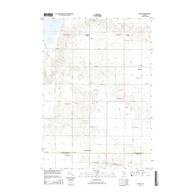
 1987 Mesick1988 Print · USGSWexford County's river valleys and state forests are captured here in the late eighties, just as the landscape of the Manistee River basin was being remapped. Genealogists and local historians can locate the streets of Mesick, the settlement at Sherman, and rural Cem locations.
 - 1987 Map of Harlan, 1988 Print
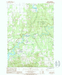
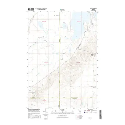
 1987 Harlan1988 Print · USGSThe border of Manistee and Wexford counties comes into focus in the late eighties as the region balanced forestry with recreational growth. Trace local history through the settlement at Harlan, the Cem, and the traces of an Old Railroad Grade.
 - 1989 Map of Traverse City, 1990 Print
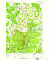
 1989 Traverse City1990 Print · USGSNorthern Michigan’s lake-country and forest lands are captured in the late eighties as seasonal tourism and timber hubs expanded. Genealogists and historians can trace the routes of the Ann Arbor RR, the boundaries of Camp Grayling, and settlements like Elk Rapids and Manton.
 - 2011 Map of Buckley, 2011 Print
 2011 Buckley2011 Print · USGSCovers Wexford Township, including Blair Township, Green Lake Township, and other nearby areas
 - 2011 Map of Karlin, 2011 Print
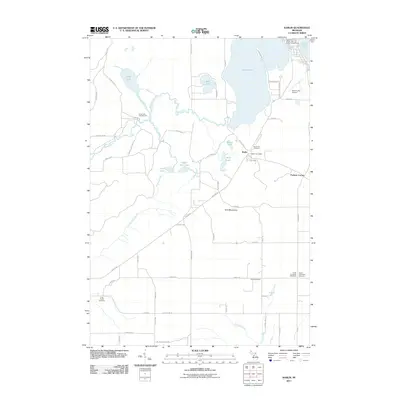 2011 Karlin2011 Print · USGSCovers Wexford Township, including Green Lake Township, Grant Township, and other nearby areas
 - 2012 Map of Harlan, 2012 Print
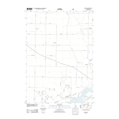 2012 Harlan2012 Print · USGSCovers Wexford Township, including Cleon Township, Springville Township, and other nearby areas
 - 2012 Map of Mesick, 2012 Print
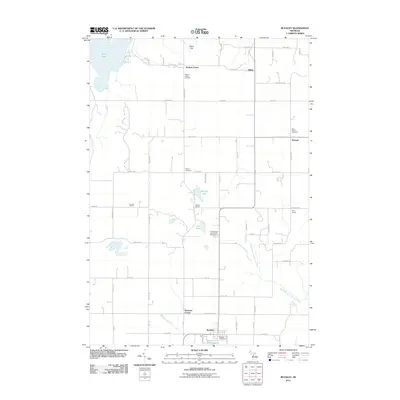
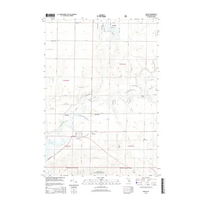
 2012 Mesick2012 Print · USGSCovers Wexford Township, including Buckley, Mesick, and other nearby areas
 - 2014 Map of Buckley, 2014 Print
 2014 Buckley2014 Print · USGSCovers Wexford Township, including Blair Township, Green Lake Township, and other nearby areas
 - 2014 Map of Karlin, 2014 Print
 2014 Karlin2014 Print · USGSCovers Wexford Township, including Green Lake Township, Grant Township, and other nearby areas
 - 2014 Map of Mesick, 2014 Print
 2014 Mesick2014 Print · USGSCovers Wexford Township, including Buckley, Mesick, and other nearby areas
 - 2014 Map of Harlan, 2014 Print
 2014 Harlan2014 Print · USGSCovers Wexford Township, including Cleon Township, Springville Township, and other nearby areas
 - 2017 Map of Harlan, 2017 Print
 2017 Harlan2017 Print · USGSCovers Wexford Township, including Cleon Township, Springville Township, and other nearby areas
 - 2017 Map of Karlin, 2017 Print
 2017 Karlin2017 Print · USGSCovers Wexford Township, including Green Lake Township, Grant Township, and other nearby areas
 - 2017 Map of Mesick, 2017 Print
 2017 Mesick2017 Print · USGSCovers Wexford Township, including Buckley, Mesick, and other nearby areas
Showing maps 1-25 of 34
Top cities near Wexford Township
- Garfield Township historical maps
- East Bay Township historical maps
- Long Lake Township historical maps
- Blair Township historical maps
- Green Lake Township historical maps
- Paradise Township historical maps
See more
Top neighborhoods of Wexford Township
Frequently asked questions
- What are the different types of historical maps available for Wexford Township?
- What is the oldest map of Wexford Township?
- Where can I purchase historical maps of Wexford Township for my home or office?
- Where can I download high-res historical maps of Wexford Township?
- Are there historical topographic maps available for Wexford Township?
- Is there historical aerial imagery available for Wexford Township?
- Where are historical maps of Wexford Township sourced from?