Old Maps of Anoka County, Minnesota
Explore 134 old maps of Anoka County, spanning from 1902 to today. These high-resolution historic maps reveal how streets, neighborhoods, landmarks, and natural features evolved over time — perfect for genealogy, metal detecting, research, and local history exploration.
What you can do with these maps:
- See how Anoka County changed over time: Compare historical maps to modern-day views to trace roads, homesites, rail lines & more.
- View detailed metadata: Each map includes creators, publishers, year, scale, and archive source.
- Overlay maps with satellite & LiDAR: Visualize the past alongside modern tools to explore terrain & human change.
- Trusted historical sources: Maps sourced from the USGS, Library of Congress, and other archives.
- Access maps your way: View online, download high-res files, or order prints for personal or research use.
Start exploring old maps of Anoka County to uncover forgotten places, hidden landmarks, and the deep history beneath your feet.
Anoka County, MN maps
(134)- 1902 Map of White Bear
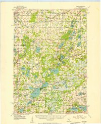
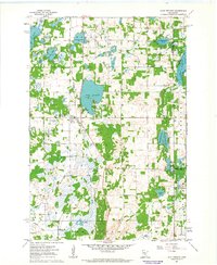
 1902 White Bear1902 Print · USGSThe lake-dotted landscape northeast of the Twin Cities is captured here at the start of the twentieth century. Researchers can trace early railroad junctions and industry at the Minneapolis Stock Yards, or locate old settlements like Lino, Cardigan, and New Brighton.4 unique versions available
 - 1902 Map of Anoka
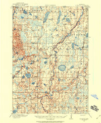
 1902 Anoka1902 Print · USGSNorth of Minneapolis at the turn of the century, this area shows a landscape of glacial lakes and growing rail towns. Genealogists can trace family roots in early settlements like Osseo, Champlin, and Robbinsdale or locate long-standing landmarks near Medicine Lake.4 unique versions available
 - 1909 Map of Rockford
 1909 Rockford1909 Print · USGSWright and Hennepin counties are shown here in the first decade of the twentieth century as the railroads transformed rural Minnesota. Genealogists can locate family-named features like Berning Mill, Salem Church, and early schools in Burschville or Hassan.2 unique versions available
 - 1916 Map of St. Francis, 1960 Print
 1916 St. Francis1960 Print · USGSAnoka and Isanti counties appear as a thriving network of rural townships and riverfront settlements just before the Great War. Genealogists can locate family-named landmarks and local hubs like Mitchell Corners, Nowthen, and the many numbered schoolhouses along the Rum River.3 unique versions available
 - 1919 Map of St. Francis
 1919 St. Francis1919 Print · USGSAnoka and Isanti counties come alive in the decade following the Great War, showing a landscape defined by the winding Rum River. Genealogists can trace early homesteads and community hubs like Saint Francis, Mitchell Corners, and the Nowthen School.2 unique versions available
 - 1952 Map of Centerville, 1954 Print
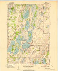 1952 Centerville1954 Print · USGSCenterville and the surrounding lake country of Anoka County are shown here in the early fifties, before suburban expansion reached these wetlands. Researchers can trace early rural life through landmarks like Rice Lake Ch, the Twitchel Cem, and a lakeside Seaplane Base.
 - 1952 Map of White Bear Lake West, 1954 Print
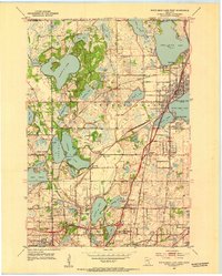 1952 White Bear Lake West1954 Print · USGSRamsey County in the early fifties shows a landscape of expansive lakefronts and emerging suburbs before the peak of mid-century sprawl. Genealogists can trace early landmarks like Little Canada and Bethany Cem, or follow old rail lines through Cardigan Junction.3 unique versions available
 - 1952 Map of Minneapolis North, 1954 Print
 1952 Minneapolis North1954 Print · USGSPost-war suburban expansion and industrial growth define the northern outskirts of Minneapolis in the early fifties. Genealogists and local historians can trace the development of Robbinsdale and Brooklyn Center alongside landmarks like Crystal Lake Cemetery and the Northern Ordnance Plant.2 unique versions available
 - 1952 Map of New Brighton, 1954 Print
 1952 New Brighton1954 Print · USGSRamsey County was undergoing rapid post-war suburbanization during the early fifties, blending industrial sites with new residential grids. Genealogists and historians can locate numerous early schools and cemeteries, from Sunnyside Sch and Lake Johanna Sch to the sprawling Hillside Cemetery.2 unique versions available
 - 1953 Map of Stillwater, 1980 Print
 1953 Stillwater1980 Print · USGSThe Twin Cities and the St. Croix Valley are captured in this mid-century survey as the interstate era began to transform the Upper Midwest. Genealogists and historians can trace the rail-and-river geography of Stillwater, locate landmarks in Anoka, or explore the sprawling St Croix State Park.
 - 1955 Map of Circle Pines, 1956 Print
 1955 Circle Pines1956 Print · USGSSouthern Anoka County is shown in the mid-fifties just as suburban development began to weave through its traditional marshlands and creek beds. Genealogists and local historians can trace early neighborhood footprints and landmarks like Red Brick Sch, St Joseph Ch, and the original layout of Circle Pines.
 - 1955 Map of Anoka, 1956 Print
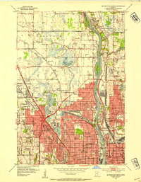
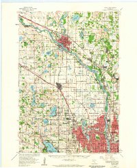
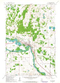
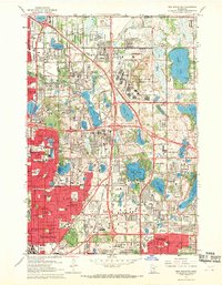
 1955 Anoka1956 Print · USGSMid-century Anoka and Champlin are mapped here as the Mississippi River corridor transitions from industrial rail hubs to expanding suburban villages. Genealogists and researchers can trace local landmarks like the State Hospital, Calvary Cem, and the Sunnyvale Sch (Abandoned).
 - 1955 Map of Coon Rapids, 1956 Print
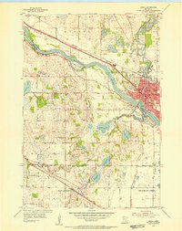
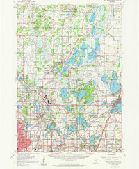
 1955 Coon Rapids1956 Print · USGSThe Mississippi River valley north of Minneapolis was undergoing a post-war transformation in the mid-fifties. Genealogists and local historians can trace the early development of Coon Rapids and Blaine, locating the WCCO Radio Tower, Bragdon Church, and the Coon Rapids Dam.
 - 1955 Map of Isanti, 1957 Print
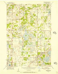
 1955 Isanti1957 Print · USGSNorth of the Twin Cities in the mid-fifties, this area reveals a dense landscape of wetlands and small rural communities. Genealogists can locate numerous pioneer sites, including Old Bethel Cem, West Bethel Ch, and several already-closed schools like Crooked Brook Sch.2 unique versions available
 - 1955 Map of Anoka, 1959 Print
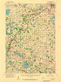
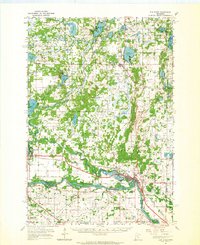
 1955 Anoka1959 Print · USGSNorth of Minneapolis in the mid-fifties, the suburban frontier was rapidly advancing through the lake-dotted landscapes of Hennepin and Anoka counties. Local historians can trace the early development of Coon Rapids, Brooklyn Park, and New Hope alongside legacy sites like the State Hospital and St Vincent Cem.
 - 1955 Map of New Brighton, 1959 Print
 1955 New Brighton1959 Print · USGSThe northern reaches of the Twin Cities were undergoing a post-war transformation in the mid-fifties as suburbs pushed into the lake country. Researchers can trace the massive Twin Cities Arsenal, find the old Red Brick Sch, and locate the Abandoned Aqueduct winding toward the city.
 - 1955 Map of Stillwater, 1965 Print
 1955 Stillwater1965 Print · USGSThe Upper St. Croix Valley and the growing Twin Cities area are shown here during the mid-fifties, before the interstate era transformed the regional commute. You can trace the lines of the Northern Pacific RR through towns like Rush City or locate the Saint Croix Indian Reservation.
 - 1958 Map of Stillwater
 1958 Stillwater1958 Print · USGSThe Upper Mississippi and St. Croix River valleys appear in the mid-fifties as the Twin Cities expanded north. Genealogists can locate family landmarks like Oak Park Cem, Saint Michael Church, and the Soo Line RR rail corridors.2 unique versions available
 - 1958 Map of Rockford, 1959 Print
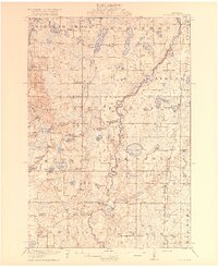
 1958 Rockford1959 Print · USGSWright and Hennepin counties are shown here in the late fifties, during a period of steady rural growth and agricultural stability. Researchers can trace ancestral roots at Berning Mill, find small country schoolhouses like Oakdale School, or locate parish centers such as St Michael Church.2 unique versions available
 - 1961 Map of Lake Fremont, 1963 Print
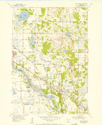
 1961 Lake Fremont1963 Print · USGSSherburne County is shown here in the early sixties as a region of dense glacial lakes and burgeoning township life. Researchers can find family sites near Zimmerman, Livonia Cem, and the old Community Hall.3 unique versions available
 - 1961 Map of Elk River, 1963 Print
 1961 Elk River1963 Print · USGSElk River and the banks of the Mississippi River are captured here in the early sixties as the region's rail and water network defined local life. Genealogists and local historians can trace landmarks like St Andrews Cem, St Johns Sch, and the riverside powerplant.3 unique versions available
 - 1961 Map of Elk River, 1965 Print
 1961 Elk River1965 Print · USGSThe Elk River and Mississippi River valleys in the early 1960s showcase a landscape of shifting industry and conservation. Local researchers can trace family sites at Orrock Cem, find Zimmerman's post office, and locate the Sand Dunes Lookout Tower.
 - 1965 Map of Stillwater
 1965 Stillwater1965 Print · USGSThe Twin Cities and the St. Croix Valley are mapped here during a period of significant post-war growth and industrial transit. Genealogists and historians can trace rail lines like the Northern Pacific RR through towns such as Rush City, Amery, and Balsam Lake.
 - 1967 Map of Circle Pines, 1969 Print
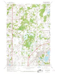 1967 Circle Pines1969 Print · USGSThe northern Twin Cities suburbs were rapidly expanding in the late sixties, as new residential grids began to replace rural fields. Genealogists and local historians can trace early neighborhood footprints near Johnsville, Lexington, and the Anoka County Airport.4 unique versions available
 - 1967 Map of New Brighton, 1969 Print
 1967 New Brighton1969 Print · USGSThe northern Minneapolis suburbs transition from industrial rail hubs to residential lakefronts in the late sixties. Genealogists and historians can trace cemetery boundaries at St Marys Cem, follow the Soo Line tracks, or locate the sprawling Twin Cities Army Ammunition Plant.5 unique versions available
Showing maps 1-25 of 134
Top cities of Anoka County
- Coon Rapids historical maps
- Blaine historical maps
- Andover historical maps
- Ramsey historical maps
- Fridley historical maps
- Lino Lakes historical maps
See more
Frequently asked questions
- What are the different types of historical maps available for Anoka County?
- What is the oldest map of Anoka County?
- Where can I purchase historical maps of Anoka County for my home or office?
- Where can I download high-res historical maps of Anoka County?
- Are there historical topographic maps available for Anoka County?
- Is there historical aerial imagery available for Anoka County?
- Where are historical maps of Anoka County sourced from?