Old Maps of Legacy Creek Preserve, Blaine for Academic Research
Study the evolution of Legacy Creek Preserve with 12 high-resolution historic maps. Whether you're teaching, researching, or modeling changes in land use, these maps provide essential visual documentation of urban, environmental, and geographic change.
- Analyze long-term change: Track patterns in development, transportation, and natural features.
- Ideal for environmental or urban studies: Support academic projects with primary historical map data.
- Use in the classroom or lab: Educators and researchers rely on these maps to bring historical context to life.
These maps are a powerful tool for teaching, research, and visualizing how Legacy Creek Preserve has changed over the decades.
Legacy Creek Preserve, Blaine maps
(12)- 1902 Map of White Bear
 1902 White Bear1902 Print · USGSThe lake-dotted landscape northeast of the Twin Cities is captured here at the start of the twentieth century. Researchers can trace early railroad junctions and industry at the Minneapolis Stock Yards, or locate old settlements like Lino, Cardigan, and New Brighton.4 unique versions available
 - 1953 Map of Stillwater, 1980 Print
 1953 Stillwater1980 Print · USGSThe Twin Cities and the St. Croix Valley are captured in this mid-century survey as the interstate era began to transform the Upper Midwest. Genealogists and historians can trace the rail-and-river geography of Stillwater, locate landmarks in Anoka, or explore the sprawling St Croix State Park.
 - 1955 Map of Circle Pines, 1956 Print
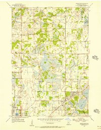 1955 Circle Pines1956 Print · USGSSouthern Anoka County is shown in the mid-fifties just as suburban development began to weave through its traditional marshlands and creek beds. Genealogists and local historians can trace early neighborhood footprints and landmarks like Red Brick Sch, St Joseph Ch, and the original layout of Circle Pines.
 - 1955 Map of New Brighton, 1959 Print
 1955 New Brighton1959 Print · USGSThe northern reaches of the Twin Cities were undergoing a post-war transformation in the mid-fifties as suburbs pushed into the lake country. Researchers can trace the massive Twin Cities Arsenal, find the old Red Brick Sch, and locate the Abandoned Aqueduct winding toward the city.
 - 1955 Map of Stillwater, 1965 Print
 1955 Stillwater1965 Print · USGSThe Upper St. Croix Valley and the growing Twin Cities area are shown here during the mid-fifties, before the interstate era transformed the regional commute. You can trace the lines of the Northern Pacific RR through towns like Rush City or locate the Saint Croix Indian Reservation.
 - 1958 Map of Stillwater
 1958 Stillwater1958 Print · USGSThe Upper Mississippi and St. Croix River valleys appear in the mid-fifties as the Twin Cities expanded north. Genealogists can locate family landmarks like Oak Park Cem, Saint Michael Church, and the Soo Line RR rail corridors.2 unique versions available
 - 1965 Map of Stillwater
 1965 Stillwater1965 Print · USGSThe Twin Cities and the St. Croix Valley are mapped here during a period of significant post-war growth and industrial transit. Genealogists and historians can trace rail lines like the Northern Pacific RR through towns such as Rush City, Amery, and Balsam Lake.
 - 1967 Map of Circle Pines, 1969 Print
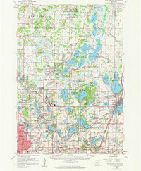
 1967 Circle Pines1969 Print · USGSThe northern Twin Cities suburbs were rapidly expanding in the late sixties, as new residential grids began to replace rural fields. Genealogists and local historians can trace early neighborhood footprints near Johnsville, Lexington, and the Anoka County Airport.4 unique versions available
 - 1975 Map of Stillwater
 1975 Stillwater1975 Print · USGSThe Twin Cities and the St. Croix Valley are captured in the mid-seventies, showing the urban growth of Minneapolis and St Paul. Researchers can trace old rail corridors of the Northern Pacific RR and locate tribal lands at the Mille Lacs Indian Reservation.2 unique versions available
 - 1985 Map of Anoka
 1985 Anoka1985 Print · USGSThe northern Twin Cities suburbs and the Mississippi River valley are captured here in the mid-eighties as suburban growth began to meet rural conservation lands. Trace the expansion of Anoka and Blaine, or locate family landmarks near the Rum River and Buffalo Lake.
 - 1991 Map of Anoka, 1992 Print
 1991 Anoka1992 Print · USGSThe northern Twin Cities suburbs and the upper Mississippi River valley are captured here in the early nineties during a period of rapid suburban expansion. Trace the rail corridors of the Burlington Northern Railroad or explore the boundaries of the Sherburne National Wildlife Refuge and Lake Maria State Park.
 - 2022 Map of Circle Pines, 2022 Print
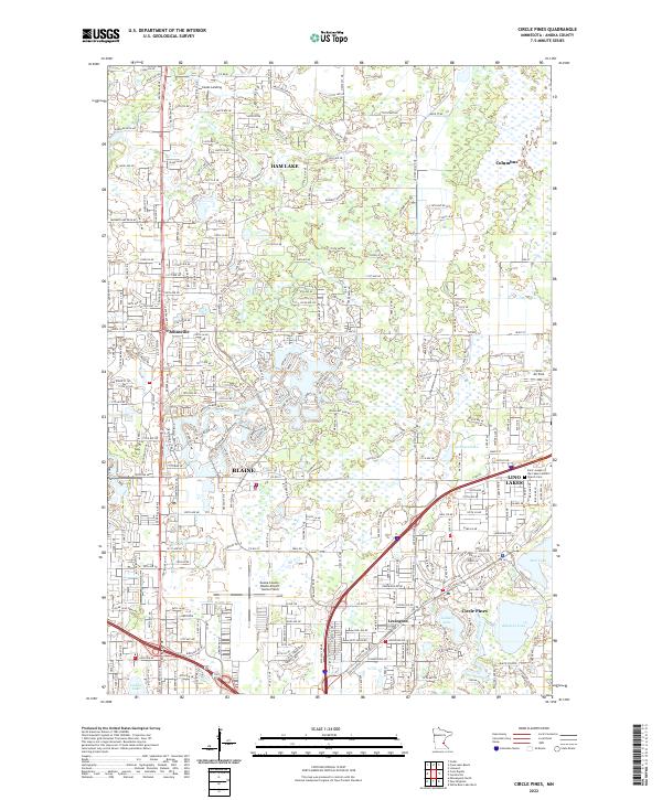 2022 Circle Pines2022 Print · USGSAnoka County's northern suburbs and chain of lakes are captured here in the early 2020s. Researchers can trace local development near Rice Lake, locate the Saint Joseph of the Lakes Catholic Church, and identify landmarks like Johnsville or Lino Air Park.
End of results
Showing maps 1-12 of 12
Frequently asked questions
- What are the different types of historical maps available for Legacy Creek Preserve?
- What is the oldest map of Legacy Creek Preserve?
- Where can I purchase historical maps of Legacy Creek Preserve for my home or office?
- Where can I download high-res historical maps of Legacy Creek Preserve?
- Are there historical topographic maps available for Legacy Creek Preserve?
- Is there historical aerial imagery available for Legacy Creek Preserve?
- Where are historical maps of Legacy Creek Preserve sourced from?