Old Maps of Columbia Heights, Minnesota for Genealogy
Trace your family roots with 16 historic maps of Columbia Heights. These high-res maps reveal old neighborhoods, homesites, landmarks, and streets — helping you uncover where your ancestors lived and how the area evolved over time.
- Explore historic neighborhoods: Identify where your relatives may have lived in the 1800s or 1900s.
- Compare maps over time: Trace the changes in streets, buildings, and landmarks for multi-generational research.
- Perfect for genealogy & ancestry research: Used by family historians and researchers to map out lineage and migration.
These maps are an incredible resource for exploring your personal connection to Columbia Heights's past.
Columbia Heights, MN maps
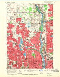
(16)- 1902 Map of White Bear
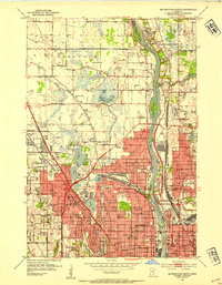
 1902 White Bear1902 Print · USGSCovers Columbia Heights, including Minneapolis, Blaine, and other nearby areas4 unique versions available
 - 1902 Map of Anoka
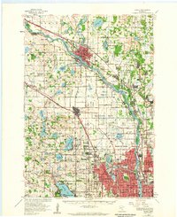
 1902 Anoka1902 Print · USGSCovers Columbia Heights, including Minneapolis, Brooklyn Park, and other nearby areas4 unique versions available
 - 1952 Map of Minneapolis North, 1954 Print
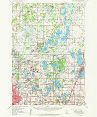
 1952 Minneapolis North1954 Print · USGSCovers Columbia Heights, including Minneapolis, Brooklyn Park, and other nearby areas2 unique versions available
 - 1952 Map of New Brighton, 1954 Print
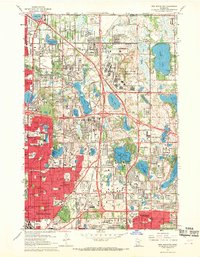
 1952 New Brighton1954 Print · USGSCovers Columbia Heights, including Minneapolis, Blaine, and other nearby areas2 unique versions available
 - 1953 Map of Stillwater, 1980 Print
 1953 Stillwater1980 Print · USGSCovers Columbia Heights, including Minneapolis, Brooklyn Park, and other nearby areas
 - 1955 Map of Anoka, 1959 Print
 1955 Anoka1959 Print · USGSCovers Columbia Heights, including Minneapolis, Brooklyn Park, and other nearby areas
 - 1955 Map of New Brighton, 1959 Print
 1955 New Brighton1959 Print · USGSCovers Columbia Heights, including Minneapolis, Blaine, and other nearby areas
 - 1955 Map of Stillwater, 1965 Print
 1955 Stillwater1965 Print · USGSCovers Columbia Heights, including Minneapolis, Brooklyn Park, and other nearby areas
 - 1958 Map of Stillwater
 1958 Stillwater1958 Print · USGSCovers Columbia Heights, including Minneapolis, Brooklyn Park, and other nearby areas2 unique versions available
 - 1965 Map of Stillwater
 1965 Stillwater1965 Print · USGSCovers Columbia Heights, including Minneapolis, Brooklyn Park, and other nearby areas
 - 1967 Map of New Brighton, 1969 Print
 1967 New Brighton1969 Print · USGSCovers Columbia Heights, including Minneapolis, Blaine, and other nearby areas5 unique versions available
 - 1967 Map of Minneapolis North, 1969 Print
 1967 Minneapolis North1969 Print · USGSCovers Columbia Heights, including Minneapolis, Brooklyn Park, and other nearby areas5 unique versions available
 - 1975 Map of Stillwater
 1975 Stillwater1975 Print · USGSCovers Columbia Heights, including Minneapolis, Brooklyn Park, and other nearby areas2 unique versions available
 - 1985 Map of Anoka
 1985 Anoka1985 Print · USGSCovers Columbia Heights, including Minneapolis, Brooklyn Park, and other nearby areas
 - 1991 Map of Anoka, 1992 Print
 1991 Anoka1992 Print · USGSCovers Columbia Heights, including Minneapolis, Brooklyn Park, and other nearby areas
 - 1997 Map of New Brighton, 1999 Print
 1997 New Brighton1999 Print · USGSCovers Columbia Heights, including Minneapolis, Blaine, and other nearby areas
End of results
Showing maps 1-16 of 16
Top cities near Columbia Heights
- Minneapolis historical maps
- Saint Paul historical maps
- Bloomington historical maps
- Brooklyn Park historical maps
- Plymouth historical maps
- Eagan historical maps
See more
Frequently asked questions
- What are the different types of historical maps available for Columbia Heights?
- What is the oldest map of Columbia Heights?
- Where can I purchase historical maps of Columbia Heights for my home or office?
- Where can I download high-res historical maps of Columbia Heights?
- Are there historical topographic maps available for Columbia Heights?
- Is there historical aerial imagery available for Columbia Heights?
- Where are historical maps of Columbia Heights sourced from?