1950s Maps of Blue Earth County, Minnesota
Explore 13 historic maps of Blue Earth County from the 1950s. These maps offer a rare glimpse into what life looked like during the 1950s — showing old roads, neighborhoods, homes, and landmarks that have changed or disappeared over time.
Whether you're researching your family's past, planning a metal detecting trip, or studying how Blue Earth County's landscape evolved across the 1950s, these high-resolution maps are a powerful tool for exploring the history of this region.
- Focus on a specific era: All maps on this page are from the 1950s, giving you a focused view of this time period.
- See what’s changed: Compare century-old streets, trails, and buildings to today's modern landscape using overlays and satellite layers.
- Research with precision: Use these maps for genealogy, historical research, land use analysis, or educational projects.
- View, download, or print: Maps are fully viewable online in high resolution, and can be downloaded or printed for your own records.
Start exploring Blue Earth County's history through authentic maps from the 1950s. This is your window into the past.
Blue Earth County, MN maps
(13)- 1950 Map of Mankato East
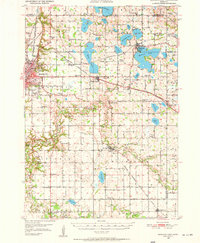 1950 Mankato East1950 Print · USGSBlue Earth County at mid-century reveals a dense network of rural school districts and rail sidings connecting farm towns to the regional hub. Researchers can trace the legacy of local education and industry through sites like Sugar Grove Sch, Lime Siding, and the St Clair settlement.3 unique versions available
 - 1951 Map of Mankato East
 1951 Mankato East1951 Print · USGSBlue Earth County's landscape in the early fifties is defined by its dense network of rural school districts and winding river valleys. Genealogists and historians can trace the foundations of local life at St Clair, Mankato Springs, and numerous family-named landmarks like Pugh Sch and Eagle Lake Cem.
 - 1951 Map of Mankato West, 1952 Print
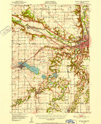 1951 Mankato West1952 Print · USGSMankato and the river valleys of Blue Earth County are captured here in the early fifties during a period of steady post-war growth. Researchers can trace rural life through the Old Grist Mill, dozens of numbered schoolhouses, and landmarks like Minneopa Falls or Good Thunder.3 unique versions available
 - 1953 Map of Saint Paul, 1964 Print
 1953 Saint Paul1964 Print · USGSThe Twin Cities and the Mississippi River valley are captured here at a mid-century turning point. Trace the early growth of Minneapolis and Saint Paul alongside landmarks like Lake Minnetonka and the St Croix River.4 unique versions available
 - 1953 Map of New Ulm, 1968 Print
 1953 New Ulm1968 Print · USGSSouthern Minnesota in the mid-1950s is defined by its deep river valleys and the expanding reach of the Great Northern and Chicago and North Western railroads. Researchers can trace rural lineages through landmarks like the Milford State Monument, St. John's Ch, and the Upper Sioux Indian Res.3 unique versions available
 - 1954 Map of Fairmont, 1967 Print
 1954 Fairmont1967 Print · USGSThe prairie landscape of southern Minnesota and northern Iowa comes alive in this mid-century survey of the Coteau des Prairies. Genealogists and historians can trace the rail-connected growth of Fairmont and Blue Earth or locate family roots near St Kilian Ch and Union Slough National Wildlife Refuge.3 unique versions available
 - 1954 Map of Mason City, 1967 Print
 1954 Mason City1967 Print · USGSSouthern Minnesota and northern Iowa are shown here at the height of the mid-century rail era, centered on the regional hubs of Mason City and Rochester. Researchers can trace the vanished paths of the Chicago Great Western and find local landmarks like Pilot Knob and Bear Lake.2 unique versions available
 - 1957 Map of New Ulm
 1957 New Ulm1957 Print · USGSCentral Minnesota in the mid-fifties remains a landscape of river-valley commerce and prairie agriculture defined by its historic mission sites and rail towns. Genealogists and local historians can trace the development of New Ulm and Montevideo, or locate specific landmarks like the Milford State Monument and Minnesota Falls.
 - 1957 Map of Mason City
 1957 Mason City1957 Print · USGSThe Minnesota-Iowa border region comes alive in this mid-century survey, from the industrial plants of Mason City to the medical hub of Rochester. Researchers can trace the rail-and-river economy through the Chicago Great Western Railway and the Shell Rock River.
 - 1958 Map of New Ulm
 1958 New Ulm1958 Print · USGSSouth-central Minnesota’s river valleys and prairie towns are captured here in the mid-fifties, during the height of the region's rail-and-river economy. Genealogists and historians can trace the legacy of the Upper Sioux Indian Mission or locate early rail stops along the Chicago and North Western Ry in towns like Redwood Falls and Glencoe.
 - 1958 Map of Mason City
 1958 Mason City1958 Print · USGSSouthern Minnesota and northern Iowa are shown during the mid-fifties when railroads still anchored the regional economy. Genealogists and historians can trace the intricate rail networks of the Illinois Central and find local landmarks in Mason City, Albert Lea, and Austin.
 - 1958 Map of Fairmont
 1958 Fairmont1958 Print · USGSThe borderlands of southern Minnesota and northern Iowa come alive in the mid-1950s, showing a landscape defined by glacial lakes and rail-line commerce. Researchers can trace historic landmarks like Lakeside Laboratory, Gridley Station, and the Bancroft Wildlife Refuge across the prairie.
 - 1959 Map of Saint Paul
 1959 Saint Paul1959 Print · USGSThe Twin Cities and southeastern Minnesota appear here in the late fifties, showing the peak of the rail era and post-war suburban growth. Genealogists can trace family footprints near Lake Minnetonka, the Univ Of Minn Rosemount Research Center, or the growing neighborhoods of Richfield.2 unique versions available
End of results
Showing maps 1-13 of 13
Top cities of Blue Earth County
- Mankato historical maps
- Lake Crystal historical maps
- Eagle Lake historical maps
- Mapleton historical maps
- Rapidan historical maps
- Madison Lake historical maps
See more
Frequently asked questions
- What are the different types of historical maps available for Blue Earth County?
- What is the oldest map of Blue Earth County?
- Where can I purchase historical maps of Blue Earth County for my home or office?
- Where can I download high-res historical maps of Blue Earth County?
- Are there historical topographic maps available for Blue Earth County?
- Is there historical aerial imagery available for Blue Earth County?
- Where are historical maps of Blue Earth County sourced from?