2020s Maps of Mankato, Minnesota
Explore 2 historic maps of Mankato from the 2020s. These maps offer a rare glimpse into what life looked like during the 2020s — showing old roads, neighborhoods, homes, and landmarks that have changed or disappeared over time.
Whether you're researching your family's past, planning a metal detecting trip, or studying how Mankato's landscape evolved across the 2020s, these high-resolution maps are a powerful tool for exploring the history of this region.
- Focus on a specific era: All maps on this page are from the 2020s, giving you a focused view of this time period.
- See what’s changed: Compare century-old streets, trails, and buildings to today's modern landscape using overlays and satellite layers.
- Research with precision: Use these maps for genealogy, historical research, land use analysis, or educational projects.
- View, download, or print: Maps are fully viewable online in high resolution, and can be downloaded or printed for your own records.
Start exploring Mankato's history through authentic maps from the 2020s. This is your window into the past.
Mankato, MN maps
(2)- 2022 Map of Mankato West, 2022 Print
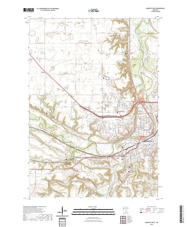 2022 Mankato West2022 Print · USGSGreater Mankato sits at the bend of the Minnesota River in the early twenty-first century, showcasing a landscape of rapid suburban growth and river-valley conservation. Researchers can trace local burial grounds like Belgrade Swedish Cem or follow historical paths such as the 207th Military Road and Seppmann Mill Trail.
 - 2022 Map of Mankato East, 2022 Print
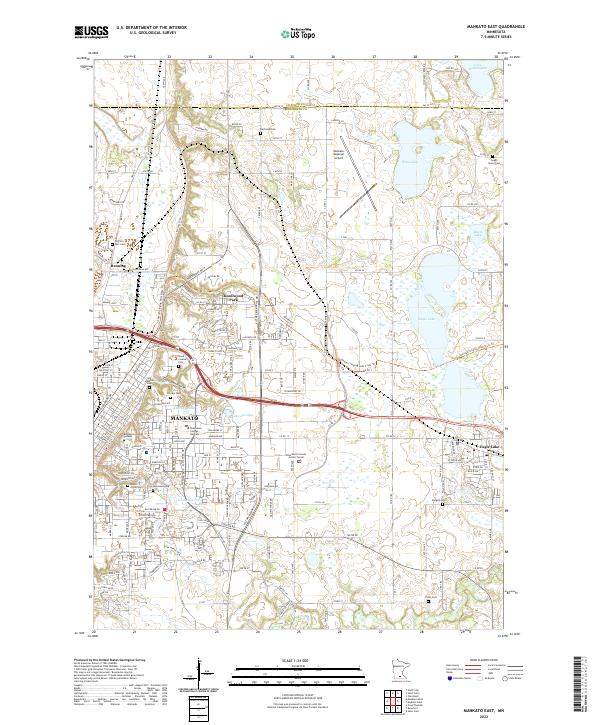 2022 Mankato East2022 Print · USGSMankato and Eagle Lake are shown during their twenty-first-century expansion, revealing a landscape of suburban growth and well-preserved civic sites. Trace family roots at the Old Masonic Cem or follow the path of the Sakatah Singing Hills State Trl.
End of results
Showing maps 1-2 of 2
Top cities near Mankato
- North Mankato historical maps
- Saint Peter historical maps
- Lake Crystal historical maps
- Eagle Lake historical maps
- Nicollet historical maps
- Rapidan historical maps
See more
Top neighborhoods of Mankato
- Benning historical maps
- Southhaven historical maps
- Lime Valley Mobile Home Park historical maps
- University Park historical maps
Frequently asked questions
- What are the different types of historical maps available for Mankato?
- What is the oldest map of Mankato?
- Where can I purchase historical maps of Mankato for my home or office?
- Where can I download high-res historical maps of Mankato?
- Are there historical topographic maps available for Mankato?
- Is there historical aerial imagery available for Mankato?
- Where are historical maps of Mankato sourced from?