1950s Maps of East Gull Lake, Minnesota
Explore 5 historic maps of East Gull Lake from the 1950s. These maps offer a rare glimpse into what life looked like during the 1950s — showing old roads, neighborhoods, homes, and landmarks that have changed or disappeared over time.
Whether you're researching your family's past, planning a metal detecting trip, or studying how East Gull Lake's landscape evolved across the 1950s, these high-resolution maps are a powerful tool for exploring the history of this region.
- Focus on a specific era: All maps on this page are from the 1950s, giving you a focused view of this time period.
- See what’s changed: Compare century-old streets, trails, and buildings to today's modern landscape using overlays and satellite layers.
- Research with precision: Use these maps for genealogy, historical research, land use analysis, or educational projects.
- View, download, or print: Maps are fully viewable online in high resolution, and can be downloaded or printed for your own records.
Start exploring East Gull Lake's history through authentic maps from the 1950s. This is your window into the past.
East Gull Lake, MN maps
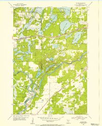
(5)- 1953 Map of Brainerd, 1966 Print
 1953 Brainerd1966 Print · USGSCentral Minnesota's lake country and iron ranges are detailed in the mid-fifties, showing the intersection of industry and wilderness. Researchers can locate specific local landmarks like the Crow Wing County Courthouse or trace the early paths of the Soo Line Railroad and the Cuyuna Range Iron Mines.3 unique versions available
 - 1954 Map of Baxter, 1955 Print
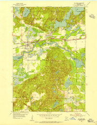
 1954 Baxter1955 Print · USGSBaxter and the lake-country of central Minnesota are captured here in the mid-1950s as a burgeoning transportation and recreation hub. Genealogists and local historians can trace family-named sites like Oak Land Cem, the Plumly Sch (Abandoned), and the rail-side community of Barrows.5 unique versions available
 - 1954 Map of Pillager, 1955 Print
 1954 Pillager1955 Print · USGSCentral Minnesota's river-and-rail corridor is captured here in the mid-1950s, highlighting the transition from rural school districts to larger state and military lands. Trace the legacy of Pillager and its Pillager Dam alongside Wildwood Cem and the Pillsbury State Forest.4 unique versions available
 - 1957 Map of Brainerd
 1957 Brainerd1957 Print · USGSNorth-central Minnesota's lake-rich landscape is captured in the mid-1950s as a crossroads of rail, river, and forest. Genealogists and historians can trace the paths of the Great Northern and Soo Line railroads through hubs like Brainerd, Wadena, and Detroit Lakes.
 - 1958 Map of Brainerd
 1958 Brainerd1958 Print · USGSCentral Minnesota in the late fifties is a landscape of dense lake chains, rail hubs, and sprawling state forests. Genealogists and local historians can trace old property alignments near the Mississippi River or locate family sites in Brainerd, Little Falls, and Detroit Lakes.
End of results
Showing maps 1-5 of 5
Top cities near East Gull Lake
- Brainerd historical maps
- Baxter historical maps
- Nisswa historical maps
- Sylvan historical maps
- Pequot Lakes historical maps
- Breezy Point historical maps
See more
Frequently asked questions
- What are the different types of historical maps available for East Gull Lake?
- What is the oldest map of East Gull Lake?
- Where can I purchase historical maps of East Gull Lake for my home or office?
- Where can I download high-res historical maps of East Gull Lake?
- Are there historical topographic maps available for East Gull Lake?
- Is there historical aerial imagery available for East Gull Lake?
- Where are historical maps of East Gull Lake sourced from?