Old Maps of Hovland, East Cook for Hiking & Exploration
Hike through history with 11 historic maps of Hovland. Explore old trails, ghost towns, and forgotten backroads — perfect for outdoor adventurers and local explorers.
- Rediscover forgotten places: Map out old mining camps, roads, and footpaths that no longer exist on modern maps.
- Layer with modern tools: Combine with LiDAR or satellite views to plan hikes through historical terrain.
- Made for exploration: Popular among hikers, overlanders, and local history lovers.
Use these maps to find adventure and explore the hidden past of Hovland.
Hovland, East Cook maps
(11)- 1958 Map of Hancock, 1967 Print
 1958 Hancock1967 Print · USGSThe Keweenaw Peninsula and Isle Royale are seen here during the mid-twentieth century as mining and maritime hubs. Trace the dense town layouts of Hancock and Calumet, or locate remote coastal markers like the Eagle Harbor Lighthouse and Rock of Ages Light.2 unique versions available
 - 1960 Map of Hancock
 1960 Hancock1960 Print · USGSThe Keweenaw Peninsula and Isle Royale are captured in detail during the late 1950s. Researchers can trace copper-mining era settlements like Calumet and Laurium, or locate remote maritime landmarks such as the Isle Royale Lighthouse.
 - 1960 Map of Hovland, 1961 Print
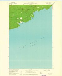 1960 Hovland1961 Print · USGSNorth Shore life in the early sixties centers on the small coastal community of Hovland along the edge of the Grand Portage State Forest. Researchers can trace old family sites near the local Cem and the mouths of the Flute Reed River and Carlson Creek.4 unique versions available
 - 1961 Map of Hancock
 1961 Hancock1961 Print · USGSThe Keweenaw Peninsula and Isle Royale are shown here at the start of the 1960s, featuring the region's historic copper mining and maritime infrastructure. Genealogists and researchers can trace local families through settlements like Atlantic Mine and Painesdale, or locate remote landmarks including Rock of Ages Light and Eagle Harbor.
 - 1966 Map of Hancock, 1987 Print
 1966 Hancock1987 Print · USGSThe Keweenaw Peninsula and Isle Royale are captured in the mid-1960s during a pivotal era for Michigan’s Copper Country. Trace the industrial footprint of the SOO LINE through Calumet or locate historic maritime landmarks like Fort Wilkins and Rock of Ages Light.
 - 1985 Map of Grand Portage
 1985 Grand Portage1985 Print · USGSThe international border along Lake Superior is shown in detail during the mid-1980s, bridging the wilderness of Minnesota and Michigan. Researchers can trace the varied terrain of Isle Royale National Park and the lakeside settlements of Hovland and Mineral Center.2 unique versions available
 - 2011 Map of Hovland, 2011 Print
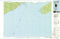
 2011 Hovland2011 Print · USGSCovers Hovland, including East Cook, Cook County, and other nearby areas
 - 2013 Map of Hovland, 2013 Print
 2013 Hovland2013 Print · USGSCovers Hovland, including East Cook, Cook County, and other nearby areas
 - 2016 Map of Hovland, 2016 Print
 2016 Hovland2016 Print · USGSCovers Hovland, including East Cook, Cook County, and other nearby areas
 - 2019 Map of Hovland, 2019 Print
 2019 Hovland2019 Print · USGSCovers Hovland, including East Cook, Cook County, and other nearby areas
 - 2022 Map of Hovland, 2022 Print
 2022 Hovland2022 Print · USGSMinnesota's North Shore is captured here in recent years, showing the quiet settlement of Hovland against the expanse of Lake Superior. Researchers can locate family landmarks like the Old Settlers Cem or trace the winding course of the Flute Reed River.
End of results
Showing maps 1-11 of 11
Frequently asked questions
- What are the different types of historical maps available for Hovland?
- What is the oldest map of Hovland?
- Where can I purchase historical maps of Hovland for my home or office?
- Where can I download high-res historical maps of Hovland?
- Are there historical topographic maps available for Hovland?
- Is there historical aerial imagery available for Hovland?
- Where are historical maps of Hovland sourced from?