1900s (20th Century) Maps of Goodhue County, Minnesota
Explore 48 historic maps of Goodhue County from the 1900s (20th Century). These maps offer a rare glimpse into what life looked like during the 1900s — showing old roads, neighborhoods, homes, and landmarks that have changed or disappeared over time.
Whether you're researching your family's past, planning a metal detecting trip, or studying how Goodhue County's landscape evolved across the 1900s, these high-resolution maps are a powerful tool for exploring the history of this region.
- Focus on a specific era: All maps on this page are from the 1900s, giving you a focused view of this time period.
- See what’s changed: Compare century-old streets, trails, and buildings to today's modern landscape using overlays and satellite layers.
- Research with precision: Use these maps for genealogy, historical research, land use analysis, or educational projects.
- View, download, or print: Maps are fully viewable online in high resolution, and can be downloaded or printed for your own records.
Start exploring Goodhue County's history through authentic maps from the 1900s. This is your window into the past.
Goodhue County, MN maps
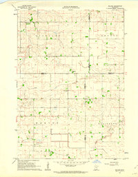
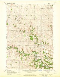
(48)- 1932 Map of Wabasha
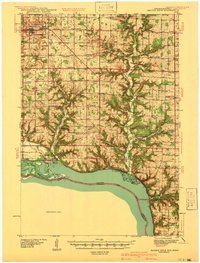
 1932 Wabasha1932 Print · USGSThe Mississippi River valley near the Chippewa delta was a thriving hub of rail and river commerce in the early thirties. Genealogists can trace early homesteads and community hubs through landmarks like Hicks Valley Sch, Stockholm, and the river crossing at Nelson.2 unique versions available
 - 1940 Map of Maiden Rock
 1940 Maiden Rock1940 Print · USGSPierce County’s bluff country meets the Mississippi River in this pre-war survey of the Wisconsin-Minnesota border. Genealogists can trace hundreds of family-named landmarks, from Clayfield Ch to vanished rural schoolhouses like Oakvale Sch and Drake Sch.2 unique versions available
 - 1944 Map of Red Wing
 1944 Red Wing1944 Print · USGSThe Wisconsin side of the Mississippi River valley is shown here just before the mid-century, where rail and river networks met. Genealogists can locate family-named landmarks and rural hubs like Moeville, Hager City, and St Marys Sch.2 unique versions available
 - 1950 Map of Maiden Rock, 1952 Print
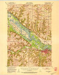
 1950 Maiden Rock1952 Print · USGSThe bluffs of Lake Pepin were a hive of rail and river activity at mid-century, supporting a dense network of upland farms and small towns. Researchers can trace rural life through dozens of named landmarks like Old Frontenac, the Villa Maria Academy, and Sleepy Hollow School.4 unique versions available
 - 1951 Map of Wabasha
 1951 Wabasha1951 Print · USGSThe Mississippi River valley and Lake Pepin define this mid-century landscape at the border of Minnesota and Wisconsin. Researchers can trace rural school districts like Scott Settlement Sch and old river settlements from Stockholm to Wabasha.3 unique versions available
 - 1951 Map of Lake City, 1953 Print
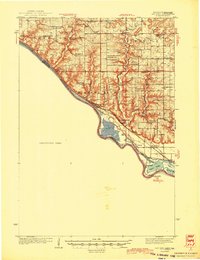
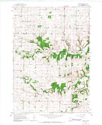
 1951 Lake City1953 Print · USGSLake City and the high bluffs overlooking the Mississippi River appear here at mid-century, documenting a landscape shaped by the rail lines and river valleys of the Upper Midwest. Researchers can locate numerous country landmarks like Sugarloaf Valley Sch, Florence Stn, and the historic Zumbro Falls.3 unique versions available
 - 1952 Map of Red Wing, 1954 Print
 1952 Red Wing1954 Print · USGSRed Wing and the Mississippi River valley are shown here in the early fifties, a time when rail lines and river sloughs defined local geography. Genealogists can trace family names at the Vasa Childrens Home School No 3, St Johns Cem, and the Prairie Island Indian Reservation.3 unique versions available
 - 1953 Map of Saint Paul, 1964 Print
 1953 Saint Paul1964 Print · USGSThe Twin Cities and the Mississippi River valley are captured here at a mid-century turning point. Trace the early growth of Minneapolis and Saint Paul alongside landmarks like Lake Minnetonka and the St Croix River.4 unique versions available
 - 1957 Map of Farmington, 1958 Print
 1957 Farmington1958 Print · USGSDakota County in the late fifties shows a landscape of busy rail junctions and transitioning rural schools. You can trace family roots through sites like Christiania Church or locate vanished landmarks like Southport Landing Field and School No 55.2 unique versions available
 - 1957 Map of Hastings, 1959 Print
 1957 Hastings1959 Print · USGSDakota County and the Mississippi riverfront appear in the late fifties as a hub of rail transit and agricultural industry. Genealogists and researchers can locate landmarks like St Lukes Cem, the Mineral Springs Sanatorium, and the tracks of the Chicago Great Western.2 unique versions available
 - 1959 Map of Saint Paul
 1959 Saint Paul1959 Print · USGSThe Twin Cities and southeastern Minnesota appear here in the late fifties, showing the peak of the rail era and post-war suburban growth. Genealogists can trace family footprints near Lake Minnetonka, the Univ Of Minn Rosemount Research Center, or the growing neighborhoods of Richfield.2 unique versions available
 - 1960 Map of Dennison, 1961 Print
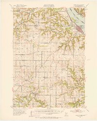
 1960 Dennison1961 Print · USGSSoutheast Minnesota's agricultural heartland is documented here at the start of the 1960s. Family historians and researchers can trace the rail-side growth of Dennison and Stanton, locate the Prairie Creek Cem, and find landmarks like Carleton Airport.
 - 1960 Map of Nerstrand, 1961 Print
 1960 Nerstrand1961 Print · USGSSoutheastern Minnesota farmland at the start of the 1960s reveals a landscape of rural churches and competing rail lines. Local historians can trace family roots at Valley Grove Ch, explore the village of Nerstrand, or locate old sites near Falls Creek.2 unique versions available
 - 1962 Map of Moland, 1964 Print
 1962 Moland1964 Print · USGSSteele and Rice counties are captured in the early sixties, showing a landscape of established farmsteads and rural social hubs. Genealogists can locate Richland Center, the Merton Cem, and the community surrounding Moland Ch.2 unique versions available
 - 1965 Map of Concord, 1966 Print
 1965 Concord1966 Print · USGSThe rural countryside of Dodge and Goodhue counties comes into focus in the mid-1960s, showing a landscape defined by the Zumbro River. Trace old homesteads near Berne, Roscoe, and the rural St Rose Ch or Riverside Cem.2 unique versions available
 - 1965 Map of West Concord, 1966 Print
 1965 West Concord1966 Print · USGSDodge County farmland was defined by its rails and rivers in the mid-sixties, with the Chicago Great Western railroad serving as a vital corridor. Genealogists can locate family landmarks like Hegre Ch Cem and the small settlement of Skyberg near the Goodhue County line.
 - 1965 Map of Oronoco, 1967 Print
 1965 Oronoco1967 Print · USGSThe Olmsted County countryside near Oronoco is captured here in the mid-sixties, centered on the waters of Shady Lake. Genealogists and local historians can trace the Chicago Great Western rail line past St Peters Ch and the Townhall.2 unique versions available
 - 1965 Map of Pine Island, 1967 Print
 1965 Pine Island1967 Print · USGSPine Island and the surrounding agricultural townships are seen here in the mid-1960s as the rail and river networks shaped the region. Genealogists and local historians can locate early burial sites like St Michael Cem and follow the Chicago Great Western tracks.2 unique versions available
 - 1968 Map of Goodhue East, 1970 Print
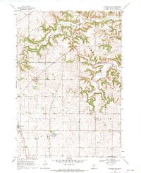 1968 Goodhue East1970 Print · USGSGoodhue and Belvidere townships are captured here in the late sixties, showcasing a landscape defined by forest conservation and agricultural industry. Researchers can trace the Old Railroad Grade and locate local landmarks like St Johns Sch and Belvidere Mills.2 unique versions available
 - 1968 Map of Zumbrota, 1970 Print
 1968 Zumbrota1970 Print · USGSZumbrota and its surrounding townships are captured in the late sixties as the region's rail and agricultural patterns remained clearly defined. Genealogists and local historians can trace legacy sites like St Johns Ch, United Cem, and the small community of Forest Mills.2 unique versions available
 - 1968 Map of Kenyon, 1970 Print
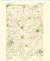
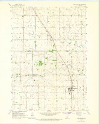
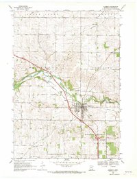
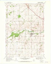
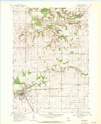 1968 Kenyon1970 Print · USGSKenyon and the surrounding Goodhue County townships are captured in the late 1960s at a peak of rail activity. Genealogists can trace family sites at Wangs Cem and St Michaels Cem or locate the old Nansen and Bombay settlements.2 unique versions available
 - 1968 Map of Sogn, 1970 Print
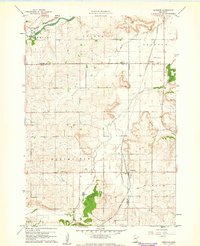
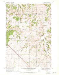
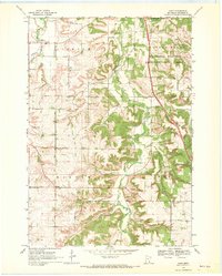 1968 Sogn1970 Print · USGSGoodhue County’s rugged blufflands come into focus in the late sixties, showcasing a landscape of isolated farmsteads and deep river valleys. Genealogists and historians can trace the foundations of rural life through Wangen Prairie Ch, Eidsvold Ch Cem, and the quiet hamlet of Sogn.2 unique versions available
 - 1968 Map of Mazeppa, 1970 Print
 1968 Mazeppa1970 Print · USGSThe river valley at Mazeppa and Bellechester is captured here during the late sixties, showing the transition from rail to road. You can trace the Old Railroad Grade along the North Fork Zumbro River or locate rural landmarks like Grace Ch and the local Townhall.2 unique versions available
 - 1968 Map of Wanamingo, 1970 Print
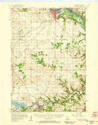
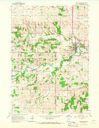
 1968 Wanamingo1970 Print · USGSGoodhue County comes into focus in the late sixties as the rail-and-river economy centers on the town of Wanamingo. Local historians can trace family ties at Trinity Cem and Dale Cem, or follow the Chicago Milwaukee St Paul and Pacific railroad through the valley.2 unique versions available
 - 1968 Map of White Rock, 1970 Print
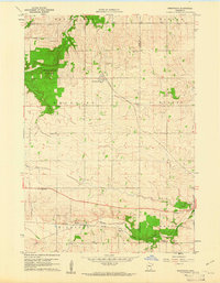
 1968 White Rock1970 Print · USGSGoodhue County in the late sixties reveals a landscape of wooded ridges and tight-knit rural communities. Genealogists and local historians can trace the foundations of Wastedo and White Rock, locating specific landmarks like Spring Garden Ch and Wastedo Sch.2 unique versions available
Showing maps 1-25 of 48
Top cities of Goodhue County
- Red Wing historical maps
- Cannon Falls historical maps
- Zumbrota historical maps
- Kenyon historical maps
- Wanamingo historical maps
- Goodhue historical maps
See more
Frequently asked questions
- What are the different types of historical maps available for Goodhue County?
- What is the oldest map of Goodhue County?
- Where can I purchase historical maps of Goodhue County for my home or office?
- Where can I download high-res historical maps of Goodhue County?
- Are there historical topographic maps available for Goodhue County?
- Is there historical aerial imagery available for Goodhue County?
- Where are historical maps of Goodhue County sourced from?