2020s Maps of Goodhue County, Minnesota
Explore 29 historic maps of Goodhue County from the 2020s. These maps offer a rare glimpse into what life looked like during the 2020s — showing old roads, neighborhoods, homes, and landmarks that have changed or disappeared over time.
Whether you're researching your family's past, planning a metal detecting trip, or studying how Goodhue County's landscape evolved across the 2020s, these high-resolution maps are a powerful tool for exploring the history of this region.
- Focus on a specific era: All maps on this page are from the 2020s, giving you a focused view of this time period.
- See what’s changed: Compare century-old streets, trails, and buildings to today's modern landscape using overlays and satellite layers.
- Research with precision: Use these maps for genealogy, historical research, land use analysis, or educational projects.
- View, download, or print: Maps are fully viewable online in high resolution, and can be downloaded or printed for your own records.
Start exploring Goodhue County's history through authentic maps from the 2020s. This is your window into the past.
Goodhue County, MN maps
(29)- 2022 Map of Diamond Bluff West, 2022 Print
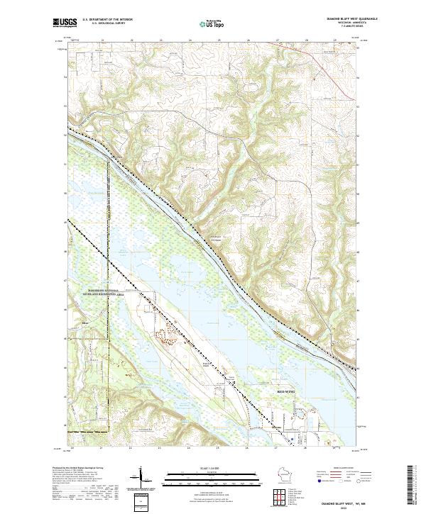 2022 Diamond Bluff West2022 Print · USGSThe river border between Pierce County, Wisconsin, and Minnesota is mapped here in the early 2020s, showcasing the intricate wetlands of the Mississippi. Historians and researchers can trace local landmarks like Prairie Island Cem and the settlements of Etter and Stroms.
 - 2022 Map of White Rock, 2022 Print
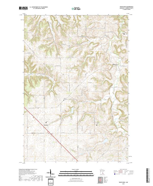 2022 White Rock2022 Print · USGSGoodhue County agriculture and early settlement sites are meticulously detailed in this recent survey of the Minnesota countryside. Local researchers can pinpoint family burial grounds like Spring Garden Cem and trace the paths of Echo Valley Trl and Belle Cr.
 - 2022 Map of Kenyon, 2022 Print
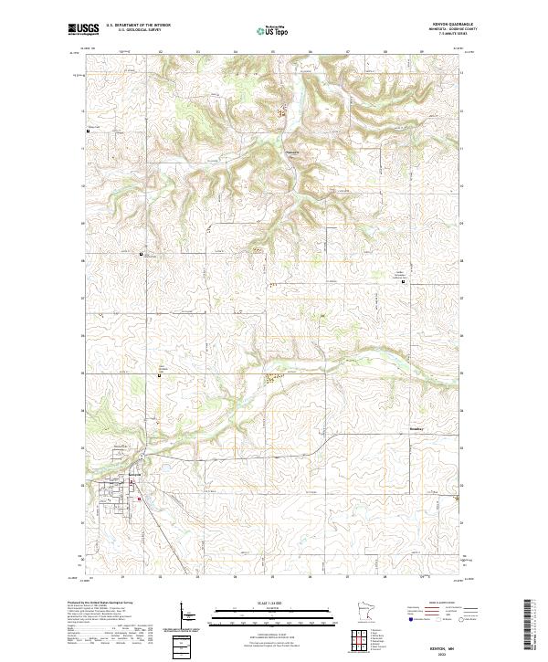 2022 Kenyon2022 Print · USGSThe rural landscape of Goodhue County is captured here in the early 2020s, centered on the river-fed town of Kenyon. Researchers can trace old family burial sites like Holden Norwegian Lutheran Cem and smaller hamlets such as Nansen and Bombay.
 - 2022 Map of Oronoco, 2022 Print
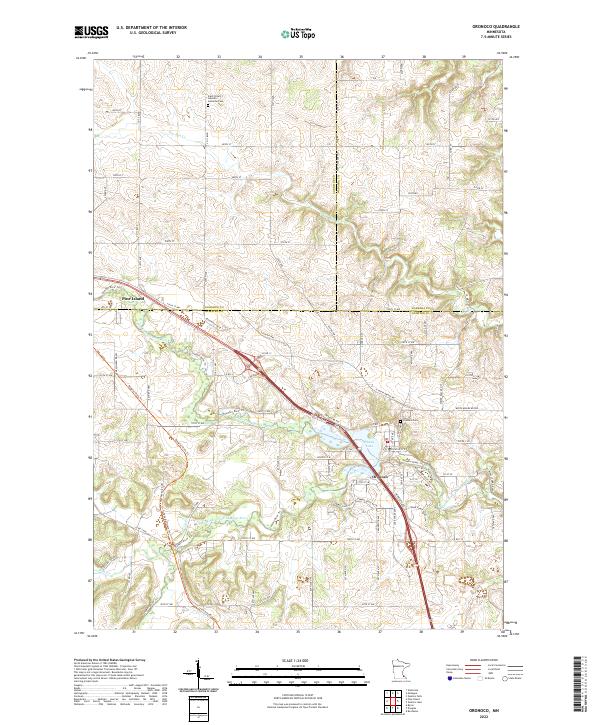 2022 Oronoco2022 Print · USGSSoutheast Minnesota’s river valleys are captured here in the early twenty-first century as the Zumbro River winds through Olmsted and Goodhue counties. Researchers can trace local heritage at Oronoco Cem or follow the waters of Shady Lake and the Middle Fork Zumbro River.
 - 2022 Map of Mazeppa, 2022 Print
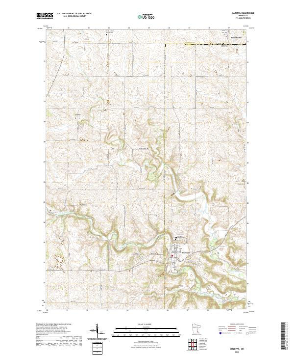 2022 Mazeppa2022 Print · USGSThe river valley and high plateaus of the Goodhue and Wabasha county line are captured here in the early 2020s. Genealogists can trace family plots at Zumbrota East Cem, Grace Luthern Church Cem, and the parish grounds in Mazeppa.
 - 2022 Map of Wanamingo, 2022 Print
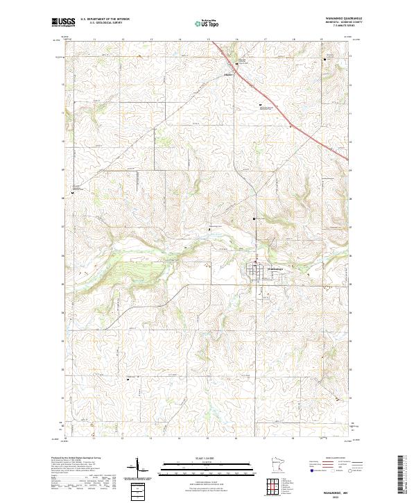 2022 Wanamingo2022 Print · USGSGoodhue County farmland in the early 2020s shows a landscape still anchored by its pioneer-era churchyards and river valleys. Genealogists can trace family names at Wanamingo Cem, Trinity Cem, and Dale Cem along the N Fork Zumbro River.
 - 2022 Map of Dennison, 2022 Print
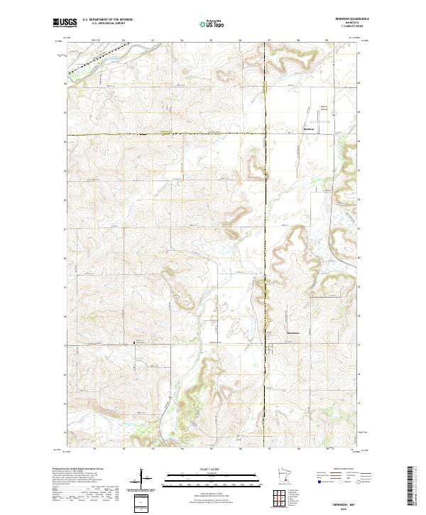 2022 Dennison2022 Print · USGSNear the intersection of Rice, Goodhue, and Dakota counties, this recent survey documents a region defined by its river valleys and aviation history. Researchers can locate the Prairie Creek Cem or trace the pathways of Sciota Trl and Cannon River Trl.
 - 2022 Map of Sogn, 2022 Print
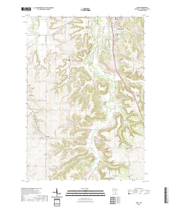 2022 Sogn2022 Print · USGSGoodhue County agriculture and river valleys are captured here in the early twenty-first century as the landscape transitions toward the Cannon River. Researchers can locate several rural burial sites, including Wangen Prairie Cem and Urland Cem, near the small settlements of Wangs and Sogn.
 - 2022 Map of Concord, 2022 Print
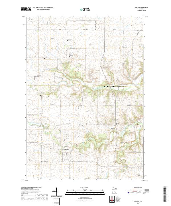 2022 Concord2022 Print · USGSDodge County agricultural lands and river valleys are captured here in the early 2020s. Researchers can trace several generations of local history through numerous burial sites like Riverside Cem, Fairpoint Cem, and the settlement at Concord.
 - 2022 Map of Randolph, 2022 Print
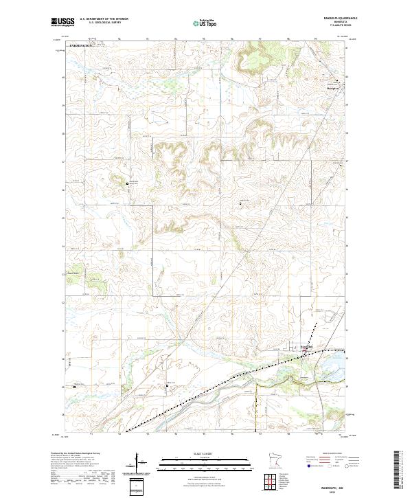 2022 Randolph2022 Print · USGSDakota County south of the Twin Cities is documented here in the early 2020s, showing a landscape defined by the Cannon River and its many tributaries. Genealogists can locate numerous local burial sites like Saint Mathias Cemetery and Kibbe Cemetery near the crossroads of Randolph and Hampton.
 - 2022 Map of Zumbro Falls, 2022 Print
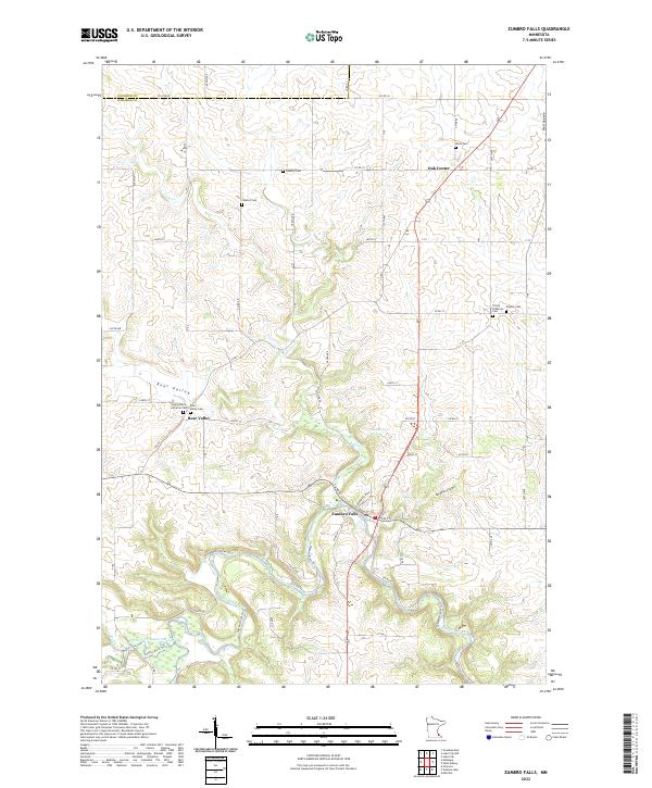 2022 Zumbro Falls2022 Print · USGSWabasha and Goodhue counties appear in this recent survey of the driftless-style terrain surrounding the Zumbro River. Researchers can trace historic church sites and local burial grounds like English Cem, Black Cem, and Bear Valley Cem across this rural landscape.
 - 2022 Map of Miesville, 2022 Print
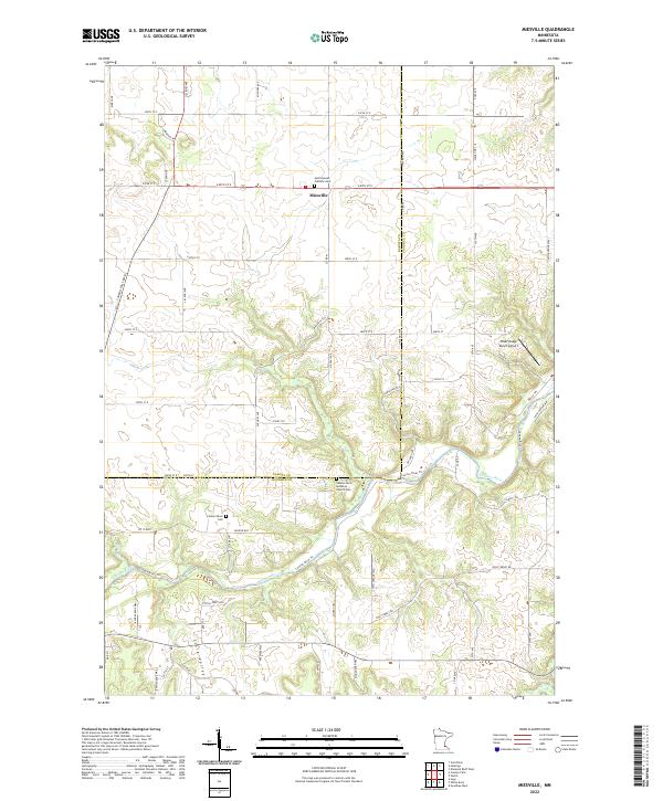 2022 Miesville2022 Print · USGSSoutheast of the Twin Cities in the 2020s, this area shows the rural intersection of agricultural plateaus and the deep Cannon River valley. Genealogists can locate family sites at Saint Joseph Catholic Cem or the Cannon River Lutheran Church Cem.
 - 2022 Map of Red Wing, 2022 Print
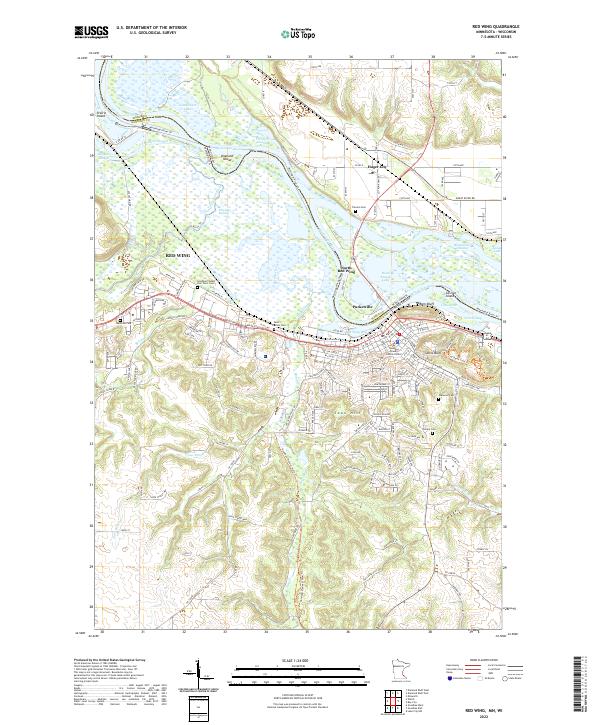 2022 Red Wing2022 Print · USGSThe Mississippi River valley comes into focus in the early 2020s, showing the enduring riverfront character of Red Wing. Researchers can locate several burial grounds including Oakwood Cem and Saint Johns Cem, or trace the paths of the Goodhue Pioneer State Trl and Mississippi River Trl.
 - 2022 Map of Zumbrota, 2022 Print
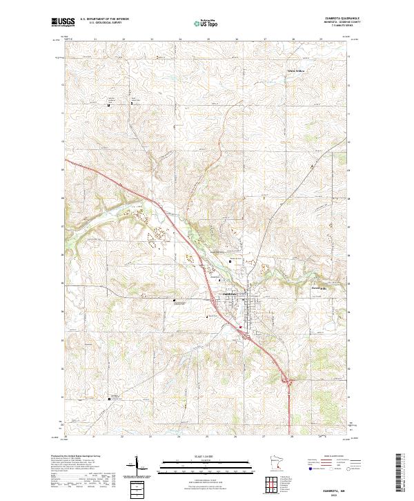 2022 Zumbrota2022 Print · USGSZumbrota and the surrounding river valleys are captured here in the early twenty-first century as a landscape of deep-rooted heritage. Local historians can trace family origins through numerous burial sites like Land Norwegian Lutheran Cem and United Cem, or explore outlying hamlets such as Forest Mills.
 - 2022 Map of Welch, 2022 Print
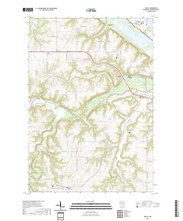 2022 Welch2022 Print · USGSThe river valleys of Goodhue County meet at the turn of the 21st century, showing a landscape of fertile bottoms and upland settlements. Researchers can trace historic family burial sites at Vasa Cemetery or locate the community hubs of Welch and Eggleston.
 - 2022 Map of Goodhue West, 2022 Print
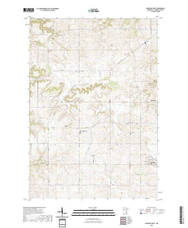 2022 Goodhue West2022 Print · USGSGoodhue County agriculture and rural life are documented here in the early twenty-first century. Genealogists can trace family connections through numerous burial grounds such as Saint Columbkill's Catholic Church Cem and Swedish Cem.
 - 2022 Map of Nerstrand, 2022 Print
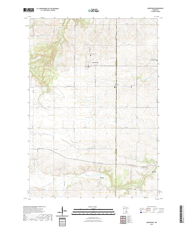 2022 Nerstrand2022 Print · USGSThe rural expanses of Rice and Goodhue counties are captured here in the early twenty-first century, centered on the historic village of Nerstrand. Genealogists can trace family footprints through numerous local sites like Wheeling Evangelical Cem, Hauge Cem, and the settlement at Epsom.
 - 2022 Map of Moland, 2022 Print
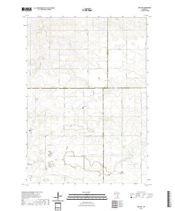 2022 Moland2022 Print · USGSSoutheastern Minnesota's rural landscape is captured here at the four-way intersection of Rice, Steele, Goodhue, and Dodge counties. Researchers can locate local burial sites at Moland Cem and Merton Cem or trace the early course of the Middle Fork Zumbro River.
 - 2022 Map of West Concord, 2022 Print
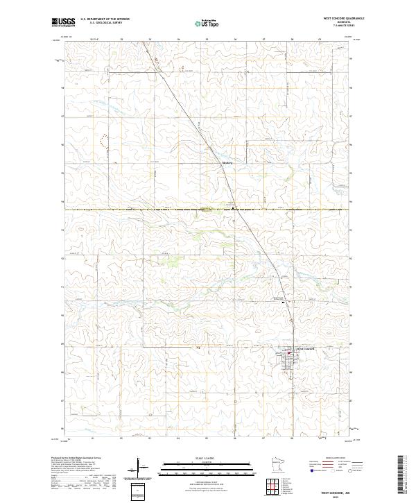 2022 West Concord2022 Print · USGSDodge County agricultural lands and river valleys are captured here in the modern era. Genealogists can locate family sites near Hegre Church, Saint Vincent De Paul Cem, and the streets of West Concord.
 - 2022 Map of Lake City NW, 2022 Print
 2022 Lake City NW2022 Print · USGSThe hills of Goodhue County are captured in this recent survey, showcasing a landscape of high ridges and winding creek valleys. Trace the topography of West Florence Ridge or find landmarks like Kohn Hill and the headwaters of Wells Cr.
 - 2022 Map of Bay City, 2022 Print
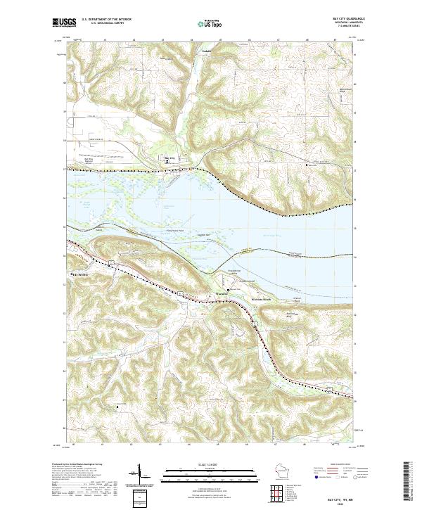 2022 Bay City2022 Print · USGSThe Mississippi River valley comes alive in this contemporary survey of the borderlands near Bay City and Wacouta. Researchers can pinpoint family history at Tabor Cem or Scherf Cem and trace the winding paths of Isabelle Cr and Bullard Cr.
 - 2022 Map of Diamond Bluff East, 2022 Print
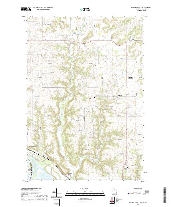 2022 Diamond Bluff East2022 Print · USGSPierce County’s river-carved bluffs and upland prairies are documented here in the early twenty-first century. Researchers can locate family landmarks such as the Bethel Mission Covenant Cem or trace the early settlement footprints of Trimbelle and Moeville.
 - 2022 Map of Maiden Rock, 2022 Print
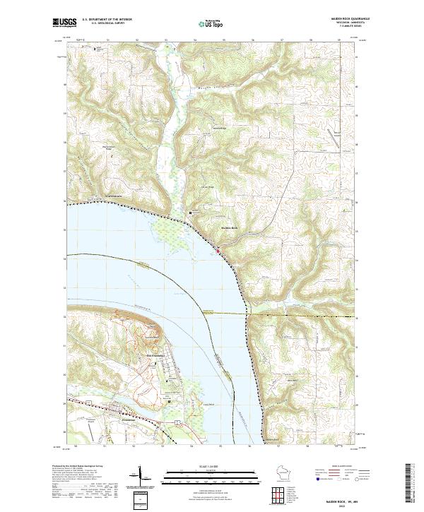 2022 Maiden Rock2022 Print · USGSThe bluffs of the upper Mississippi River valley define this area where Minnesota and Wisconsin meet during the early twenty-first century. Researchers can trace historic riverfront settlements and cemeteries, from Old Frontenac and Maiden Rock to the Villa Maria Cem.
 - 2022 Map of Pepin, 2022 Print
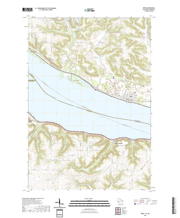 2022 Pepin2022 Print · USGSThe widening Mississippi River defines the border between Wisconsin and Minnesota in this contemporary survey of the Lake Pepin region. Researchers can trace the layout of Pepin and Stockholm or locate rural landmarks like Oakwood Cem and Maple Springs.
 - 2022 Map of Hastings, 2022 Print
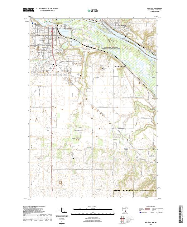 2022 Hastings2022 Print · USGSHastings and the river confluence at the Minnesota-Wisconsin border are detailed here in the early twenty-first century. Researchers can trace numerous local burial sites like Soldiers and Sailors Cem or Marsh Cem, and locate small airfields such as Sandy Flats Airport.
Showing maps 1-25 of 29
Top cities of Goodhue County
- Red Wing historical maps
- Cannon Falls historical maps
- Zumbrota historical maps
- Kenyon historical maps
- Wanamingo historical maps
- Goodhue historical maps
See more
Frequently asked questions
- What are the different types of historical maps available for Goodhue County?
- What is the oldest map of Goodhue County?
- Where can I purchase historical maps of Goodhue County for my home or office?
- Where can I download high-res historical maps of Goodhue County?
- Are there historical topographic maps available for Goodhue County?
- Is there historical aerial imagery available for Goodhue County?
- Where are historical maps of Goodhue County sourced from?