2020s Maps of Grant County, Minnesota
Explore 15 historic maps of Grant County from the 2020s. These maps offer a rare glimpse into what life looked like during the 2020s — showing old roads, neighborhoods, homes, and landmarks that have changed or disappeared over time.
Whether you're researching your family's past, planning a metal detecting trip, or studying how Grant County's landscape evolved across the 2020s, these high-resolution maps are a powerful tool for exploring the history of this region.
- Focus on a specific era: All maps on this page are from the 2020s, giving you a focused view of this time period.
- See what’s changed: Compare century-old streets, trails, and buildings to today's modern landscape using overlays and satellite layers.
- Research with precision: Use these maps for genealogy, historical research, land use analysis, or educational projects.
- View, download, or print: Maps are fully viewable online in high resolution, and can be downloaded or printed for your own records.
Start exploring Grant County's history through authentic maps from the 2020s. This is your window into the past.
Grant County, MN maps
(15)- 2022 Map of Wheaton SE, 2022 Print
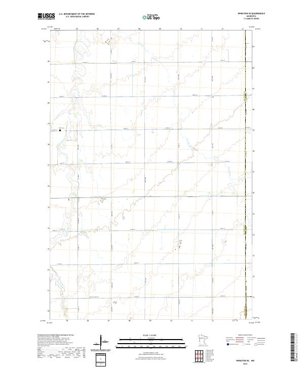 2022 Wheaton SE2022 Print · USGSTraverse County's eastern townships are captured here in the early twenty-first century, showing the precise grid of a modern agricultural landscape. Genealogists can locate Zion Cemetery and trace the paths of Twelvemile Creek and Fivemile Creek across the prairie.
 - 2022 Map of Charlesville, 2022 Print
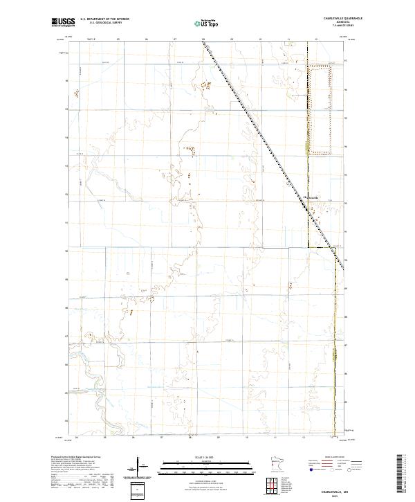 2022 Charlesville2022 Print · USGSTraverse and Grant counties are captured here in the early twenty-first century, showing the enduring agricultural geometry of the Minnesota prairie. Researchers can trace the meandering Mustinka River and locate the small settlement of Charlesville alongside the old path of Fivemile Creek.
 - 2022 Map of Tintah, 2022 Print
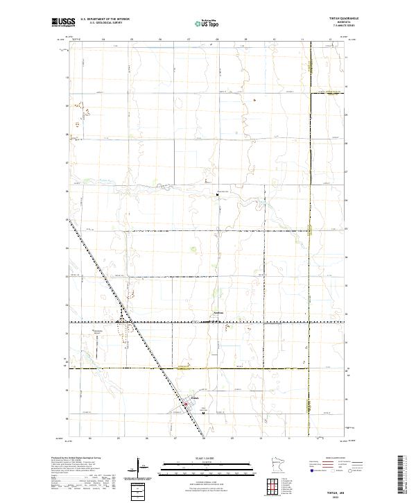 2022 Tintah2022 Print · USGSThe prairie landscape of Traverse and Wilkin counties comes to life in this survey of the northern Red River Valley. Genealogists and local historians can locate Nashua and Tintah, or trace the winding Rabbit River past Saint Galls Cem and Riverside Cem.
 - 2022 Map of Stony Lake, 2022 Print
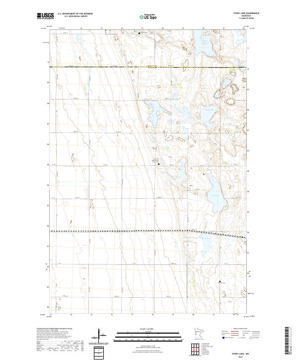 2022 Stony Lake2022 Print · USGSThe Otter Tail and Grant County border comes alive in this study of prairie wetlands and rural heritage. Genealogists can locate Western Cem, Hereford Cem, and the historic Lawrence Presbyterian Church.
 - 2022 Map of Wendell, 2022 Print
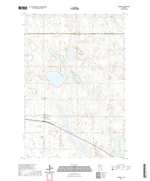 2022 Wendell2022 Print · USGSPrairie agriculture and glacial lakes define the landscape near Wendell in the early twenty-first century. Genealogists and historians can locate markers at Rock Prairie Cem and Trinity Lutheran Cem or trace the path of the Mustinka River.
 - 2022 Map of Erdahl, 2022 Print
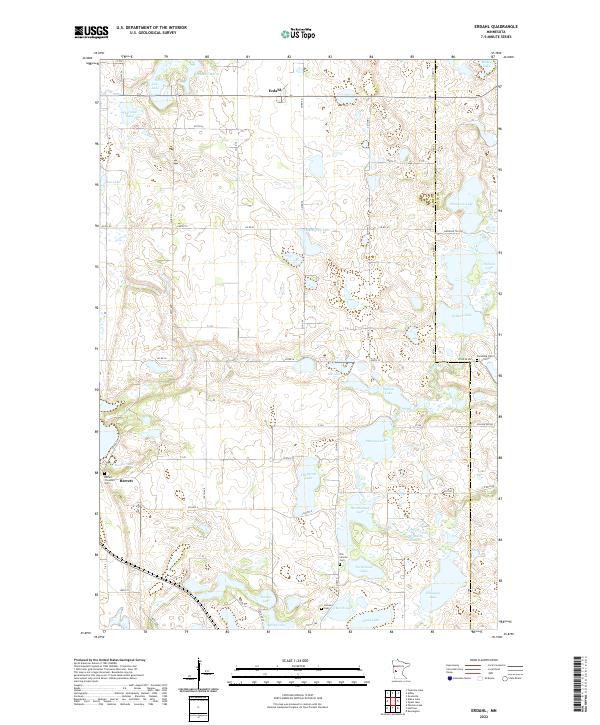 2022 Erdahl2022 Print · USGSGrant County is a landscape of prairie potholes and small rural hubs in the early twenty-first century. Genealogists can trace family history at Old Lincoln Cem, Barrett Covenant Cem, and the village of Erdahl set among numerous lakes and the Chippewa River.
 - 2022 Map of Elbow Lake, 2022 Print
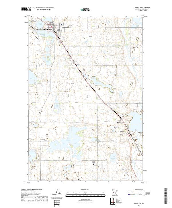 2022 Elbow Lake2022 Print · USGSThe Grant County seat and the nearby town of Barrett are shown here in the 2020s, set against a landscape of glacial lakes and the Pomme de Terre River. Genealogists can trace numerous family-named burial sites including Ness Cem, Bethania Cem, and the Native American Burial Grounds.
 - 2022 Map of Hoffman, 2022 Print
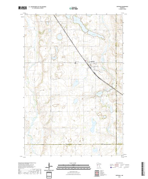 2022 Hoffman2022 Print · USGSIn the lake-dotted plains of western Minnesota, this survey captures the agricultural heart of Grant County. Researchers can trace family sites near Hoffman or locate burial records at Zion Cem, Lands Cem, and Bethel Cem along the Chippewa River.
 - 2022 Map of Patchen Lake, 2022 Print
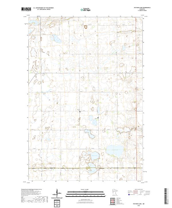 2022 Patchen Lake2022 Print · USGSThe Grant and Stevens county line in western Minnesota shows a landscape of productive farmland and prairie lakes as it appeared recently. Genealogists and local historians can locate early burial sites like Roseville Cem and Brennin Cem while tracing the shores of Patchen Lake.
 - 2022 Map of Niemackl Lakes, 2022 Print
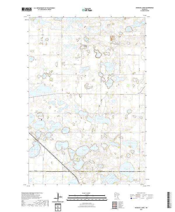 2022 Niemackl Lakes2022 Print · USGSGrant County is captured in this modern survey of a high-prairie lake district. Genealogists and local historians can locate early burial sites at Lakeside Cem or trace the drainage of the Mustinka River near Niemackl Lakes and Hazzard Lakebed.
 - 2022 Map of Herman, 2022 Print
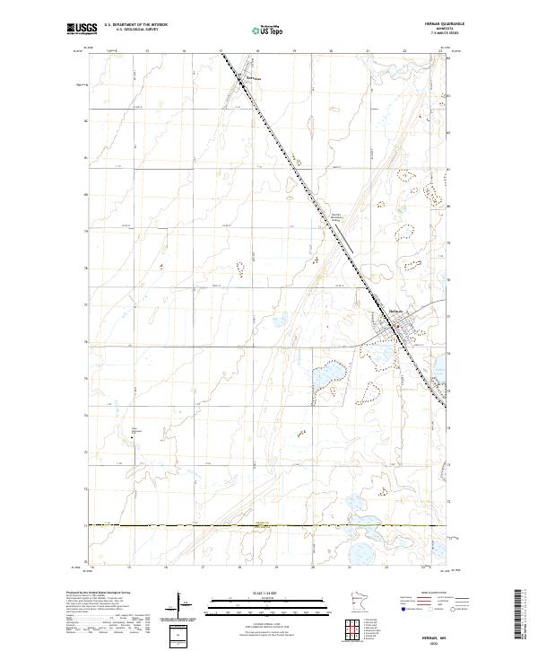 2022 Herman2022 Print · USGSHerman and Norcross are captured here in the early twenty-first century, showcasing the deep-rooted agricultural grid of West Central Minnesota. Researchers can trace local burial sites at Eden Reformed Cem or follow the waters of the Mustinka River and Pullman Lake.
 - 2022 Map of Herman NW, 2022 Print
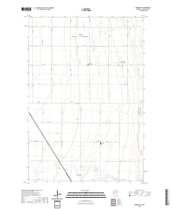 2022 Herman NW2022 Print · USGSIn the plains of western Minnesota, this survey captures a landscape of river-side settlement and organized agriculture. Genealogists and historians can locate heritage sites like Sigdal Norwegian Lutheran Cem and Norcross along the winding Mustinka River.
 - 2022 Map of Ashby, 2022 Print
 2022 Ashby2022 Print · USGSAshby and its surrounding glacial lake country are detailed in this modern survey of the Grant County borderlands. Researchers can locate family sites and landmarks like the Pelican Lake Cem, the Erdahl Lutheran Cem, and Native American Burial Grounds.
 - 2022 Map of Fourmile Lake, 2022 Print
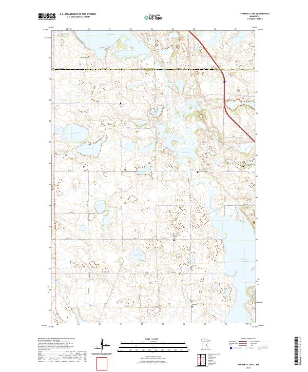 2022 Fourmile Lake2022 Print · USGSGrant and Otter Tail counties are shown here in the early twenty-first century, featuring a landscape defined by glacial lakes and the Pomme de Terre River. Genealogists can trace family history through sites like Christ Lutheran Cem and Pomme De Terre Cem.
 - 2022 Map of Trisko Lake, 2022 Print
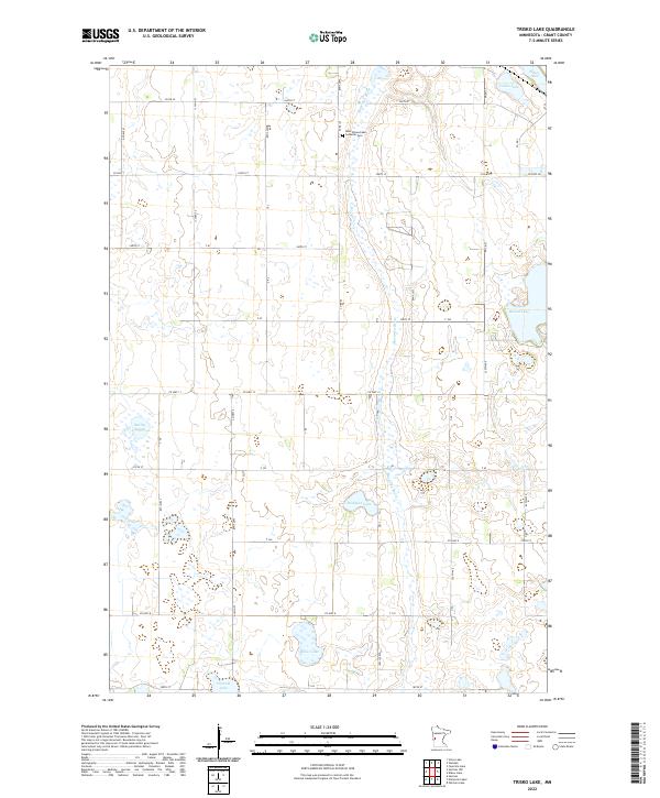 2022 Trisko Lake2022 Print · USGSGrant County is captured in this recent survey, showcasing a landscape defined by the winding Mustinka River and a dense network of glacial lakes. Researchers can locate family landmarks such as the West Elbow Lake Lutheran Cem and trace rural roads around Trisko Lake and Moses Lake.
End of results
Showing maps 1-15 of 15
Top cities of Grant County
- Elbow Lake historical maps
- Hoffman historical maps
- Ashby historical maps
- Herman historical maps
- Barrett historical maps
- Erdahl historical maps
See more
Frequently asked questions
- What are the different types of historical maps available for Grant County?
- What is the oldest map of Grant County?
- Where can I purchase historical maps of Grant County for my home or office?
- Where can I download high-res historical maps of Grant County?
- Are there historical topographic maps available for Grant County?
- Is there historical aerial imagery available for Grant County?
- Where are historical maps of Grant County sourced from?