1900s (20th Century) Maps of Peace Township, Minnesota
Explore 15 historic maps of Peace Township from the 1900s (20th Century). These maps offer a rare glimpse into what life looked like during the 1900s — showing old roads, neighborhoods, homes, and landmarks that have changed or disappeared over time.
Whether you're researching your family's past, planning a metal detecting trip, or studying how Peace Township's landscape evolved across the 1900s, these high-resolution maps are a powerful tool for exploring the history of this region.
- Focus on a specific era: All maps on this page are from the 1900s, giving you a focused view of this time period.
- See what’s changed: Compare century-old streets, trails, and buildings to today's modern landscape using overlays and satellite layers.
- Research with precision: Use these maps for genealogy, historical research, land use analysis, or educational projects.
- View, download, or print: Maps are fully viewable online in high resolution, and can be downloaded or printed for your own records.
Start exploring Peace Township's history through authentic maps from the 1900s. This is your window into the past.
Peace Township, MN maps
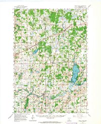
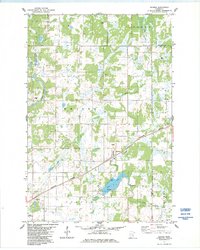
(15)- 1953 Map of Duluth, 1964 Print
 1953 Duluth1964 Print · USGSCovers Peace Township, including Duluth, Superior, and other nearby areas2 unique versions available
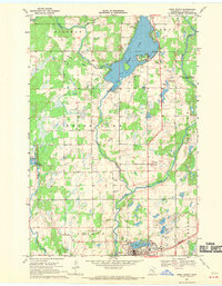
 - 1953 Map of Stillwater, 1980 Print
 1953 Stillwater1980 Print · USGSCovers Peace Township, including Minneapolis, Brooklyn Park, and other nearby areas
 - 1955 Map of Stillwater, 1965 Print
 1955 Stillwater1965 Print · USGSCovers Peace Township, including Minneapolis, Brooklyn Park, and other nearby areas
 - 1958 Map of Stillwater
 1958 Stillwater1958 Print · USGSCovers Peace Township, including Minneapolis, Brooklyn Park, and other nearby areas2 unique versions available
 - 1958 Map of Duluth
 1958 Duluth1958 Print · USGSCovers Peace Township, including Duluth, Superior, and other nearby areas
 - 1961 Map of Brook Park, 1963 Print
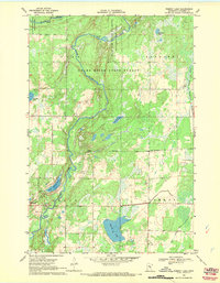
 1961 Brook Park1963 Print · USGSCovers Peace Township, including Rock Creek, Grass Lake, and other nearby areas2 unique versions available
 - 1965 Map of Stillwater
 1965 Stillwater1965 Print · USGSCovers Peace Township, including Minneapolis, Brooklyn Park, and other nearby areas
 - 1968 Map of Mora North, 1970 Print
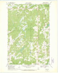
 1968 Mora North1970 Print · USGSCovers Peace Township, including Mora, Comfort Township, and other nearby areas2 unique versions available
 - 1968 Map of Pomroy Lake, 1970 Print
 1968 Pomroy Lake1970 Print · USGSCovers Peace Township, including Pomroy Township, Kroschel Township, and other nearby areas2 unique versions available
 - 1968 Map of Warman, 1970 Print
 1968 Warman1970 Print · USGSCovers Peace Township, including Ford Township, Warman, and other nearby areas2 unique versions available
 - 1975 Map of Stillwater
 1975 Stillwater1975 Print · USGSCovers Peace Township, including Minneapolis, Brooklyn Park, and other nearby areas2 unique versions available
 - 1983 Map of Quamba, 1984 Print
 1983 Quamba1984 Print · USGSCovers Peace Township, including Quamba, Pomroy Township, and other nearby areas
 - 1985 Map of Mora
 1985 Mora1985 Print · USGSCovers Peace Township, including North Branch, Cambridge, and other nearby areas
 - 1985 Map of Mille Lacs Lake
 1985 Mille Lacs Lake1985 Print · USGSCovers Peace Township, including Crosby, Bay Lake, and other nearby areas2 unique versions available
 - 1991 Map of Mora
 1991 Mora1991 Print · USGSCovers Peace Township, including North Branch, Cambridge, and other nearby areas
End of results
Showing maps 1-15 of 15
Top cities near Peace Township
- Mora historical maps
- Isle historical maps
- Ogilvie historical maps
- Kroschel historical maps
- Brook Park historical maps
- Grasston historical maps
See more
Top neighborhoods of Peace Township
Frequently asked questions
- What are the different types of historical maps available for Peace Township?
- What is the oldest map of Peace Township?
- Where can I purchase historical maps of Peace Township for my home or office?
- Where can I download high-res historical maps of Peace Township?
- Are there historical topographic maps available for Peace Township?
- Is there historical aerial imagery available for Peace Township?
- Where are historical maps of Peace Township sourced from?