Old Maps of Kandiyohi County, Minnesota
Explore 151 old maps of Kandiyohi County, spanning from 1953 to today. These high-resolution historic maps reveal how streets, neighborhoods, landmarks, and natural features evolved over time — perfect for genealogy, metal detecting, research, and local history exploration.
What you can do with these maps:
- See how Kandiyohi County changed over time: Compare historical maps to modern-day views to trace roads, homesites, rail lines & more.
- View detailed metadata: Each map includes creators, publishers, year, scale, and archive source.
- Overlay maps with satellite & LiDAR: Visualize the past alongside modern tools to explore terrain & human change.
- Trusted historical sources: Maps sourced from the USGS, Library of Congress, and other archives.
- Access maps your way: View online, download high-res files, or order prints for personal or research use.
Start exploring old maps of Kandiyohi County to uncover forgotten places, hidden landmarks, and the deep history beneath your feet.
Kandiyohi County, MN maps
(151)- 1953 Map of New Ulm, 1968 Print
 1953 New Ulm1968 Print · USGSSouthern Minnesota in the mid-1950s is defined by its deep river valleys and the expanding reach of the Great Northern and Chicago and North Western railroads. Researchers can trace rural lineages through landmarks like the Milford State Monument, St. John's Ch, and the Upper Sioux Indian Res.3 unique versions available
 - 1953 Map of Saint Cloud, 1968 Print
 1953 Saint Cloud1968 Print · USGSCentral Minnesota's lake country and the Mississippi River valley are caught in a period of steady mid-century growth. Researchers can trace historic rail lines, old granite works, and local landmarks like St. Johns University, Camp Ripley, and the shores of Lake Minnewaska.3 unique versions available
 - 1956 Map of Atwater, 1958 Print
 1956 Atwater1958 Print · USGSMid-century Kandiyohi County is defined here by its lakeland geography and its dependence on the Great Northern railroad. Researchers can trace dozens of rural landmarks, from the Union Cemetery at Atwater to numerous local schoolhouses like School No 78 and School No 44.2 unique versions available
 - 1957 Map of Saint Cloud
 1957 Saint Cloud1957 Print · USGSCentral Minnesota's lake country and rail corridors are meticulously detailed in the mid-1950s. Genealogists and researchers can trace the growth of towns like Alexandria, Willmar, and Saint Cloud along the Great Northern railroad line.
 - 1957 Map of New Ulm
 1957 New Ulm1957 Print · USGSCentral Minnesota in the mid-fifties remains a landscape of river-valley commerce and prairie agriculture defined by its historic mission sites and rail towns. Genealogists and local historians can trace the development of New Ulm and Montevideo, or locate specific landmarks like the Milford State Monument and Minnesota Falls.
 - 1957 Map of Olivia, 1959 Print
 1957 Olivia1959 Print · USGSRenville and Kandiyohi Counties are shown during the late fifties, defined by a dense grid of farm roads and competing rail lines. Genealogists can locate family landmarks like Christina Cem, St Johns Ch, and the village of Olivia.
 - 1958 Map of New Ulm
 1958 New Ulm1958 Print · USGSSouth-central Minnesota’s river valleys and prairie towns are captured here in the mid-fifties, during the height of the region's rail-and-river economy. Genealogists and historians can trace the legacy of the Upper Sioux Indian Mission or locate early rail stops along the Chicago and North Western Ry in towns like Redwood Falls and Glencoe.
 - 1958 Map of Saint Cloud
 1958 Saint Cloud1958 Print · USGSCentral Minnesota in the mid-1950s shows a landscape of growing regional hubs and hundreds of glacial lakes connected by an extensive rail network. Genealogists and historians can trace the early footprints of Saint Cloud, Alexandria, and Willmar along the Great Northern Railway.
 - 1958 Map of Kerkhoven, 1959 Print
 1958 Kerkhoven1959 Print · USGSKerkhoven and the surrounding Minnesota prairie appear here in the late fifties, centered on the Great Northern rail corridor. Genealogists and local historians can locate early landmarks like Hillside Cem, West Salem Cem, and the waters of School Lake.3 unique versions available
 - 1958 Map of Raymond, 1960 Print
 1958 Raymond1960 Print · USGSIn the late fifties, the prairie of Kandiyohi County was defined by the diagonal line of the Great Northern railroad. Researchers can locate the small settlement of Priam, family plots at Fairview Cem, and rural schoolhouses like Golden Grove Sch.2 unique versions available
 - 1958 Map of Pennock, 1960 Print
 1958 Pennock1960 Print · USGSKandiyohi County was defined by its prairie wetlands and the steel of the mid-century rail era. You can trace the development of small-town life through locations like Pennock, the rural Town Hall, and local landmarks like Mamré Lund Ch or School No 780.2 unique versions available
 - 1958 Map of Willmar, 1960 Print
 1958 Willmar1960 Print · USGSWillmar is captured here in the late fifties as a growing rail and aviation hub surrounded by the tight-knit farming townships of Kandiyohi County. Genealogists can locate family landmarks like Bethel Cem, St Marys Ch, and numerous rural schoolhouses including Pleasant View Sch.3 unique versions available
 - 1958 Map of Solomon Lake, 1960 Print
 1958 Solomon Lake1960 Print · USGSNorth of Willmar in the late fifties, the landscape was a mosaic of glacial lakes and institutional hubs. Genealogists and local historians can trace rural school districts, the grounds of the Willmar State Hospital, and family-named landmarks like Lunby Cem and Skataas Lake.3 unique versions available
 - 1965 Map of Blomkest, 1966 Print
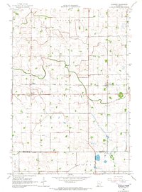 1965 Blomkest1966 Print · USGSThe prairie landscape of southern Kandiyohi County is captured here in the mid-1960s, showing a region defined by its rail-and-ditch infrastructure. Genealogists can trace the rural layout of Roseland, locate the Blomkest Cemetery, and follow the Chicago and North Western rail line.
 - 1965 Map of Prinsburg, 1967 Print
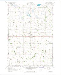 1965 Prinsburg1967 Print · USGSThe rural agricultural landscapes of Kandiyohi County are shown here in the mid-1960s as a complex network of managed drainage and rail transit. Researchers can locate community anchors like Prinsburg, Holland Cem, and School No 815 along the Chicago and North Western line.
 - 1967 Map of New Ulm
 1967 New Ulm1967 Print · USGSSouthern Minnesota in the mid-fifties is captured here as a landscape of river-valley missions and busy prairie rail towns. Researchers can trace the Yellow Medicine Trail and locate historic sites like the Morton Indian Mission and Milford State Monument.
 - 1967 Map of Mount Tom, 1968 Print
 1967 Mount Tom1968 Print · USGSThe glacial lakelands of Kandiyohi County are captured here in the late sixties, showcasing the area's rural character and conservation lands. Genealogists can locate family landmarks like Colfax Cem, Swedish Ch, and Lake Florida.2 unique versions available
 - 1967 Map of Sunburg, 1968 Print
 1967 Sunburg1968 Print · USGSThe Kandiyohi County prairie landscape is captured here in the late sixties, showing a region defined by its glacial lakes and rural parishes. Genealogists and local historians can locate specific sites like the Sunburg Cem Ch, Nannestad Cem, and West Lake Ch.
 - 1967 Map of Belgrade, 1968 Print
 1967 Belgrade1968 Print · USGSCentral Minnesota's prairie and wetlands are mapped here in the late sixties, highlighting the agrarian development between Brooten and Belgrade. Genealogists can trace local roots through sites like St Donatus Cem, Crow Lake Ch, and the Soo Line rail corridor.2 unique versions available
 - 1967 Map of Lake Johanna, 1968 Print
 1967 Lake Johanna1968 Print · USGSPope and Kandiyohi counties are defined by their deep-water lakes and protected wetlands in the late sixties. Genealogists and local historians can trace the rural landscape around South Lake Johanna Ch, Lake Johanna, and Brooten.2 unique versions available
 - 1967 Map of Georgeville, 1969 Print
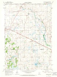 1967 Georgeville1969 Print · USGSStearns and Kandiyohi counties are captured in the late sixties at a time when rail and river dominated the rural landscape. Genealogists and local historians can trace the SOO LINE through Belgrade or locate family sites at St Francis de Sales Cem and Gandal Cem.
 - 1967 Map of Hawick, 1969 Print
 1967 Hawick1969 Print · USGSThe rural landscape of Kandiyohi County is captured here in the late sixties, where the railroad town of Hawick sits amidst a web of glacial lakes. Local historians can locate vanished landmarks like School No 812 and the Roseville Cem or trace the early course of the Middle Fork Crow River.
 - 1967 Map of Lake Henry, 1969 Print
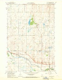 1967 Lake Henry1969 Print · USGSThe rural borderlands of Stearns and Kandiyohi Counties come to life in the late sixties, where the North Fork Crow River meanders through a landscape of wildlife refuges and small-town junctions. Genealogists and local historians can trace the foundations of Regal and Lake Henry, identifying sites like St Margaret Ch and the Grove Cem.
 - 1967 Map of New London, 1969 Print
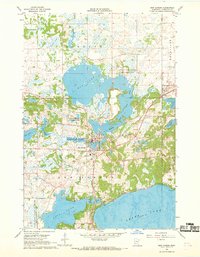 1967 New London1969 Print · USGSKandiyohi County was a land of water and wildlife in the late 1960s, centered on the river-fed village of New London. Researchers can trace the local economy and community through the National Fish Hatchery, the Great Northern rail line, and historic sites like Grace Ch.
 - 1968 Map of Lake Simon, 1970 Print
 1968 Lake Simon1970 Print · USGSCentral Minnesota's glacial prairie pothole region is captured here in the late sixties, showcasing a landscape defined by water and wildlife management. Local historians can trace family roots at the Lake Johanna Church, Cem West, and the rural Townhall.2 unique versions available
Showing maps 1-25 of 151
Top cities of Kandiyohi County
- Willmar historical maps
- New London historical maps
- Spicer historical maps
- Atwater historical maps
- Raymond historical maps
- Kandiyohi historical maps
See more
Frequently asked questions
- What are the different types of historical maps available for Kandiyohi County?
- What is the oldest map of Kandiyohi County?
- Where can I purchase historical maps of Kandiyohi County for my home or office?
- Where can I download high-res historical maps of Kandiyohi County?
- Are there historical topographic maps available for Kandiyohi County?
- Is there historical aerial imagery available for Kandiyohi County?
- Where are historical maps of Kandiyohi County sourced from?