Old Maps of Pelland, Minnesota for Academic Research
Study the evolution of Pelland with 11 high-resolution historic maps. Whether you're teaching, researching, or modeling changes in land use, these maps provide essential visual documentation of urban, environmental, and geographic change.
- Analyze long-term change: Track patterns in development, transportation, and natural features.
- Ideal for environmental or urban studies: Support academic projects with primary historical map data.
- Use in the classroom or lab: Educators and researchers rely on these maps to bring historical context to life.
These maps are a powerful tool for teaching, research, and visualizing how Pelland has changed over the decades.
Pelland, MN maps
(11)- 1919 Map of Pelland
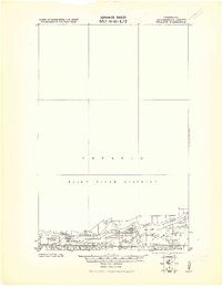 1919 Pelland1919 Print · USGSKoochiching County sits at the edge of the international border in 1919, where river traffic and rail transport defined the local economy. Genealogists and historians can trace the early layouts of Pelland, Big Fork, and Laurel along the path of the Minnesota Dakota and Western railroad.2 unique versions available
 - 1954 Map of International Falls, 1980 Print
 1954 International Falls1980 Print · USGSThe Minnesota-Ontario borderlands come alive in this mid-century survey of the Rainy River region and the interconnected waterways that now form Voyageurs National Park. Genealogists and local historians can trace the rail-and-timber era through settlements like Littlefork, the Nett Lake Indian Reservation, and the Canadian National rail lines.
 - 1957 Map of International Falls
 1957 International Falls1957 Print · USGSThe Minnesota-Ontario borderlands come alive in the mid-fifties, showing the industrial nodes of International Falls and Fort Frances. Genealogists and historians can trace rail-tied settlements like Aylsworth and Littlefork or locate ancestral lands within the Nett Lake Indian Reservation.
 - 1958 Map of International Falls
 1958 International Falls1958 Print · USGSThe borderlands of northern Minnesota and Ontario are mapped here during the mid-fifties, centered on the river-and-rail hubs of the Northwoods. Researchers can trace the path of the Northern Pacific through Big Falls or locate early settlements like Ericsburg and Ranier.2 unique versions available
 - 1970 Map of Pelland, 1973 Print
 1970 Pelland1973 Print · USGSThe Rainy River borderlands of Koochiching County come into focus during the early 1970s. Researchers can trace the riverfront settlements of Pelland and Isherwood, alongside the Canadian National tracks and the historic Winter Road Trail.
 - 1978 Map of International Falls, 1993 Print
 1978 International Falls1993 Print · USGSThe Minnesota-Ontario borderlands come alive in the late seventies, where the timber and rail economy meets the lake wilderness. Genealogists and local historians can trace the growth of International Falls and Ranier or locate island landmarks like Grindstone Island and Bushyhead Island.
 - 2011 Map of Pelland, 2011 Print
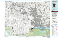
 2011 Pelland2011 Print · USGSCovers Pelland, including Alberton Township, La Vallee Township, and other nearby areas
 - 2013 Map of Pelland, 2013 Print
 2013 Pelland2013 Print · USGSCovers Pelland, including Alberton Township, La Vallee Township, and other nearby areas
 - 2016 Map of Pelland, 2016 Print
 2016 Pelland2016 Print · USGSCovers Pelland, including Alberton Township, La Vallee Township, and other nearby areas
 - 2019 Map of Pelland, 2019 Print
 2019 Pelland2019 Print · USGSCovers Pelland, including Alberton Township, La Vallee Township, and other nearby areas
 - 2022 Map of Pelland, 2022 Print
 2022 Pelland2022 Print · USGSThe international border along the Rainy River defines this northern Minnesota landscape in the early 2020s. Researchers can trace rural transportation routes and local landmarks like Pelland and the Little Fork River Trl as they navigate the river’s edge.
End of results
Showing maps 1-11 of 11
Top cities near Pelland
Frequently asked questions
- What are the different types of historical maps available for Pelland?
- What is the oldest map of Pelland?
- Where can I purchase historical maps of Pelland for my home or office?
- Where can I download high-res historical maps of Pelland?
- Are there historical topographic maps available for Pelland?
- Is there historical aerial imagery available for Pelland?
- Where are historical maps of Pelland sourced from?