1960s Maps of Le Sueur, Minnesota
Explore 2 historic maps of Le Sueur from the 1960s. These maps offer a rare glimpse into what life looked like during the 1960s — showing old roads, neighborhoods, homes, and landmarks that have changed or disappeared over time.
Whether you're researching your family's past, planning a metal detecting trip, or studying how Le Sueur's landscape evolved across the 1960s, these high-resolution maps are a powerful tool for exploring the history of this region.
- Focus on a specific era: All maps on this page are from the 1960s, giving you a focused view of this time period.
- See what’s changed: Compare century-old streets, trails, and buildings to today's modern landscape using overlays and satellite layers.
- Research with precision: Use these maps for genealogy, historical research, land use analysis, or educational projects.
- View, download, or print: Maps are fully viewable online in high resolution, and can be downloaded or printed for your own records.
Start exploring Le Sueur's history through authentic maps from the 1960s. This is your window into the past.
Le Sueur, MN maps
(2)- 1965 Map of Le Sueur, 1966 Print
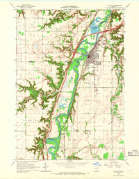 1965 Le Sueur1966 Print · USGSLe Sueur and the Minnesota River valley are captured in the mid-sixties during a period of steady growth and industrial activity. Researchers can trace the Chicago and North Western rail line and locate ancestral sites like Mound Cem and the settlement of Ottawa.4 unique versions available
 - 1965 Map of St Thomas, 1966 Print
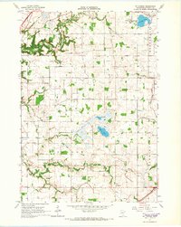 1965 St Thomas1966 Print · USGSLe Sueur County in the mid-1960s reveals a deeply settled agricultural landscape shaped by its early townships and prairie lakes. Genealogists and local historians can locate numerous family burial sites like Dresselville Cem and Hillside Cem, or trace the old rail corridor of the Chicago Milwaukee St Paul and Pacific.2 unique versions available
End of results
Showing maps 1-2 of 2
Top cities near Le Sueur
- Saint Peter historical maps
- Belle Plaine historical maps
- Le Center historical maps
- Arlington historical maps
- Henderson historical maps
- Lexington historical maps
See more
Top neighborhoods of Le Sueur
Frequently asked questions
- What are the different types of historical maps available for Le Sueur?
- What is the oldest map of Le Sueur?
- Where can I purchase historical maps of Le Sueur for my home or office?
- Where can I download high-res historical maps of Le Sueur?
- Are there historical topographic maps available for Le Sueur?
- Is there historical aerial imagery available for Le Sueur?
- Where are historical maps of Le Sueur sourced from?