Old Maps of Lyon County, Minnesota
Explore 160 old maps of Lyon County, spanning from 1953 to today. These high-resolution historic maps reveal how streets, neighborhoods, landmarks, and natural features evolved over time — perfect for genealogy, metal detecting, research, and local history exploration.
What you can do with these maps:
- See how Lyon County changed over time: Compare historical maps to modern-day views to trace roads, homesites, rail lines & more.
- View detailed metadata: Each map includes creators, publishers, year, scale, and archive source.
- Overlay maps with satellite & LiDAR: Visualize the past alongside modern tools to explore terrain & human change.
- Trusted historical sources: Maps sourced from the USGS, Library of Congress, and other archives.
- Access maps your way: View online, download high-res files, or order prints for personal or research use.
Start exploring old maps of Lyon County to uncover forgotten places, hidden landmarks, and the deep history beneath your feet.
Lyon County, MN maps
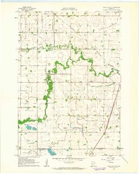
(160)- 1953 Map of Watertown, 1968 Print
 1953 Watertown1968 Print · USGSEastern South Dakota and the Minnesota borderlands are captured here during the mid-twentieth century as the region's agricultural and rail-service centers thrived. Genealogists and local historians can trace family-named sites across the Coteau des Prairies and find landmarks in Watertown, De Smet, and Brookings.3 unique versions available
 - 1953 Map of New Ulm, 1968 Print
 1953 New Ulm1968 Print · USGSSouthern Minnesota in the mid-1950s is defined by its deep river valleys and the expanding reach of the Great Northern and Chicago and North Western railroads. Researchers can trace rural lineages through landmarks like the Milford State Monument, St. John's Ch, and the Upper Sioux Indian Res.3 unique versions available
 - 1957 Map of New Ulm
 1957 New Ulm1957 Print · USGSCentral Minnesota in the mid-fifties remains a landscape of river-valley commerce and prairie agriculture defined by its historic mission sites and rail towns. Genealogists and local historians can trace the development of New Ulm and Montevideo, or locate specific landmarks like the Milford State Monument and Minnesota Falls.
 - 1958 Map of New Ulm
 1958 New Ulm1958 Print · USGSSouth-central Minnesota’s river valleys and prairie towns are captured here in the mid-fifties, during the height of the region's rail-and-river economy. Genealogists and historians can trace the legacy of the Upper Sioux Indian Mission or locate early rail stops along the Chicago and North Western Ry in towns like Redwood Falls and Glencoe.
 - 1958 Map of Watertown
 1958 Watertown1958 Print · USGSThe eastern South Dakota prairie and the Minnesota borderlands are captured here in the late fifties, showcasing a landscape of terminal moraine lakes and burgeoning rail hubs. Genealogists and historians can trace the early paths of the Chicago and North Western railroad or locate family roots in Watertown, Clark, or the Sisseton Indian Reservation.2 unique versions available
 - 1962 Map of Wood Lake NW, 1963 Print
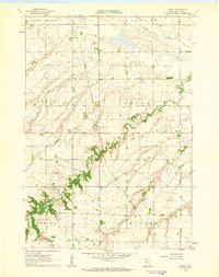
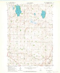
 1962 Wood Lake NW1963 Print · USGSYellow Medicine County during the early 1960s shows a landscape of productive prairie and vital rail lines like the Great Northern. Genealogists and local historians can locate Hazel Run, the West Cem, and trace the winding course of the Yellow Medicine River.
 - 1962 Map of Dudley, 1963 Print
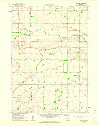
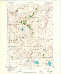
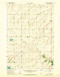
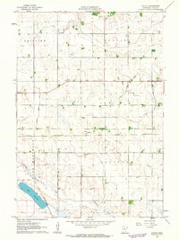 1962 Dudley1963 Print · USGSThe rural prairie of Lyon County is captured in the early sixties as a highly engineered agricultural landscape. Genealogists and historians can trace the rail-driven economy through Dudley and the Chicago and North Western line, or locate early water management projects like Judicial Ditch No 31.2 unique versions available
 - 1962 Map of Cottonwood, 1964 Print
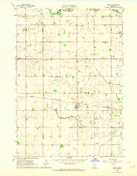
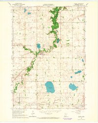
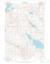
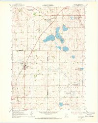
 1962 Cottonwood1964 Print · USGSLyon County at the start of the 1960s reveals a prairie landscape of railroads, drainage ditches, and lakeside settlements. Genealogists can trace family footprints at Swan Lake Ch, English Cem, or near the shores of Cottonwood Lake.
 - 1962 Map of School Grove Lake, 1964 Print
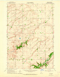
 1962 School Grove Lake1964 Print · USGSThe prairie townships of Yellow Medicine and Redwood counties are captured here in the early sixties as drainage networks reshaped the land. Genealogists can locate family farmstead sites near St Lukes Sch, the local Townhall, and along the banks of School Grove Lake.
 - 1962 Map of Milroy SE, 1964 Print
 1962 Milroy SE1964 Print · USGSSouthwestern Minnesota prairie lands are captured here in the early sixties, showing the agricultural heart of the Redwood and Lyon county line. Researchers can locate family roots at several burial sites including Gales Cem, Luther Cem, and Swedish Cem.
 - 1962 Map of Wood Lake, 1964 Print
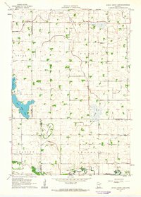
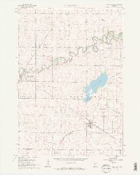 1962 Wood Lake1964 Print · USGSSouthwest Minnesota in the early sixties reveals a landscape of high-prairie agriculture and critical rail junctions. Trace the paths of the Chicago and North Western through Hanley Falls and locate community anchors like the Lutheran Cem and the Gaging Station.2 unique versions available
 - 1962 Map of Amiret, 1964 Print
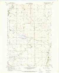
 1962 Amiret1964 Print · USGSLyon County at the start of the sixties reveals a landscape of precision-mapped townships and river-carved valleys. Genealogists and local historians can locate family burial sites at Amiret Cem and Bethel Cem or trace the Cottonwood River through Amiret.
 - 1962 Map of Milroy, 1964 Print
 1962 Milroy1964 Print · USGSThe prairie landscape around Milroy is captured here in the early sixties, showing a region defined by its rail-and-river economy. Researchers can locate family landmarks like Danish Cem and St Michael Cem or trace the Chicago And North Western rail line.
 - 1963 Map of Dead Coon Lake, 1964 Print
 1963 Dead Coon Lake1964 Print · USGSThe town of Tyler and the surrounding Minnesota prairie are captured here in the early 1960s as a hub of rail and drainage. Trace family roots at St Dionysius Cem and Mission Cem, or follow the Chicago and North Western rail line through the marshy terrain of Dead Coon Lake.
 - 1963 Map of Gislason Lake, 1964 Print
 1963 Gislason Lake1964 Print · USGSThe rural borderlands of Lincoln and Lyon counties are captured here in the early sixties, showing a landscape of townships and prairie lakes. Genealogists can locate Zion Ch and trace family-named water bodies like Gislason Lake and Goose Lake.2 unique versions available
 - 1963 Map of Russell, 1964 Print
 1963 Russell1964 Print · USGSLyon County in the early sixties was a landscape of prairie townships and vital rail corridors. Genealogists and historians can trace the paths of the Great Northern railroad, locate the small settlement of Burchard, and identify rural burial sites like Lyons Cem.
 - 1963 Map of Lynd, 1964 Print
 1963 Lynd1964 Print · USGSLyon County at the start of the sixties reveals a landscape of prairie townships and river-valley industry. Genealogists and historians can trace the Great Northern rail line through Lynd or locate the Zion Cem and the borders of Camden State Park.
 - 1963 Map of Marshall SE, 1964 Print
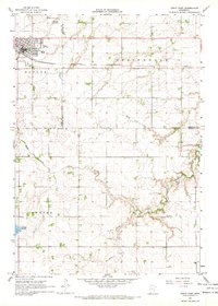
 1963 Marshall SE1964 Print · USGSLyon County at the start of the 1960s reveals a quiet agricultural landscape shaped by the Cottonwood River and structured by historic township boundaries. Researchers can locate family sites near Lakeside Cem and trace local resource extraction at several Gravel Pits near Lake Yankton.2 unique versions available
 - 1963 Map of Marshall, 1964 Print
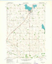
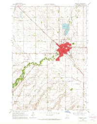 1963 Marshall1964 Print · USGSMarshall enters the early sixties as a bustling regional hub where the Redwood River meets two major rail lines. Genealogists and local historians can trace the mid-century city layout from Marshall Cemetery and the Courthouse to the Drive-in Theater and Marshall Airport.3 unique versions available
 - 1967 Map of New Ulm
 1967 New Ulm1967 Print · USGSSouthern Minnesota in the mid-fifties is captured here as a landscape of river-valley missions and busy prairie rail towns. Researchers can trace the Yellow Medicine Trail and locate historic sites like the Morton Indian Mission and Milford State Monument.
 - 1967 Map of Minneota, 1968 Print
 1967 Minneota1968 Print · USGSMinneota and Ghent anchored this Lyon County agricultural region in the late sixties along the busy Chicago and North Western line. Genealogists can locate several historic burial grounds like Icelandic Cem, Hope Cem, and St Edwards Cem.
 - 1967 Map of Balaton, 1968 Print
 1967 Balaton1968 Print · USGSSouthwestern Minnesota prairie and glacial lakes define this landscape in the late sixties, where the railroad connects small rural hubs. Trace the historical footprints of Balaton and Garvin along the Chicago and North Western line near the shores of Lake Sarah.2 unique versions available
 - 1967 Map of Green Valley, 1968 Print
 1967 Green Valley1968 Print · USGSLyon County, Minnesota, is captured in the late sixties as a precisely engineered agricultural landscape. Genealogists and local historians can trace the Great Northern rail line through Green Valley or locate family lands near Threemile Creek and the Vallers State Wildlife Management Area.
 - 1967 Map of Ruthton, 1968 Print
 1967 Ruthton1968 Print · USGSThe rail-and-river landscape of the Minnesota prairie comes into focus in the mid-1960s, centered on the settlements of Ruthton and Florence. Researchers can trace old family burial sites at Opdal Cem and Peace Cem or follow the path of the Great Northern railroad.
 - 1967 Map of Tracy East, 1968 Print
 1967 Tracy East1968 Print · USGSMurray and Redwood Counties are shown in detail during the late sixties as agricultural development shaped the Minnesota prairie. Researchers can locate family landmarks like Tracy Cemetery, follow the Plum Creek drainage, and find rural hubs such as Holly Ch.
Showing maps 1-25 of 160
Top cities of Lyon County
- Marshall historical maps
- Tracy historical maps
- Minneota historical maps
- Cottonwood historical maps
- Balaton historical maps
- Lynd historical maps
See more
Frequently asked questions
- What are the different types of historical maps available for Lyon County?
- What is the oldest map of Lyon County?
- Where can I purchase historical maps of Lyon County for my home or office?
- Where can I download high-res historical maps of Lyon County?
- Are there historical topographic maps available for Lyon County?
- Is there historical aerial imagery available for Lyon County?
- Where are historical maps of Lyon County sourced from?