1980s Maps of Perez Mobile Home Park, Glencoe
Explore 2 historic maps of Perez Mobile Home Park from the 1980s. These maps offer a rare glimpse into what life looked like during the 1980s — showing old roads, neighborhoods, homes, and landmarks that have changed or disappeared over time.
Whether you're researching your family's past, planning a metal detecting trip, or studying how Perez Mobile Home Park's landscape evolved across the 1980s, these high-resolution maps are a powerful tool for exploring the history of this region.
- Focus on a specific era: All maps on this page are from the 1980s, giving you a focused view of this time period.
- See what’s changed: Compare century-old streets, trails, and buildings to today's modern landscape using overlays and satellite layers.
- Research with precision: Use these maps for genealogy, historical research, land use analysis, or educational projects.
- View, download, or print: Maps are fully viewable online in high resolution, and can be downloaded or printed for your own records.
Start exploring Perez Mobile Home Park's history through authentic maps from the 1980s. This is your window into the past.
Perez Mobile Home Park, Glencoe maps
(2)- 1982 Map of Glencoe
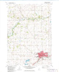 1982 Glencoe1982 Print · USGSMcLeod County is anchored by the industrial and agricultural activity of the early eighties, where the Milwaukee Road railroad meets the waters of Buffalo Creek. Genealogists and historians can trace family plots at Hillcrest Cemetery and Bear Creek Cemetery or locate the former settlement of Konaska.
 - 1986 Map of Glencoe
 1986 Glencoe1986 Print · USGSThe south-central Minnesota prairie and its glacial lake basins are captured here in the mid-1980s, showcasing a landscape of intensive farming and conservation. Genealogists can locate family-named landmarks and trace the rail lines of the Soo Line and Chicago and North Western through towns like Gaylord, Olivia, and Hutchinson.2 unique versions available
End of results
Showing maps 1-2 of 2
Top cities near Perez Mobile Home Park
- Hutchinson historical maps
- Glencoe historical maps
- Norwood Young America historical maps
- Winsted historical maps
- Gaylord historical maps
- Arlington historical maps
See more
Frequently asked questions
- What are the different types of historical maps available for Perez Mobile Home Park?
- What is the oldest map of Perez Mobile Home Park?
- Where can I purchase historical maps of Perez Mobile Home Park for my home or office?
- Where can I download high-res historical maps of Perez Mobile Home Park?
- Are there historical topographic maps available for Perez Mobile Home Park?
- Is there historical aerial imagery available for Perez Mobile Home Park?
- Where are historical maps of Perez Mobile Home Park sourced from?