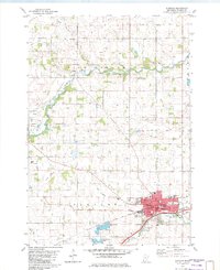
1982 Map of Glencoe
USGS Topo · Published 1982About this map
The Rich Valley of central Minnesota is defined by the winding course of the South Fork Crow River and the industrial hub of Glencoe. This early 1980s survey captures the city's growth, featuring a dense network of local landmarks including the High School, St. Pius X School, and the Hospital. To the west, the landscape transitions into agricultural drainage and reclaimed land, notably the Swan Lakebed and Bog Lakebed, indicating a history of shifting water levels and human intervention through systems like County Ditch No. 11.
Find a feature on this map
43 named features on this map. Tap any name to fly to it.
Don’t see what you’re looking for? This feature index may not catch every label — zoom into the map to look around manually.
Map Details
Editions of this 1982 Glencoe Map
This is the sole edition of this map. No revisions or reprints were ever made.
Other maps of this area

1953 · New Ulm
USGS Topo · 1:250,000

1957 · New Ulm
USGS Topo · 1:250,000

1958 · New Ulm
USGS Topo · 1:250,000

1958 · Gaylord
USGS Topo · 1:62,500

1958 · Glencoe
USGS Topo · 1:62,500

1958 · Winthrop
USGS Topo · 1:62,500

1958 · Hutchinson
USGS Topo · 1:62,500

1967 · New Ulm
USGS Topo · 1:250,000
1982 · Silver Lake
USGS Topo · 1:24,000
1982 · Plato
USGS Topo · 1:24,000
Featured Places
- Glencoe, MN
- Bergen Township, MN
- Helen Township, MN
- Rich Valley Township, MN
- Glen Knoll Mobile Home Park, Glencoe