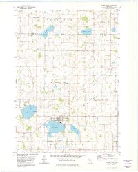
1982 Map of Silver Lake
USGS Topo · Published 1982About this map
Silver Lake sits at the heart of this prairie landscape, serving as a hub for the surrounding townships of Hale, Rich Valley, and Winsted. The 1980s era topography shows a region defined by its glacial lakes and a complex drainage network, including Judicial Ditch No 11 and several others that managed the fertile farmland. The presence of the Burlington Northern railroad and the Luce Line State Recreational Trail illustrates the transition of old rail corridors into modern recreational use.
Find a feature on this map
38 named features on this map. Tap any name to fly to it.
Don’t see what you’re looking for? This feature index may not catch every label — zoom into the map to look around manually.
Map Details
Editions of this 1982 Silver Lake Map
This is the sole edition of this map. No revisions or reprints were ever made.
Other maps of this area

1953 · New Ulm
USGS Topo · 1:250,000

1953 · Saint Cloud
USGS Topo · 1:250,000

1957 · Saint Cloud
USGS Topo · 1:250,000

1957 · New Ulm
USGS Topo · 1:250,000

1958 · New Ulm
USGS Topo · 1:250,000

1958 · Saint Cloud
USGS Topo · 1:250,000

1958 · Glencoe
USGS Topo · 1:62,500

1958 · Dassel
USGS Topo · 1:62,500

1958 · Cokato
USGS Topo · 1:62,500

1958 · Hutchinson
USGS Topo · 1:62,500